|
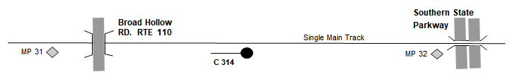
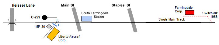
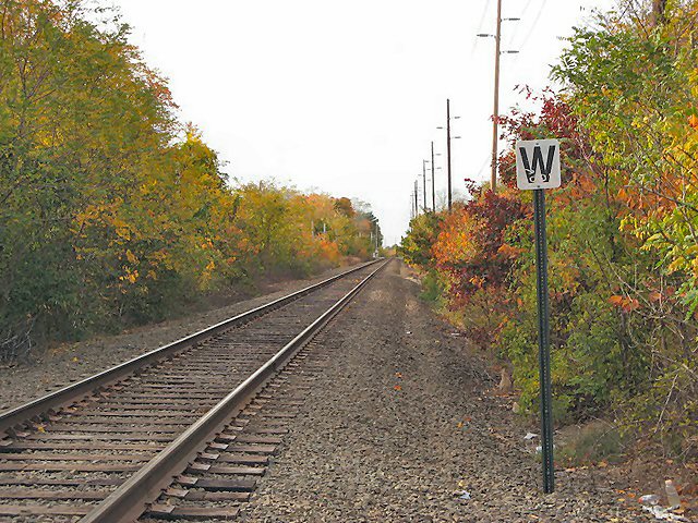
MP 30 is 4 blocks west of Farmingdale Station |
|
|
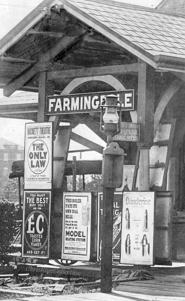
FARMINGDALE STATION
AREA |
|
|
MP 30 is 4 blocks west of Farmingdale Station |
|
|
FARMINGDALE STATION
AREA |
|
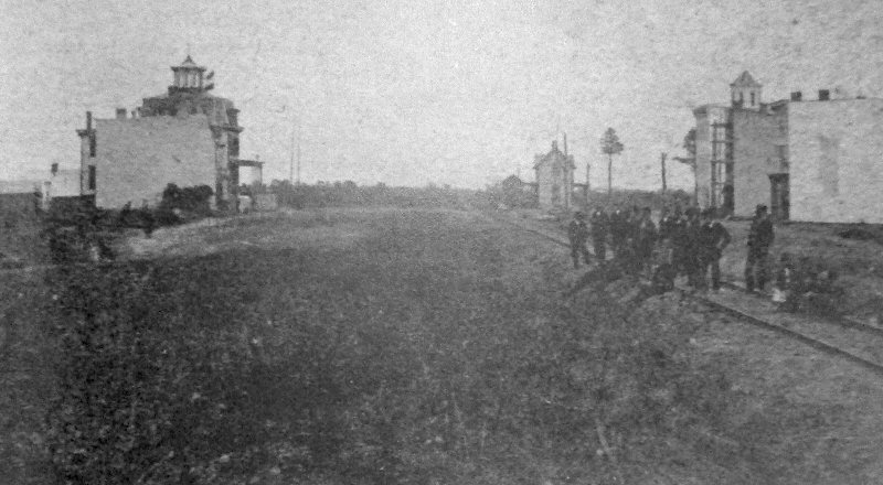
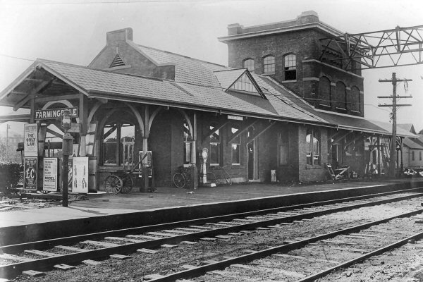 Farmingdale Station at Atlantic Ave and Depot Ave 9/29/1909 Photo: William J. Rugen Archive: Queens Public Library
|
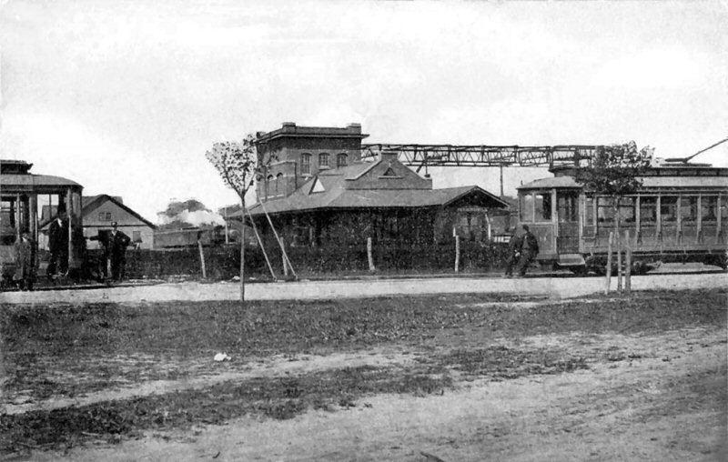 Farmingdale Station - Eastbound on LIRR main line - Huntington RR trolley line crossing View NW c.1915 Archive: Bill Mangahas
Note: Photo was taken anywhere
between August/1909 when the line was extended to Farmingdale and
Amityville and September/1919 when the entire trolley company shut
down. A 10-year window. Research: Dave Keller
|
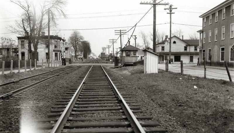
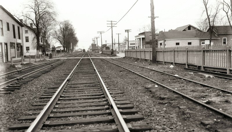
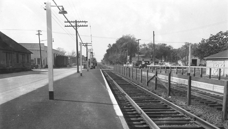
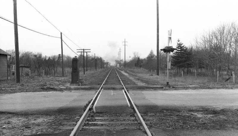
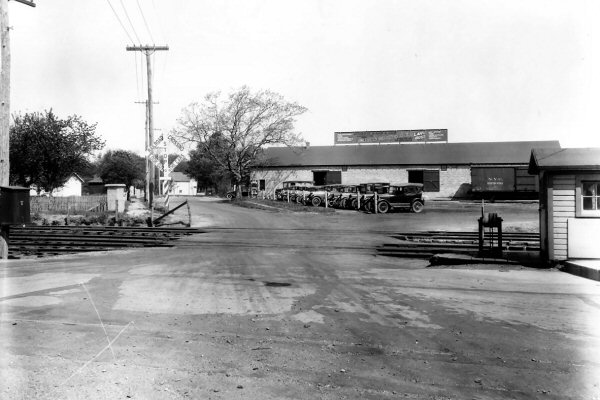
 Farmingdale crossing view SE 05/18/31
View
is looking north. The skewed siding was south of the |
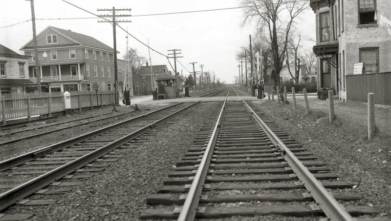
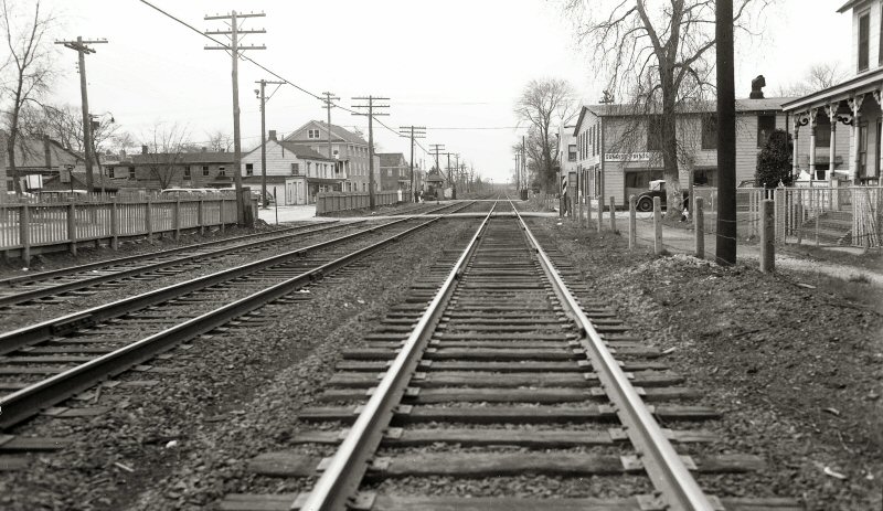
 Farmingdale 5/18/31 view W
|
|||||
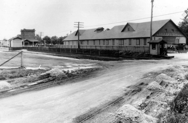
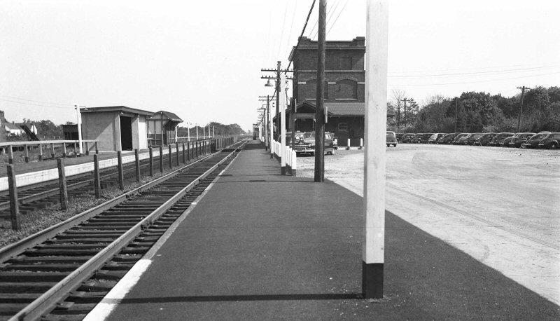
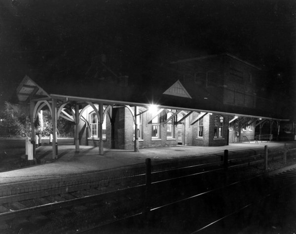 Farmingdale Station 1952 |
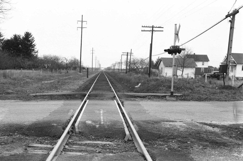
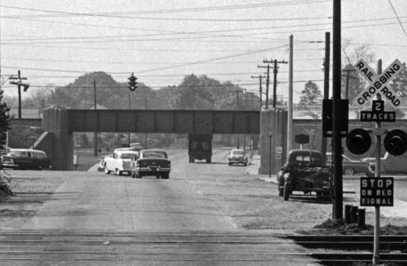 Merritts Road, Farmingdale zoom View S 3/26/1958 Archive: Dave Morrison |
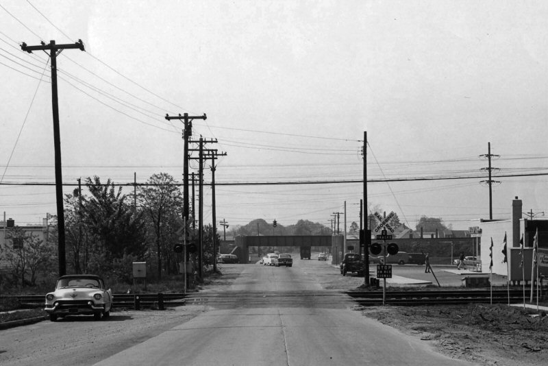 Merritts Road prior to four lane widening and installation of automatic gates View S 3/26/1958 Archive: Dave Morrison |
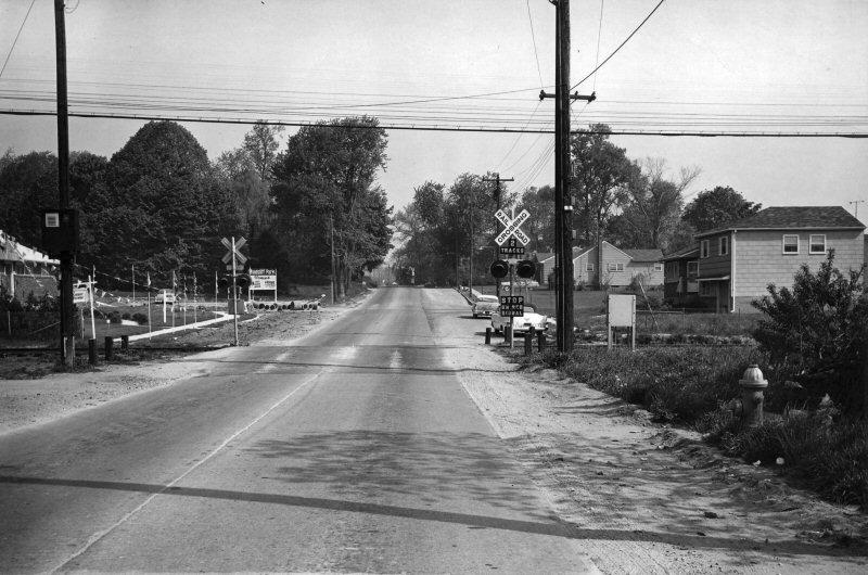 Merritts Road - View N 3/26/1958 Archive: Dave Morrison |
|||||
|
One crossing
watchman controlled both sets of gates at the Hempstead Tpke and
Merritt Rd. crossings when at grade. May, 1925 was when
the electrification to Babylon was placed in service and the LIRR had
plans to electrify the practically no longer-used Central branch.
They re-laid all the tracks, installed new ties along with third rail
ties and . . . never went any further with the project. Info: Dave
Keller |
||||||||
|
|
|
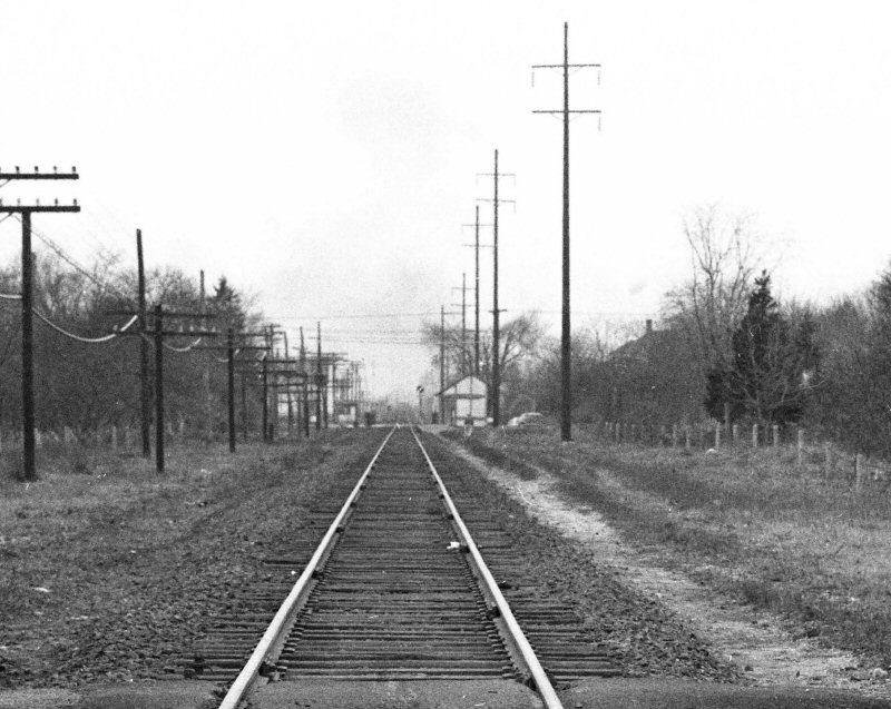
.jpg) RS2 #1520-Freight westbound at Farmingdale 6/1972 Photo/Archive: Dave Keller
|
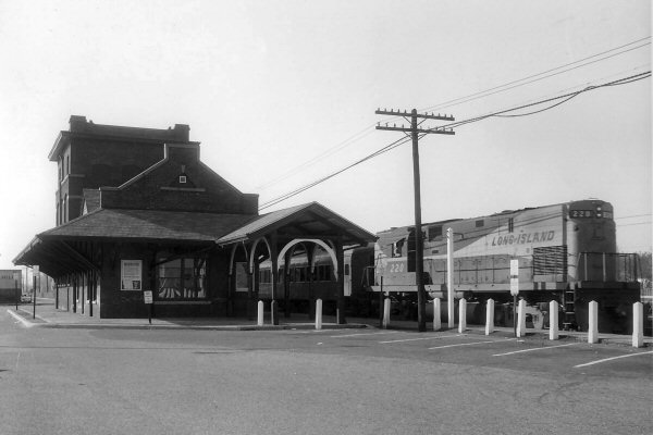 LIRR #220 eastbound c.1963+ at Farmingdale Station
|
|||||
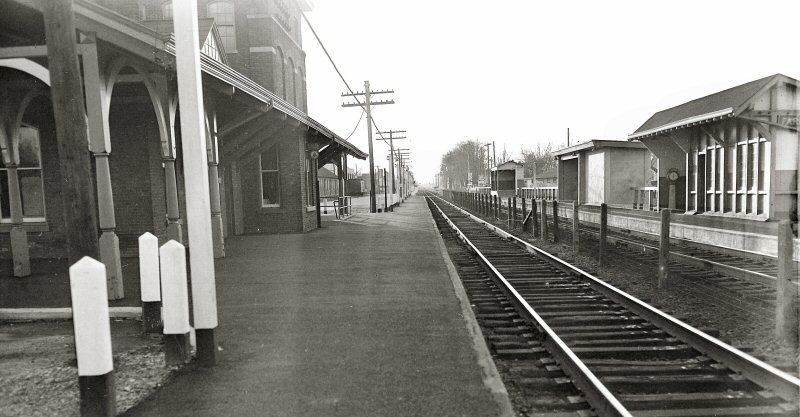
.jpg) Farmingdale Station- View W 1966 Photo/Archive: Dave Keller |
.jpg) Farmingdale Station - rear view NE-1966 Photo/Archive: Dave Keller |
.jpg) Caboose C50 on eastbound freight at Farmingdale 6/1972 Photo/Archive: Dave Keller |
%20-%201969%20(Keller-Keller).jpg) Section House-Farmingdale - View N 1969 Photo/Archive: Dave Keller |
|||||
.jpg) Farmingdale - FA2 #608 train being pulled westbound against traffic 6/1972 Photo/Archive: Dave Keller |
.jpg) Ticket Window at Farmingdale Station 6/1972 Photo/Archive: Dave Keller |
.jpg) AT&T Sign -Farmingdale Station 6/1972 Photo/Archive: Dave Keller |
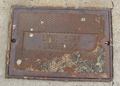 LIRR lighting manhole cover 12/05/2010 (Not in Ziel collection) |
|||||
|
FARMINGDALE STATION - POST WW II Photos: Fred Weber Archive: Dave Morrison |
||||||||
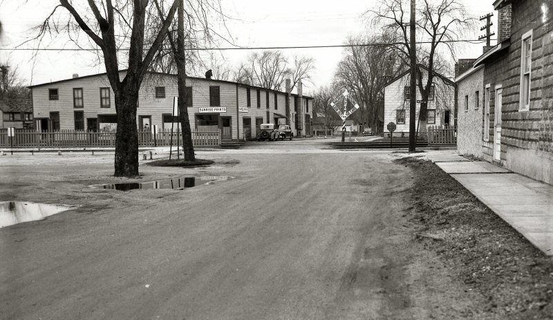
 Ex-Block Office crossing Shanty Main St. view N 4/24/1947 |
 Ex-Block Office crossing Shanty Main St. view S 4/24/1947 |
 Ex-Block Office crossing Shanty -Main St. View E 4/24/1947 |
 Ex-Block Office crossing Shanty Main St. view W 4/24/1947 |
|||||
| The crossing shanty in the 4 views of Main St. was the ex-“A” Cabin block office which was in service from 1918 – 1925 when it was converted to a crossing shanty to manually operate the crossing gates. Research: Dave Keller | ||||||||
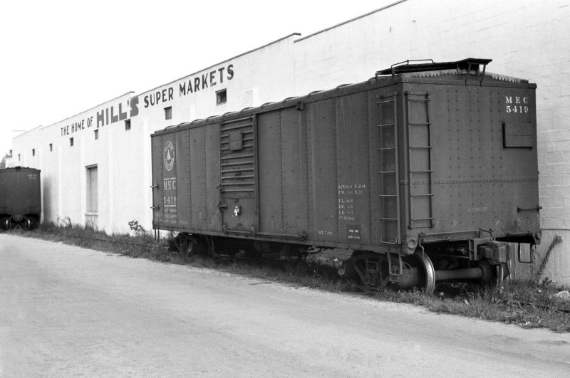 Maine Central boxcar #5419 spotted at Hills Supermarket Warehouse (see location below) 9/07/55 Archive: Dave Keller |
 Station Area Express House and baggage car View E - 10/06/1948 |
|
.jpg) Farmingdale Station - baggage wagon 6/1972 (Keller-Keller) |
|||||
 Division St. crossing view E Hills Supermarket Warehouse at back center 4/27/1947 |
 Division St. crossing view W 4/27/1947 |
 Division St. crossing view N 4/27/1947 |
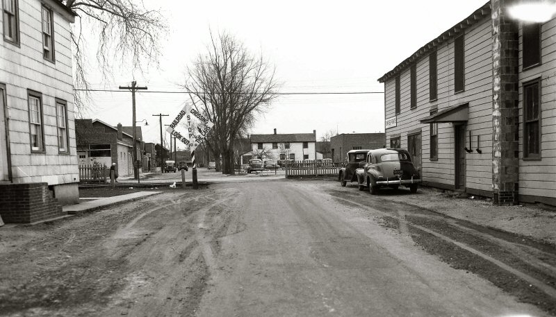 Division St. crossing view S 4/27/1947 |
|||||
 Secatogue Ave. crossing view W 10/06/1948 Hills Supermarket Warehouse at left center |
 Shelter Shed Crossover E 11/21/1948 |
 Station, Shelter Shed, Crossover Entrance, Express House 11/21/1948 |
||||||
|
What I thought was great was how this entire area had so many structures and old houses so close to trackside! Sidings everywhere, manned crossing gates, and an overall feeling of “tiredness”. Definitely an “old” railroad community is portrayed here. One
shot I loved was an overall view of the station area looking east from
the Secatogue Ave.
crossing . . . the old brick depot with attached power plant,
open-air express platforms at both station platforms. Wooden
shelter shed across from the depot. Covered stairwell for the
below-track underpass, Pennsy baggage/express car laying up at the old
express/freight house adjacent to the team tracks! |
||||||||
|
|
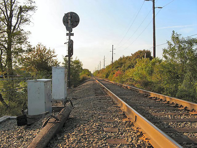
 Signal #308 is on the Main Line just west of Rt. 110 in Farmingdale. View east c.1950 with Picone Bros. sand pits in the left distance. (A prefix of "G" or none at all indicates Main Line signals.) Info: Dave Keller Archive: Dave Morrison |
|||||||
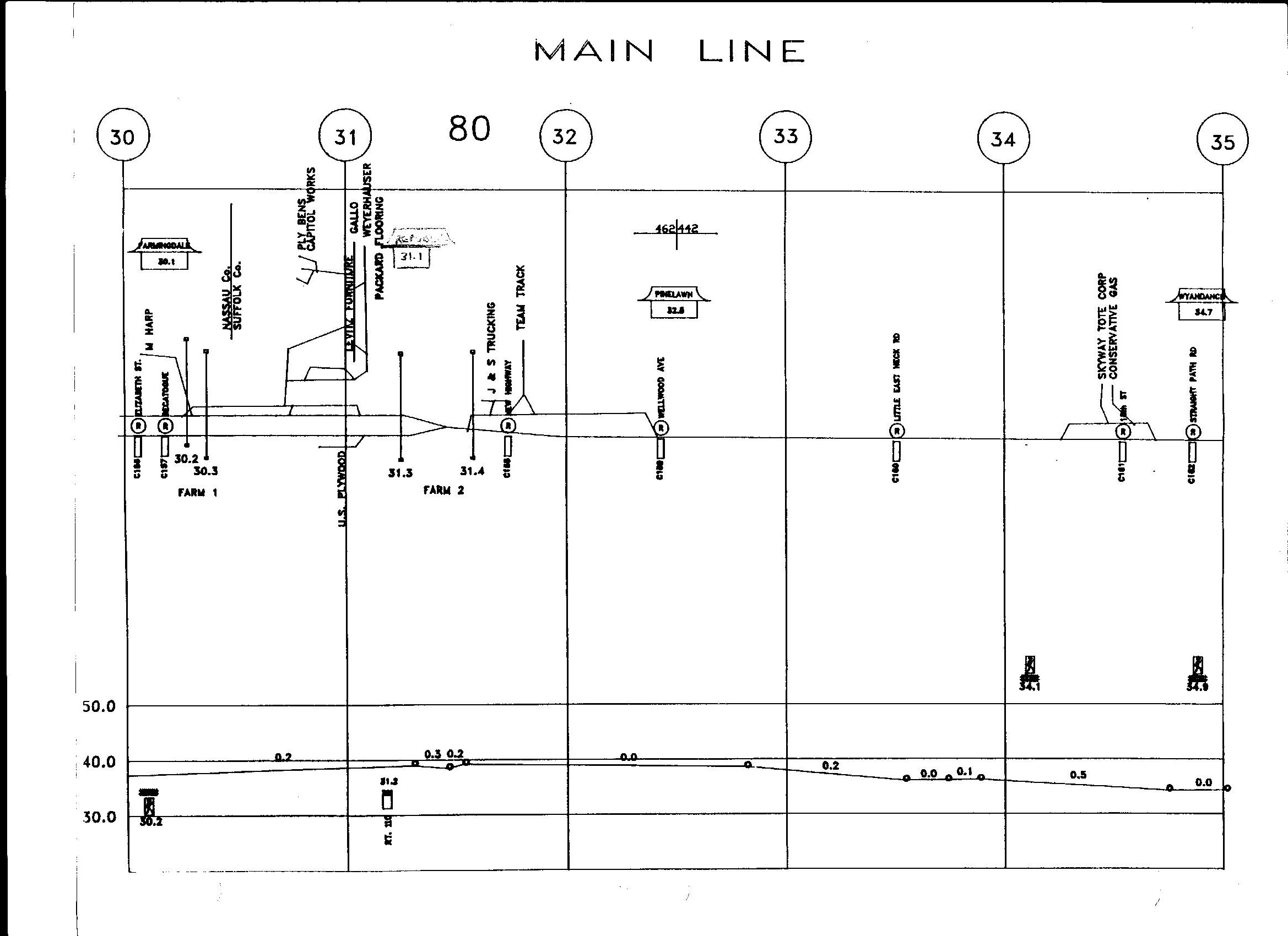
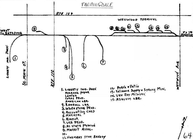
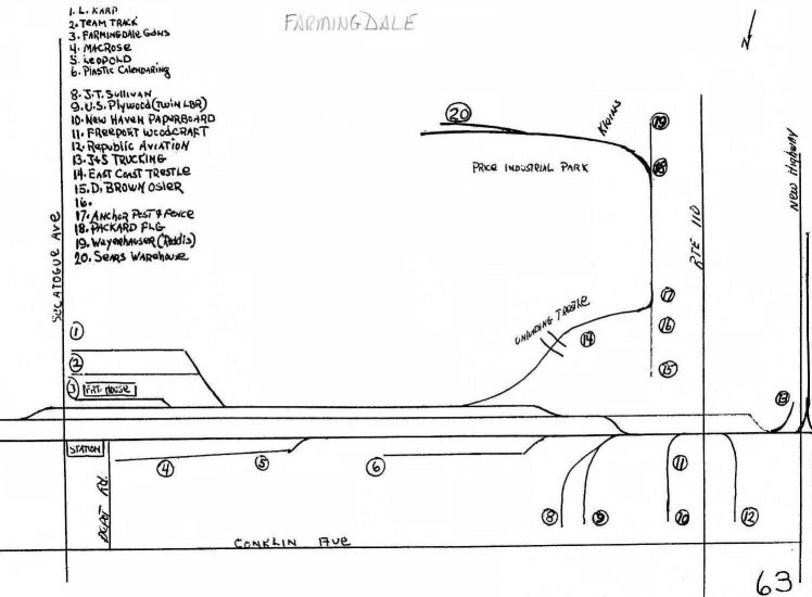 LIRR track map 1966 page 63 Farmingdale Main Line MP30-31 |
 LIRR track map 1978 page 50 Farmingdale Main Line MP30-31 |
 Price Industrial Park, East Farmingdale - North siding freight track Signal #308 (right) Signal #307 background both with tall masts as station lights would obscure the signal aspect. View E 4/07/1979 Photo/Archive: Jeff Erlitz |
||||||
| Price INDUSTRIAL pARK, FARMINGDALE | ||||||||
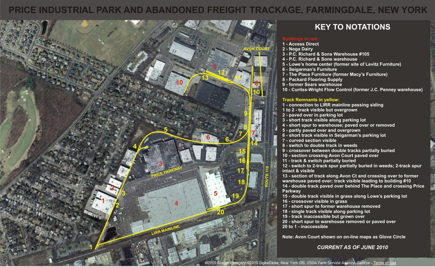 LIRR MP31 Main Line Google Imagery, DigitalGlobe New York GIS ©2010 from 06/2010 |
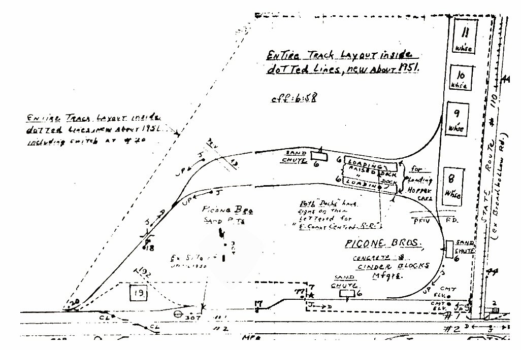 Emery MP31 Farmingdale - Picone Bros. 6/1958 Archive: Dave Keller
|
|||||||
|
Farmingdale Price Parkway Railroad Remnants
Over
the years this area has changed from basically a sand pit to a
developed industrial area. From the 1958 hand-drawn map by Bob
Emery, it can be seen that in the early 1950s this area was served by
a railroad spur off the LIRR’s mainline. That spur is
essentially what remains today. The spur exists as two sections,
one running north in a large curve (call this the north section), and
the other running east along the mainline then curving north (call
this the south section) where it connects with the north section.
Emery’s map as well as another hand-drawn map by Henry Raudenbush in
1952 shows the south section looping back west to join with the north
section. This also can be seen in a 1953 aerial photograph
(above) and
most likely made the movement of cars through the Picone Brothers
operation more efficient.
The
buildings north of The
aerial photo from 1953, although not of the higher resolution of
satellite images, provides a good view of what the area looked like
almost 60 years ago. A Google satellite photo available in 2007
showed the tracks serving the area clearly visible. Although
Lowe’s opened in 2006, this photo still showed the Levitz building.
A Google satellite image from today (2010) shows the area as it now
exists. Looking at a birdseye view from the BING web site, the
image also is as it appears now. However, changing the view of
the BING image will show the area from a different aspect and a
different time period – that of the construction of Lowe’s. From
that view, part of the siding that fed the Levitz building is visible
in the construction area. I
visited the area several times in the 1980s and 90s and noticed the
railroad tracks serving the area, but I never bothered to take any
notes or photos. An inquiry on one of the railroad web forums in
2007 prompted some research into this area as well as a visit to see
and photograph what remained. Much of the track still existed
then, and still does today. Some portions were removed or just
paved over, like the double-track crossing Other
trackage still in existence is either partially buried in weeds or
sandy soil, heavily overgrown, or clearly visible with some
overgrowth. From the Google image shown here with the notations,
an accurate picture exists of the area. Much of the track is
easily accessible, while some is behind buildings. The crossover
behind The Place furniture store is partially visible in the sandy
soil there. The two tracks for the Sears siding are intact, and
the switch to them is overgrown but easily seen in the weeds. |
||||||||
|
|
||||||||
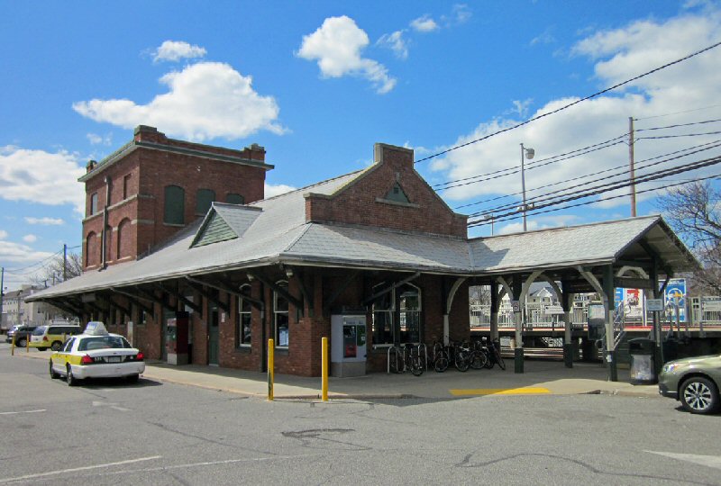
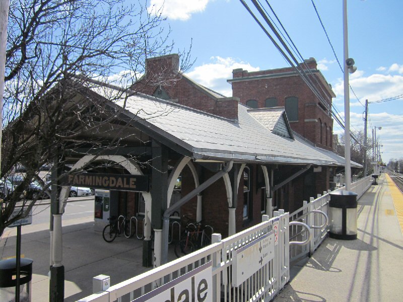
| FARMINGDALE STATION - 1950+ | ||||||||
 Farmingdale Station View NE 4/08/18 Photo: Dave Morrison
|
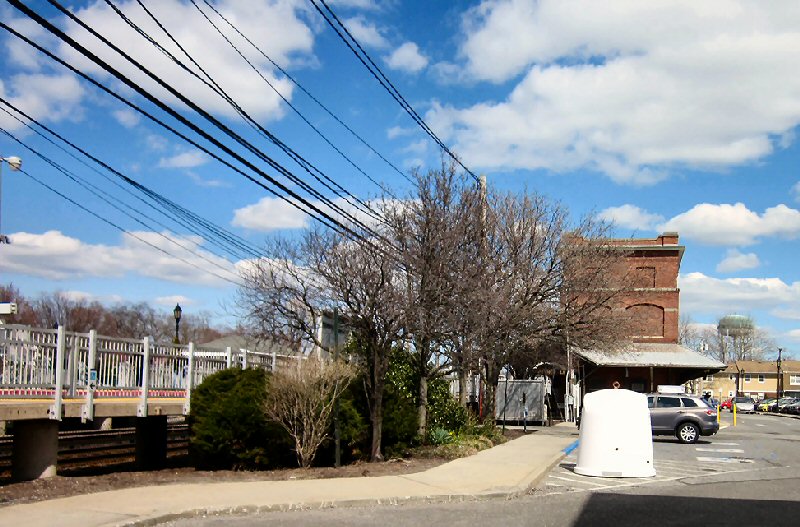 Farmingdale Station View E 4/08/18 Photo: Dave Morrison
|
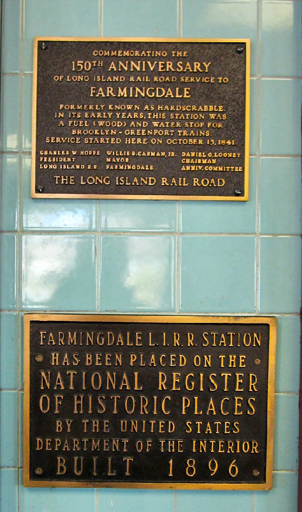 150th Anniversary of LIRR service to Farmingdale, formerly known as Hardscrabble. In its early years, this station was a fuel (wood) and water stop for Brooklyn-Greenport trains. Service started here on October 15, 1841. Interior station plaque. 4/08/18 Photo: Dave Morrison |
||||||
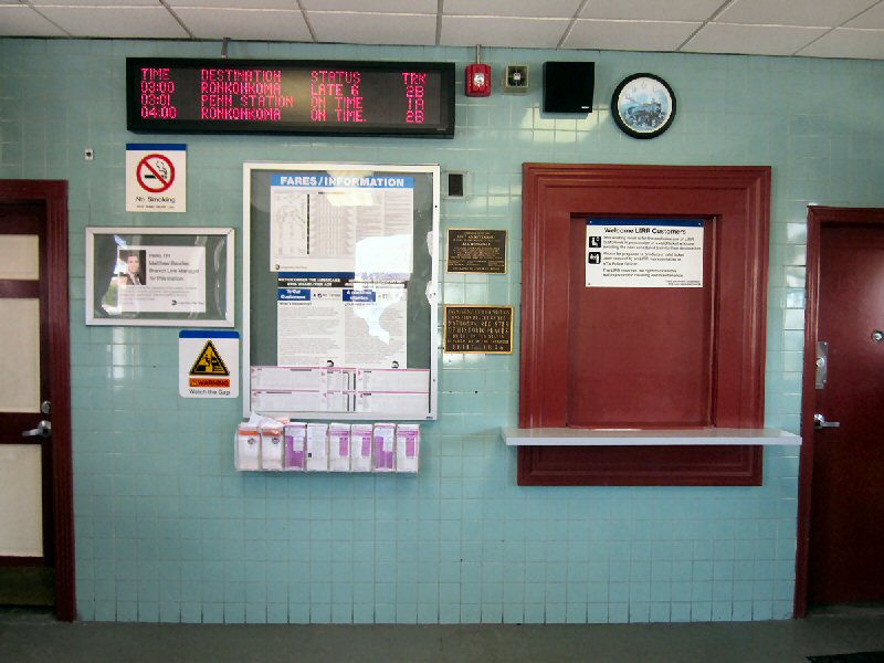 Farmingdale Station Interior 4/08/18 Photo: Dave Morrison |
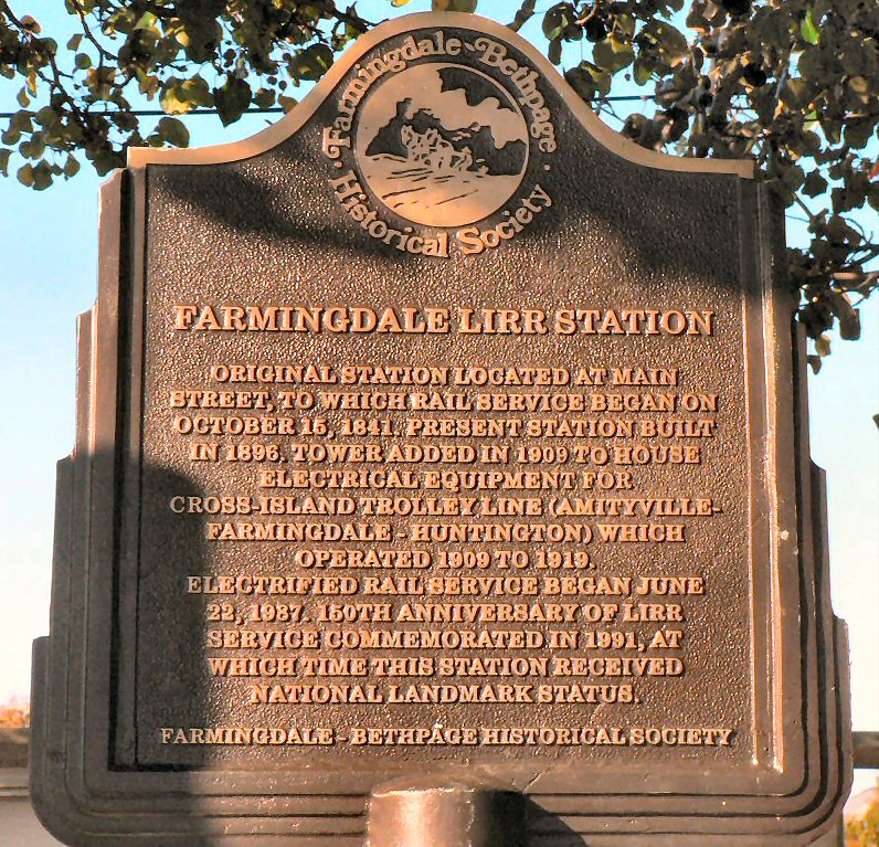 Farmingdale LIRR Station Historical Sign Farmingdale-Bethpage Historical Society |
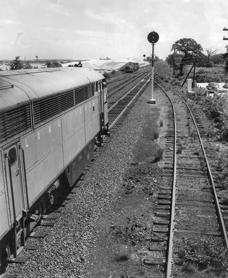
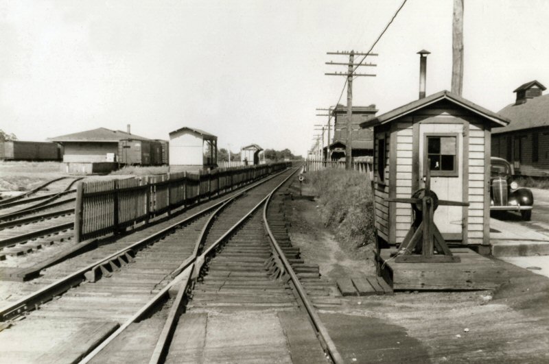
.jpg) MP15ac #171, #155 - Freight westbound thru Farmingdale 2/1979 Photo/Archive: Dave Keller |
||||||
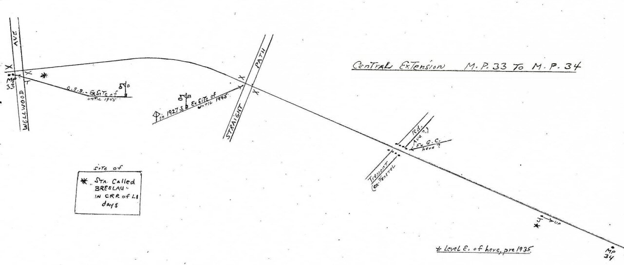
| South Farmingdale Station - Central Extension | ||||||||
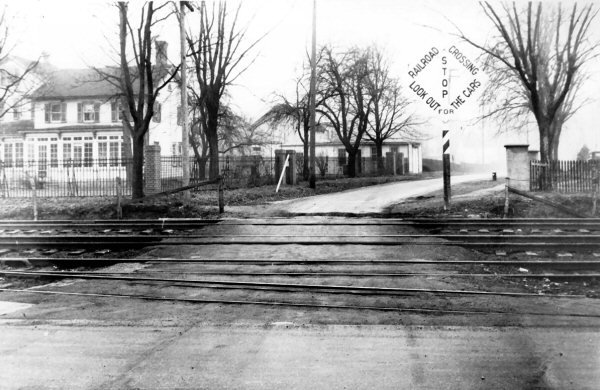
 South Farmingdale Staples St. crossing view W 11/27/1948 |
 South Farmingdale Staples St. crossing view E 11/27/1948 |
 South Farmingdale view W from Staples St. crossing11/27/1948 |
Note:
Position Light Signal in "Approach" mode in background.
|
|||||
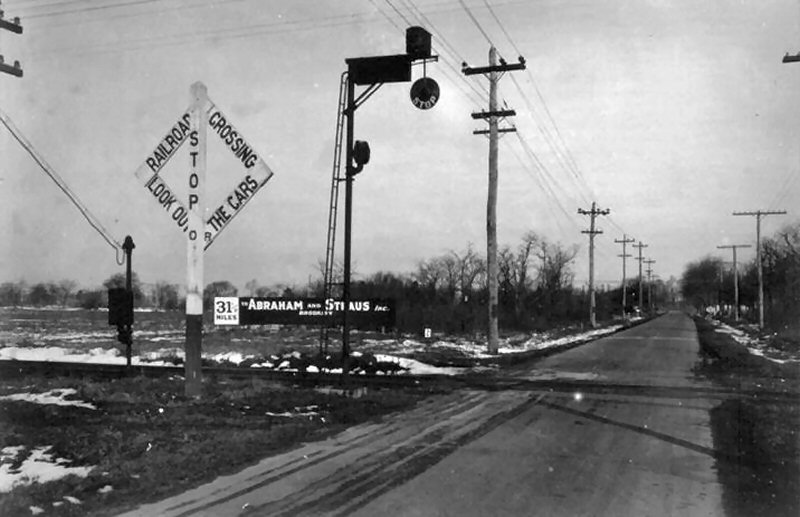
 West Babylon c.1918 Photo: Ed White, Archive: Jim Gillin |
In early years it was called the Central Extension, for at least the past 60 years it has been known as the Central Branch. In Vince Seyfried's LIRR History Vol II on page 140 it states " In 1925 the disused Central Extension between Farmingdale and Babylon was extensively overhauled for the use of through trains to Babylon and points east, this change being necessitated by the electrification of the Montauk Division." So my Uncle Ed White was right about the line being rarely used at the time of his photo. Jim Gillin The Central Extension ran the occasional freight and that was it. Passenger service ended before the end of the 19th century and the line was NEVER used as a connecting branch as was the high-volume Manorville-Eastport connection. As a result, the Central Extension from Bethpage Jct. to Belmont Jct., Babylon fell into disrepair and was relegated to switching some sidings. Montauk trains crossed over from the Main Line to the Montauk branch via Manorville and Eastport and the Central Extension was ignored. When the Montauk branch was electrified to Babylon in 1925, the Central Extension from Bethpage Jct. to Belmont Jct., Babylon was revitalized and heavily rebuilt with then-current-sized rail and new ties. Third rail ties were also installed as it was originally intended to be electrified. New signals were installed and the newly-renovated branch placed in service at or around the same time as the first electric trains ran to Babylon in May, 1925. The Central extension never became electrified for some reason, but passenger trains began using it semi-regularly, and when the Manorville/Eastport spur was removed, the Central was used for all Montauk trains that ran via the Main Line to "B" tower at Bethpage Junction and return. Info: Dave Keller |
|||||||
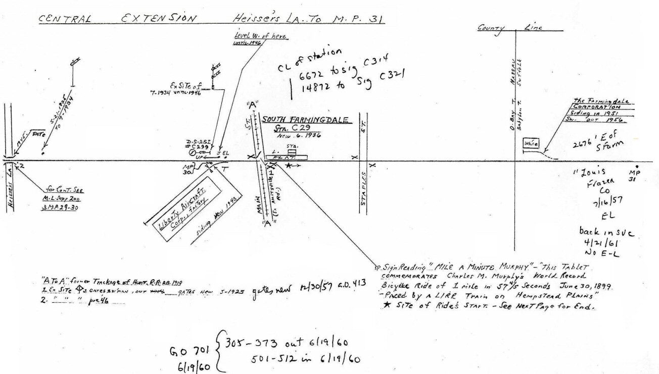 Emery Map Central Ext. Heisser's Lane to MP31 S. Farmingdale 8/1958 Archive: Dave Keller |
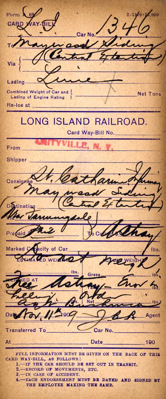 Waybill Maywood Siding 1909 Archive: Dave Keller Note: Whatever the load, it was carried by a LIRR freight car and was weighed in Hicksville, per the note at the very top
|
A shipment of lime from Amityville to St. Catherine's Infirmary at Maywood Siding, the famous siding along the Central Extension where Charles "Mile-a-Minute" Murphy made his famous bicycle ride behind a LIRR train in 1899 (only 10 years earlier!). The directions on the bill say "Central Extension . . . near Farmingdale." Guess the train crew didn't know where it was . . . Back then, lime was used
for two major purposes: |
||||||
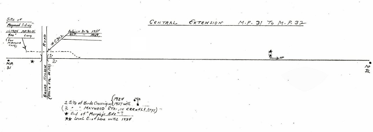 Emery Map Central Ext. MP 31- 32 Maywood 8/1958 Archive: Dave Keller 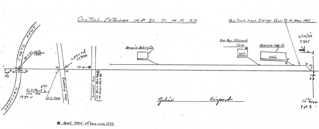 Emery Map Central Ext. MP 32-33 8/1958
|
|
|||||||
 Central Ext. B Tower to Heisser Lane early 1960's
|
 Central Ext. MP31-32 early 1960's 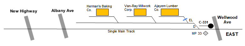 Central Ext. MP32-33 early 1960's |
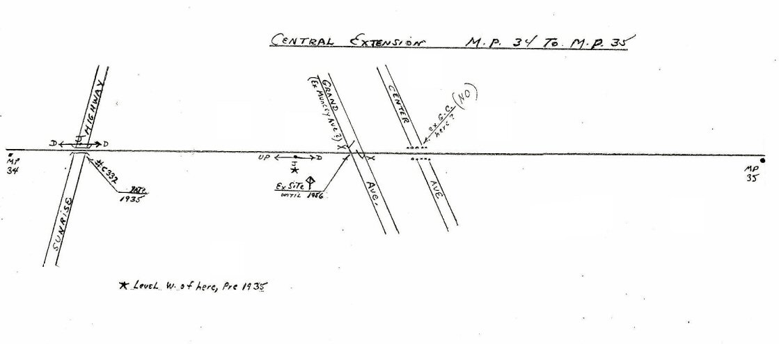
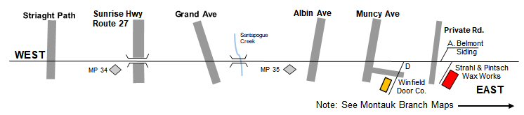 Central Ext. MP34-35+ early 1960's Note: Continued here: Montauk Branch Maps |
||||||
|
The 1958 Robert Emery maps (Dave Keller
collection) were utilized in conjunction with the 1966 LIRR track maps
and other historical information to develop this series of pictorial diagrams to illustrate the early 1960's Central Extension. - Research and drawings: Steven Lynch |
||||||||
| BRESLAU - CRR of LI | ||||||||
| BRESLAU: CENTRAL RAILROAD OF L.I. DEPOT IN SVC: JUNE OR JULY/1873, EAST OF WELLWOOD AVE. OPENED IN COMPETITION WITH THE SOUTH SIDE RAILROAD'S BRESLAU STATION STOP. LAST LISTED ON CRR of LI TIMETABLE OF 03/1875. Research: Dave Keller | ||||||||
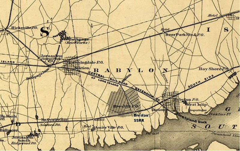 Breslau map modified showing SSRR Breslau Station 4/04/1873 Archive: Library of Congress
|
 |
|||||||
|
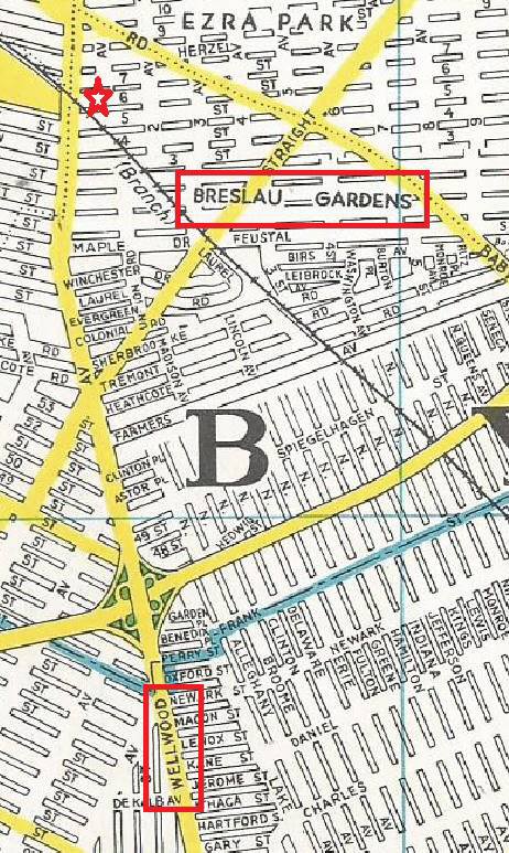
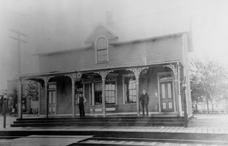
The SSRR of LI opened a Breslau station on the south shore at Wellwood Ave. and the stop later became Lindenhurst. In competition, the CRR of LI opened a Breslau station also at Wellwood Ave. only on the Central branch, north of the SSRR's Breslau stop. The CRR's station didn't last long and was discontinued. The red star is the location of the CRR of LI's Breslau station on the east side of Wellwood Ave. (Hagstrom 1960 - Breslau Gardens Archive: William Gilligan) An interesting point is the name of the area . . . "Breslau Gardens." The station stop is long gone, but the name remained (as of the time this map was printed), given to the area that later developed there. Research: Dave Keller |
||||||||
| BRESLAU - SOUTH SIDE RAIL ROAD | ||||||||
|
BRESLAU: SOUTH SIDE RAIL ROAD SSRR SERVICE
BEGAN ON 10/28/1867 AS WELLWOOD. ORIGINAL 2-STOREY, WOODEN DEPOT WITH
FRONT VERANDA STYLE COVERED PLATFORM AND PORTE COCHERE AT REAR. ALSO
HOUSED THE POST OFFICE. RELIGIOUS MEETINGS HELD EVERY SUNDAY AFTERNOON
AND SUNDAY SCHOOL CLASSES SUNDAY MORNINGS. (South Side Signal of
12-17-1870) BUILT ON SOUTH SIDE OF TRACKS AND EAST OF WELLWOOD AVE.
RENAMED "BRESLAU": 1869. 2ND DEPOT PRIVATELY BUILT 25’ NORTH OF ORIGINAL DEPOT SITE (ACROSS TRACKS ON NORTH SIDE OF TRACKS.) 2-STOREY, WOODEN DEPOT HAD AGENT'S LIVING QUARTERS UPSTAIRS. OPENED IN TIME FOR JUNE 6TH, 1870 FESTIVITIES FOR LAND SALE AND DEVELOPMENT OF BRESLAU. SSRR GAVE A TERRIBLE PERFORMANCE AT THE FESTIVITIES AND RECEIVED SUCH SCATHING REVIEWS FROM THE BROOKLYN DAILY EAGLE THAT IT'S BELIEVED THE OFFER TO GIVE THE SSRR THE DEPOT WAS CANCELLED AND MOVED OFF-SITE WITHIN A FEW MONTHS TO BECOME A MUCH-NEEDED SCHOOL WHICH OPENED ON 12/12/1870, BUT WAS FOUND TO BE TOO SMALL AND "WOULD BE REPLACED SOON" (Bayles, 1874). THIS 2ND STRUCTURE BECAME FIRE HOUSE. ORIGINAL 1867 DEPOT REMAINED IN SERVICE ON ITS ORIGINAL SITE. STATION NAME CHANGED TO “LINDENHURST": 7/14/1891. (SEE: "LINDENHURST”) Research: Dave Keller |
||||||||
 PTT SSRR East - Wellwood 1/01/1869 Archive: Art Huneke |
 PTT SSRR East - Breslau 5/30/1870 Archive: Art Huneke |
 Nehring's Hotel at Breslau Station SSRR 1870 Archive: Art Huneke
|
||||||
 Lindenhurst Station - SSRR 1891 Archive: Dave Keller |
The LIRR: Part One: South Side R.R. of Long
Island Lindenhurst: Thomas Wellwood, a real estate promoter, bought the village land in 1861, and was joined by Charles S. Schleier in October 1869, who renamed the new development after his native Breslau in Prussia and boomed it as a German colony. The village first appears on the timetable of September 1, 1868 as Wellwood and so remains through 1869. In May 1870 the station appears as Breslau. In June 1891 the Hon. Benjamin F. Tracy, owner of much of the shore-front acreage, successfully lobbied a petition through the Post Office Department to change the name to Lindenhurst, and the railroad station was so changed on July 14, 1891.
|
|||||||
|
|
||||||||
 LIRR map 1978 page 51 - Central Branch - Wellwood Terminal Archive: Jeff Erlitz |
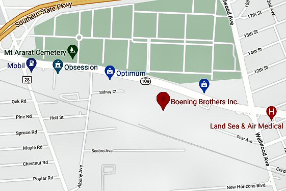
 LIRR C420 #221 Train #4012 Jamaica to Montauk - RS3-#1553 working Wellwood Terminal Boening Bros. Beer and Herman's Star Bakery east of B Tower in North Lindenhurst - View NW 11/16/1975 Photo/Archive: Jeff Erlitz |
 Wellwood Terminal - Central Extension Google map 2021 |
||||||
 Central Branch bridge over the Southern State Parkway at MP32 view east 7/25/10 Photo: Al Castelli
|
|
|||||||
 Emery Map Central Ext. MP 34-35 8/1958
|
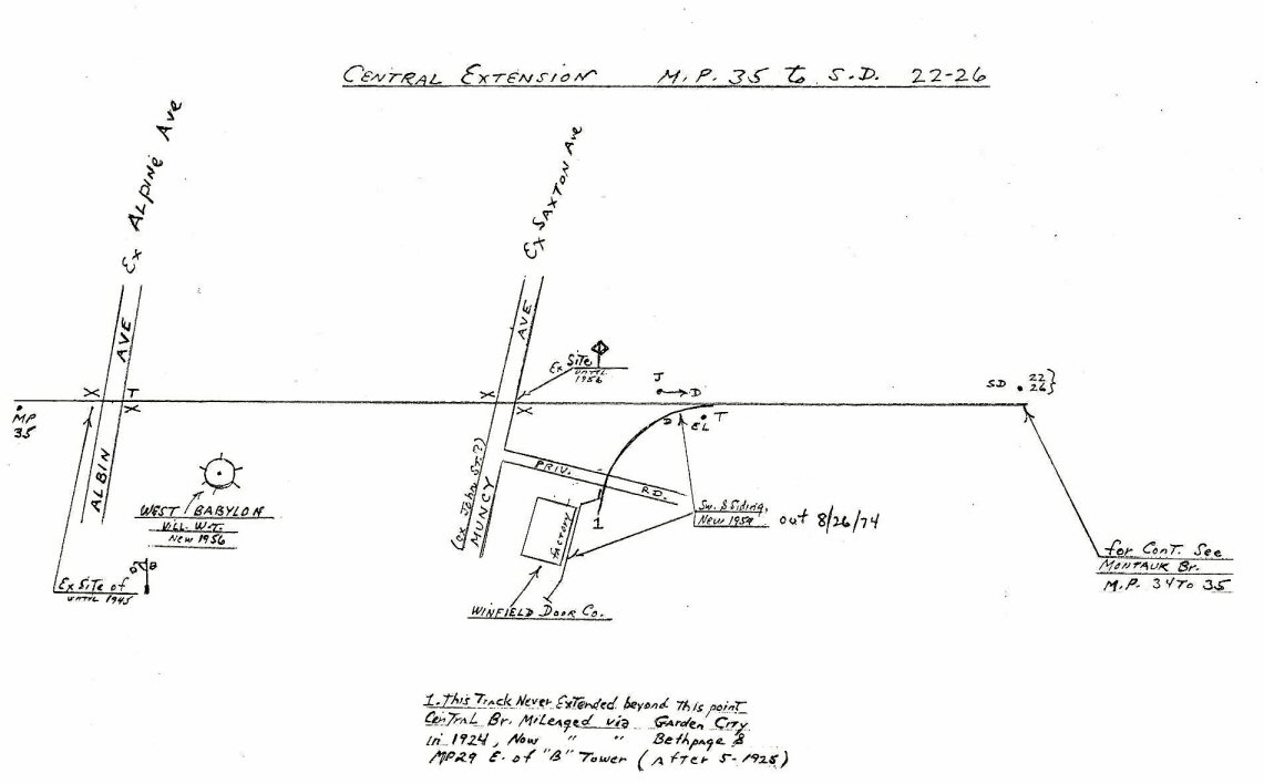 Emery Map Central Ext. MP 35 to SD 22-26 West Babylon 8/1958 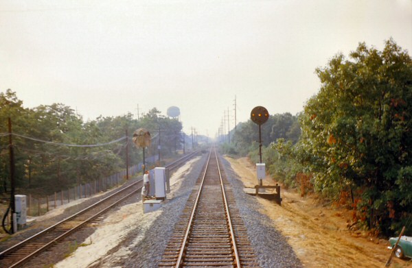 Central Extension east of Muncy Ave view NW 1st train into new elevated Babylon Station Old ROW at left 8/26/64 Photo: Brad Phillips
|
|||||||
toBabylonDock.jpg) Emery Map Central RR Co. of LI at Belmont Jct. c.1874 to Babylon Dock Archive: Dave Keller |
.jpg) Emery Map Central RR Co. of LI at Belmont Jct. prior to 05/16/1906 MP35-36 Archive: Dave Keller |
|||||||
|
"Mile-A-Minute" Murphy |
||||||||
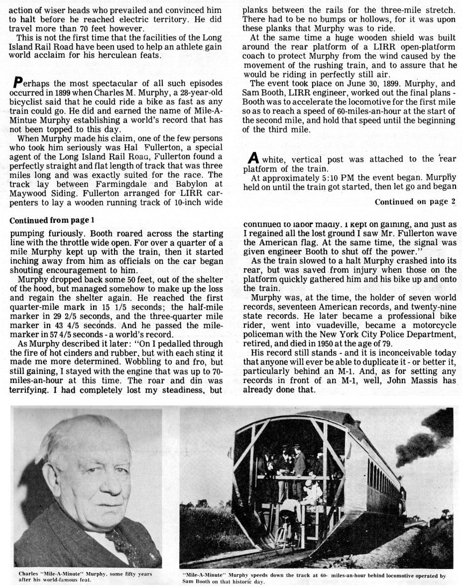 Long Island Metro Lines 1974 Apr-May No. 39 article on Charles "Mile-A-Minute" Murphy |
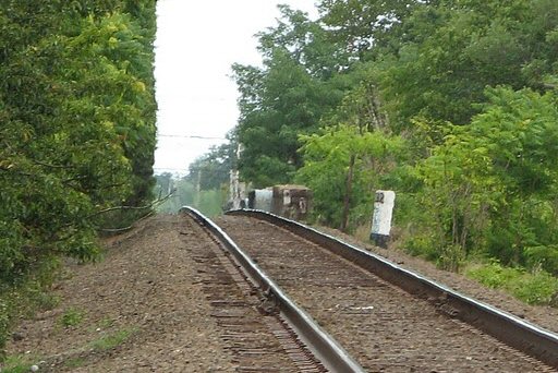
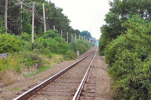 LIRR Central Branch looking west towards Route 110. A position light signal is visible to the left with the Route 110 bridge beyond it. 7/25/10 Photo: Al Castelli |
|||||||
08/12/2025
 Farmingdale
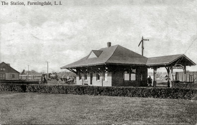
.jpg)
_viewN-1940_ThomasValentino.jpg)
.jpg)
.jpg)


