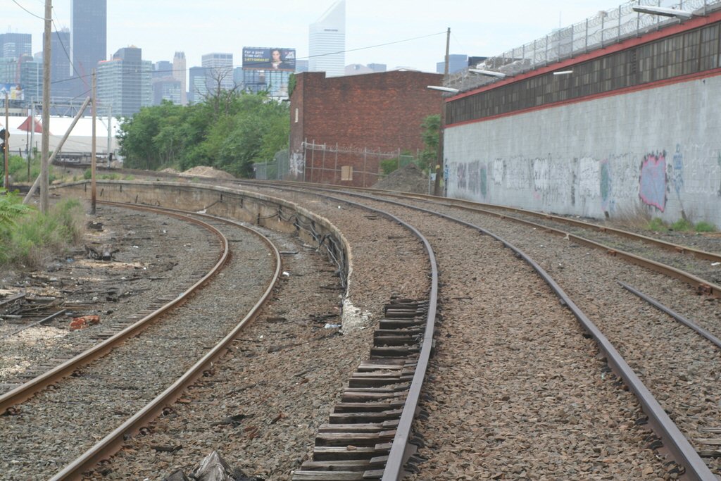
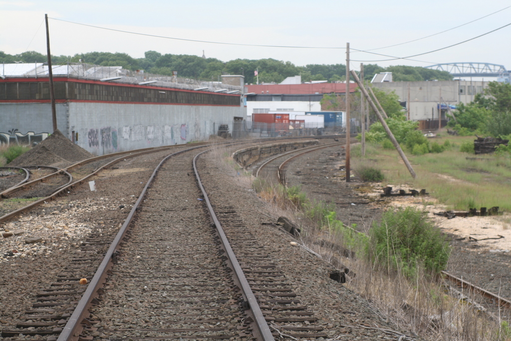
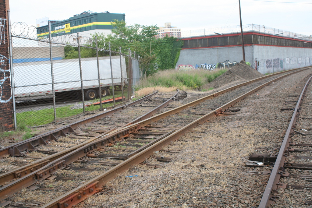
 Montauk Cutoff
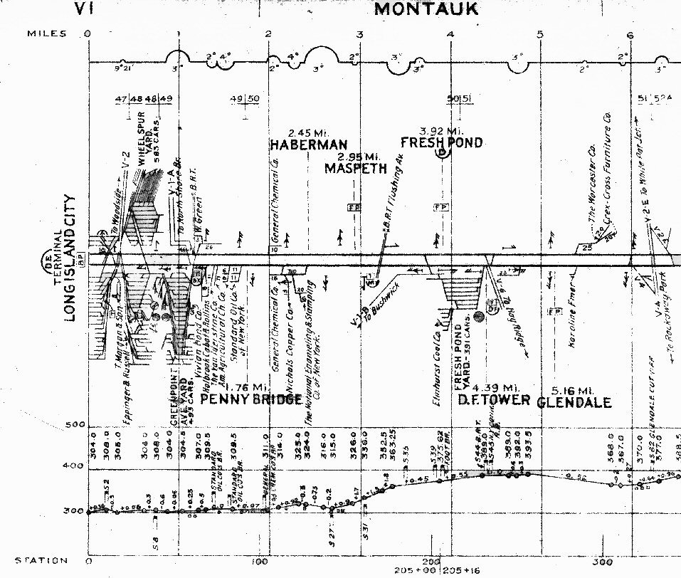
Montuak Branch track profile map LI City 0-6 miles
Collection: John Fusto
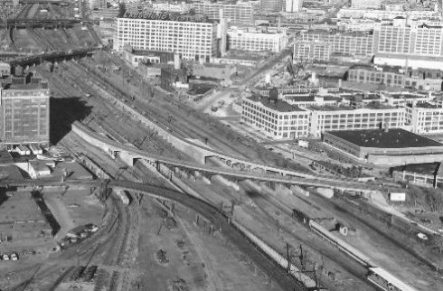
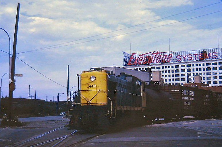
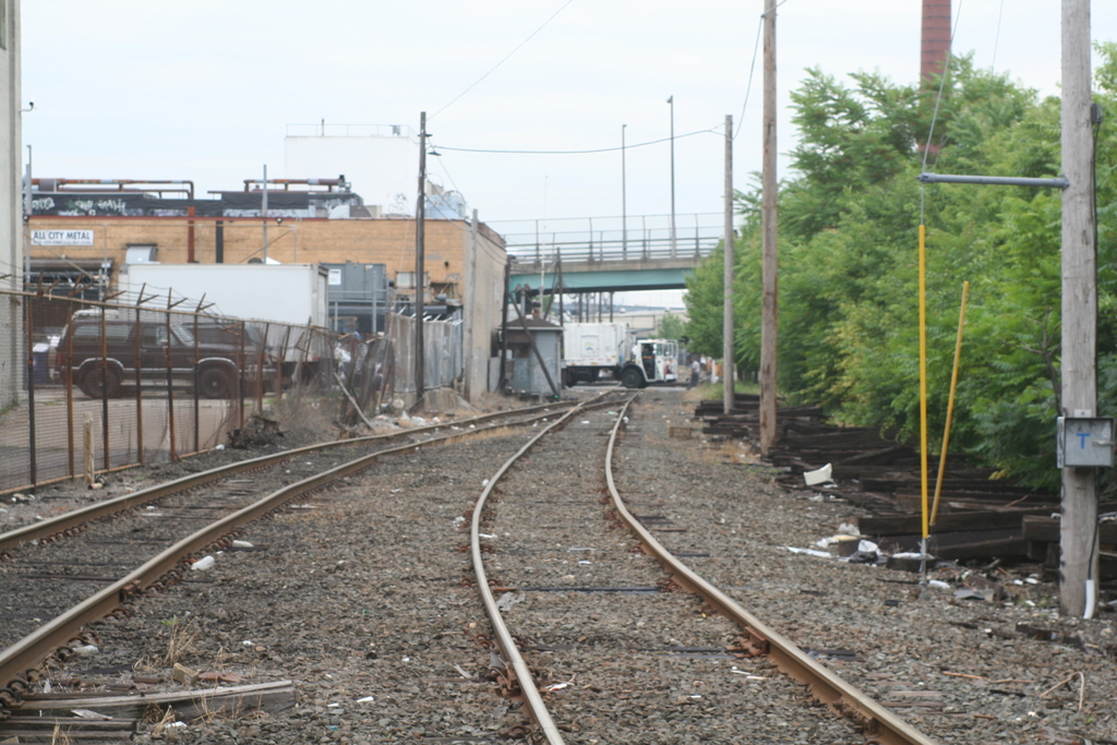
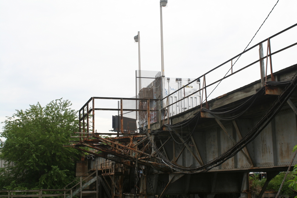
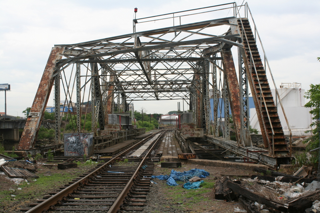
Looking East-NE: Sunnyside passenger yard upper left, freight team track platforms lower left, Montauk Cut-off tracks centerview, and Executone Telephone Systems (ex-Sunshine Biscuits bakery 1956) upper center.
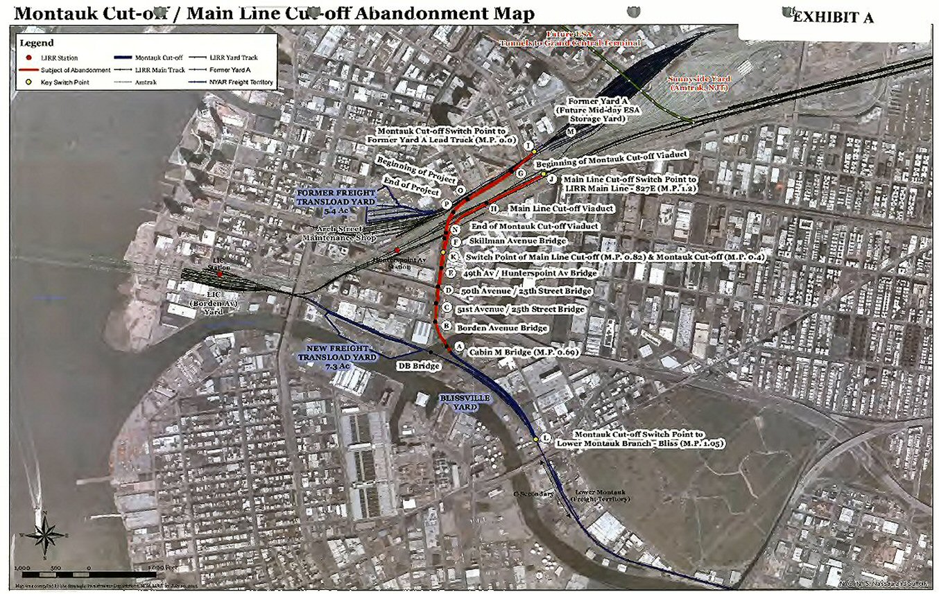
Montauk Cutoff Abandonment petition map 10/13/15
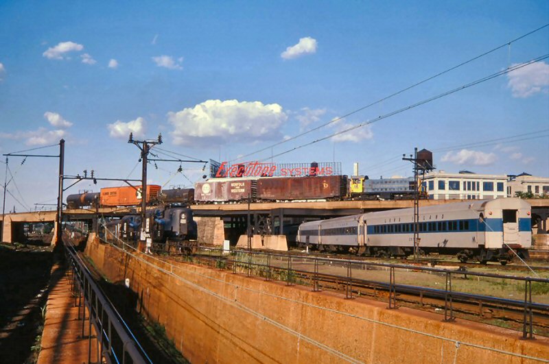
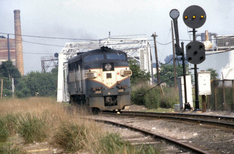
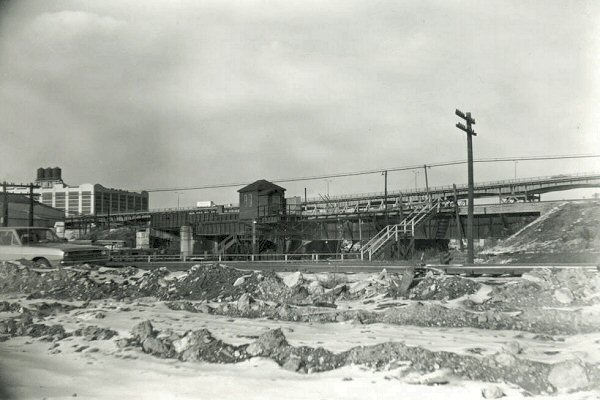
Long Island City, NY 7/12/1974 Photo: Vincent J. Benkovitz, Archive: Mike Woodruff
Locomotives: PC 4875 (GG1), LIRR MTA Alco S1 (Info: Paul Strubeck)
Three trains moving in this shot; on the right, a LIRR commuter train has departed Hunterspoint Avenue station headed east, on the left a pair of GG1s bring an equipment move from Sunnyside Yard into Penn Station, while up above a LIRR Alco S1 hauls a short cut of cars out of Yard A on the Montauk Cut Off toward Bliss tower. Author: Vincent J. Benkovitz
View east from the mouth of the East River tunnel portals towards the Montauk Cutoff curving overhead with an eastbound LIRR freight consist. The tracks to Penn Station and the tunnel are to the right and left of the abutment and low railing, visible in the shadows and are beginning to angle downwards. Info: Dave Keller
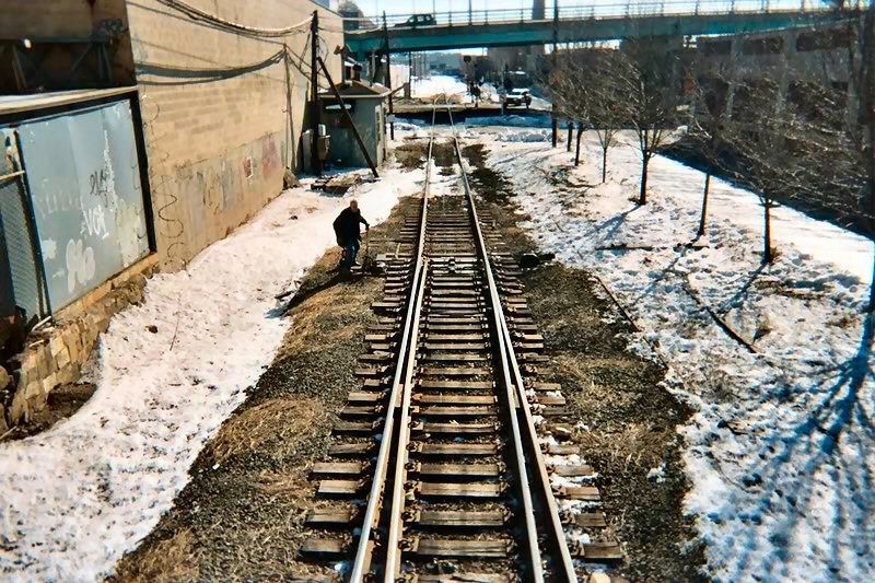
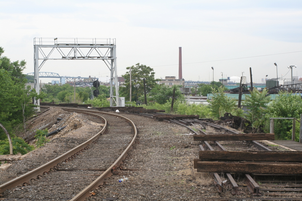
Montauk Cutoff west leg into Yard A from Bliss cab view
Going from Bliss to yard A is considered west. 03/2005
Photo: Bob Anderson

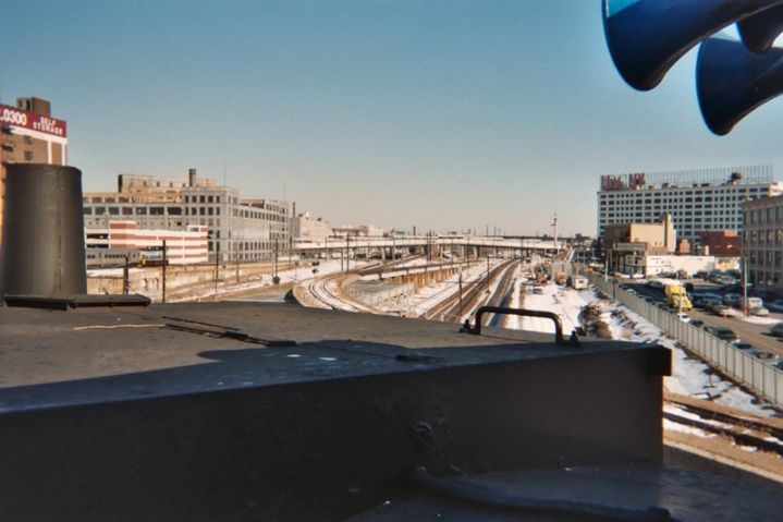
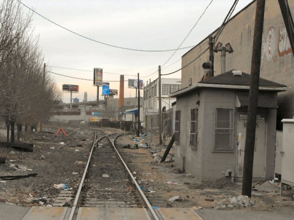
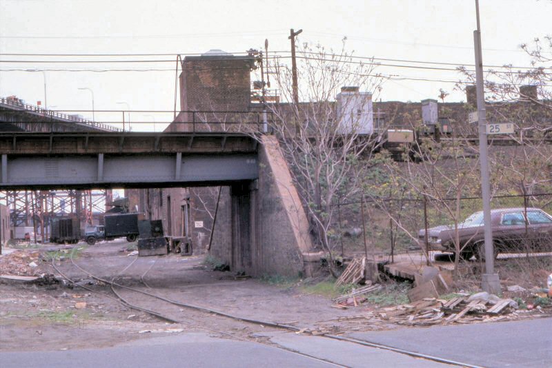
Montauk Cutoff view from City Storage Bldg
Photo: Kevin Katta 11/07
Office of Chief Engineer, Pennsylvania Railroad, May 20, 1946
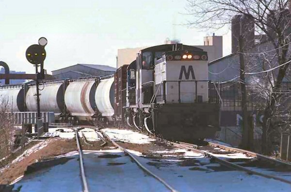
LIRR #155,156 eastbound to Bliss
from LI City Yard A 12/08/77
Archive: Henry Wagner
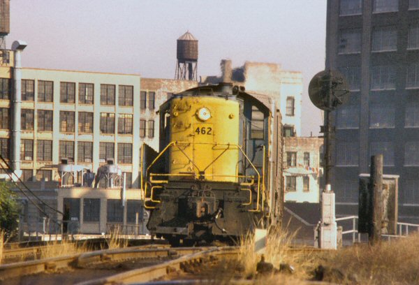
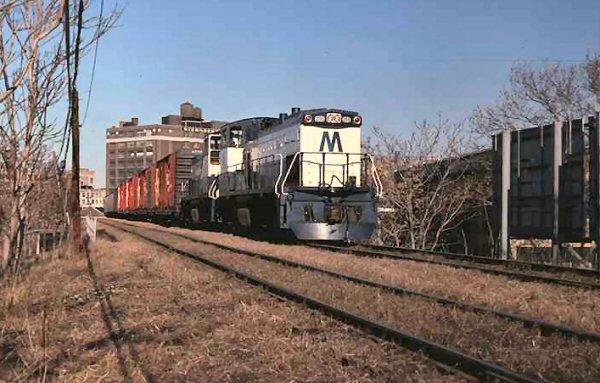
LIRR RS-1 #462 Montauk Cutoff 10/1974
Photo: A. Joseph Daly
LIRR S-1 climbing out from North Shore/Yard
A, on Montauk cut-off 10/1974 Photo: A. Joseph Daly
LIRR #159, 154, 224 westbound Bliss to Yard A on secondary track Train RF-15 02/11/1979
Archive: Henry Wagner
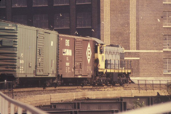
LIRR #443 1971 at Degnon Terminal
Info: Henry Wagner
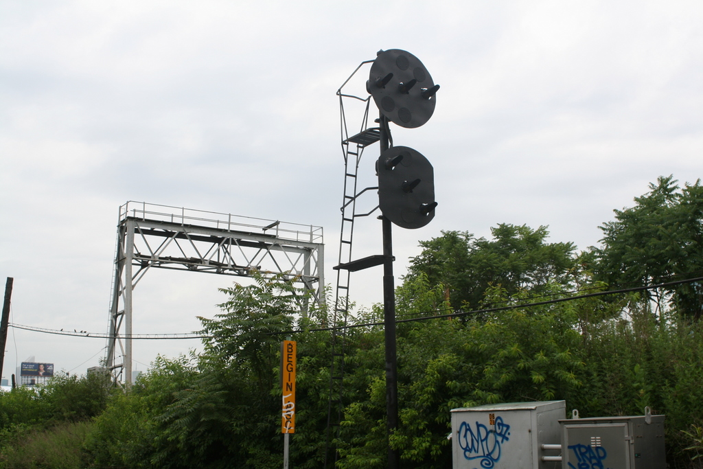
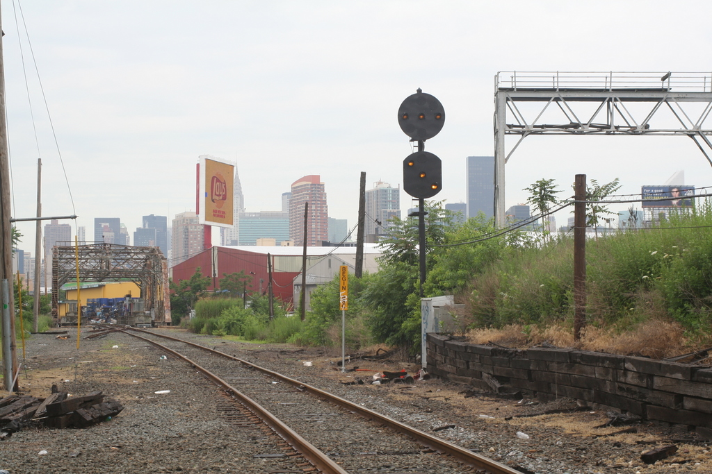
Bliss Cabin 03/2005 view E. Aligning the switch after entering, this is going west, taken
from the rear of the train. On the eastbound trip back, it's a spring switch.
Montauk Cut-off - Removed GN 3-22 8/19/17
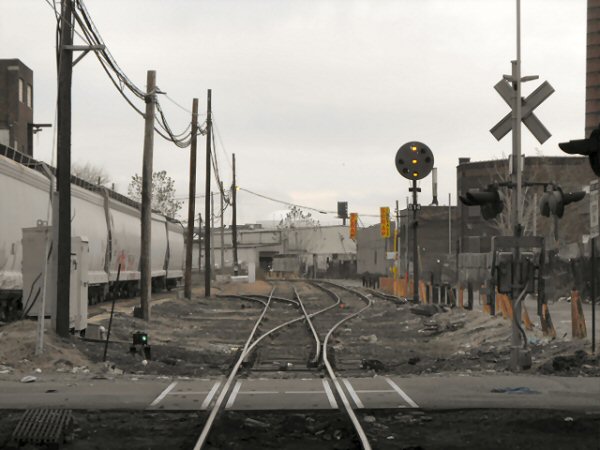
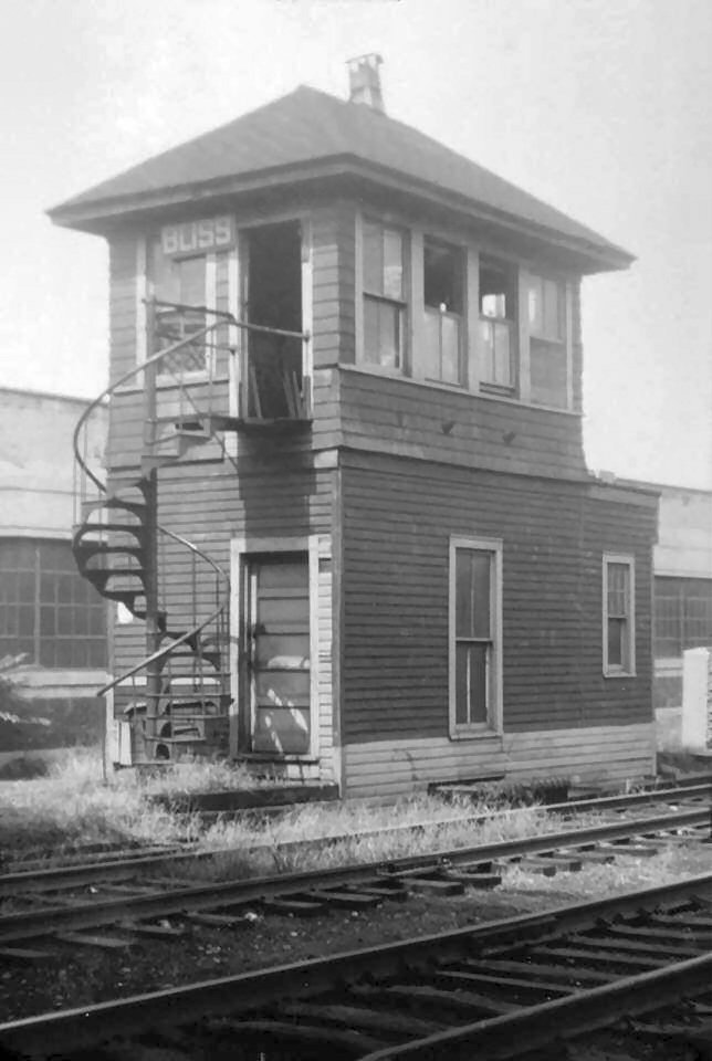
Bliss Cabin, facing west. 11/24/08
Photo: Bob Anderson
Bliss facing east. 11/24/08 Photo: Bob Anderson
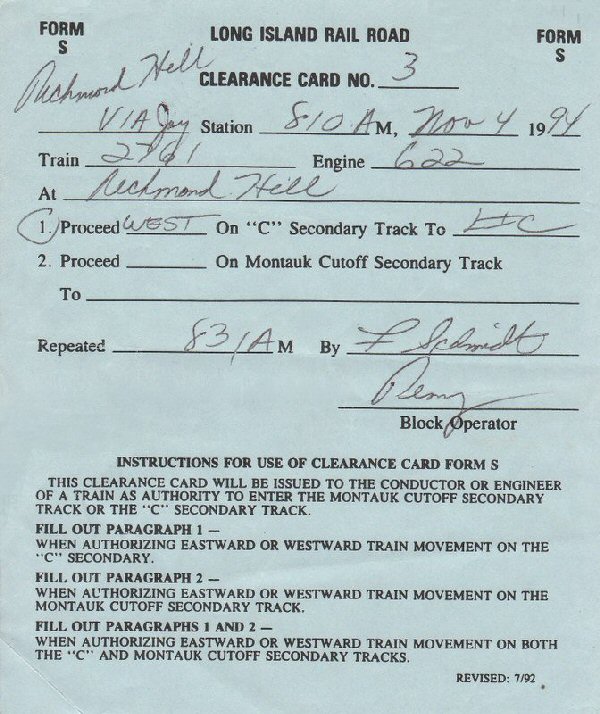
S Form Clearance Card: 11/04/94 Proceed west from Richmond Hill to LI City via the C secondary
Archive: Neil Feldman
Going from Yard A to Bliss is
considered going east.
Going from Bliss to yard A is considered west.
It's a secondary track with no assigned direction. You need the authority of an "S" Card to enter the track.
When I was on the roustabout, we would get the "S" Card from Jay Tower, Via Radio, T box ( wayside phone) or by cell phone.. I guess with recent events the cell phone is out.
The S Card was the authority to operate on the C secondary, and/or Montauk Cutoff.
It would not be issued unless the operator knew the track was clear.
We in turn had to report clear of the secondary, and Montauk Cutoff.
Entering the cutoff from the C secondary, the spring switch has to be manually
lined, normal is lined for the C secondary, then after clearing the switch, it
had to be lined back to normal.
Coming off the Montauk Cutoff to the secondary, no alignment is needed, it works as a
spring switch in that direction. Research: Bob Anderson
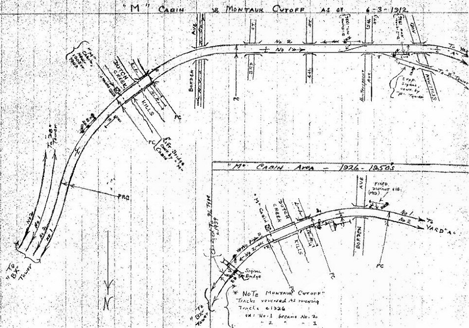
Emery Map: M Cabin 1912-1950s
Archive: Dave Keller
Emery Map: Bliss Yard 11-1960
Archive: Dave Keller
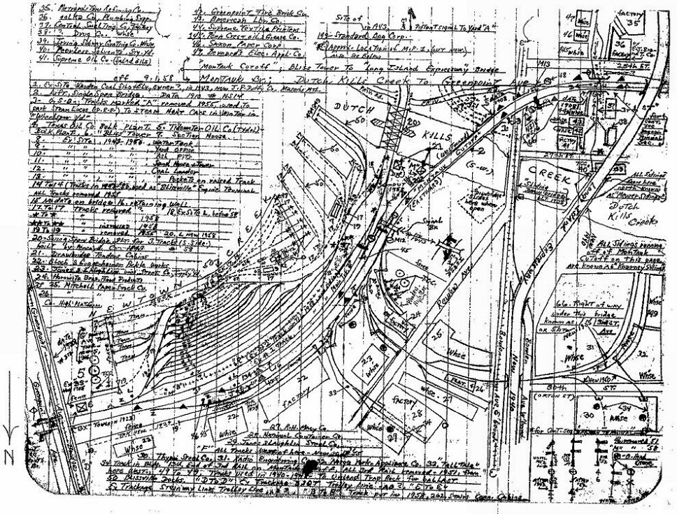
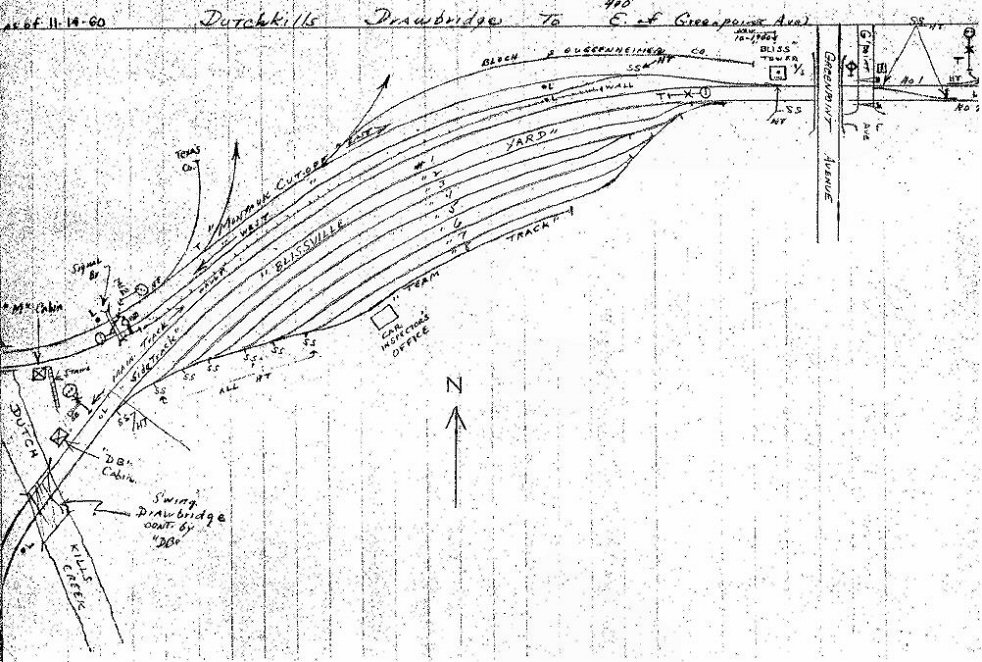
Emery Map: Dutch Kills to Greenpoint Ave 1958
Archive: Dave Keller
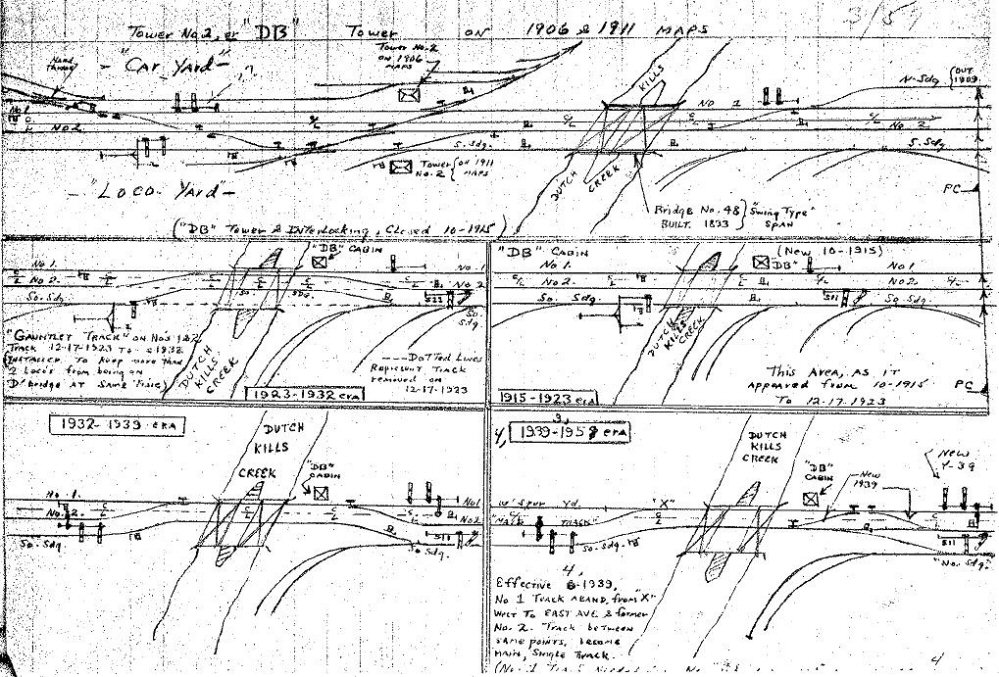
Emery Map: DB Tower 1906-1958
Archive: Dave Keller
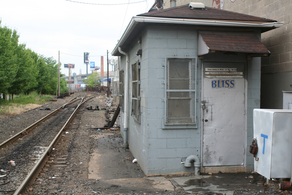
Bliss Cabin, facing west. Greenpoint Ave and the rest of the Montauk is at my back.
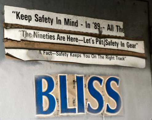
LIRR Bliss Cabin Messages
09/1991
Leaving Bliss, check out the remains of the yard. Facing east towards
Bliss is where the C-secondary joins the line, the switch to Blissville
yard was right in front of where I stand.
On my left you have the C-secondary, which links the Lower Montauk with LI City yard, the right is the active track of the Montauk Cutoff, that's what were headed down looking west
View looking back east.
Head up around the curve and we have the Kearny siding facing east, the
out of service track
which is serving nothing but some shrubbery these days. Kearny is to my
left.
Here's a shot looking back towards the old signal bridge, you
can see a PLS (PRR/LIRR position light signal) protecting the C-secondary
that is on the lead to the Lift Bridge. The Lift bridge is the closest to
the L.I.E or "Midtown Highway" on your older map. Directly to
the right is where the Swing bridge (Which is known as the Draw Bridge,
dating back to the former bridge standing there).
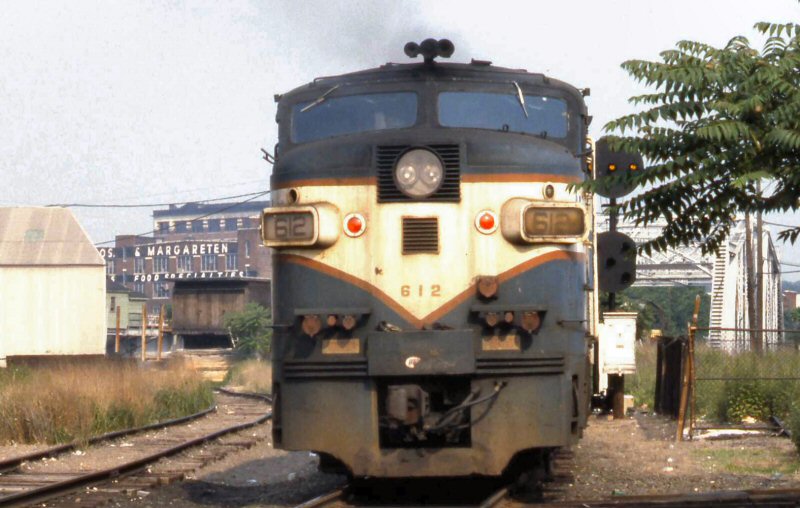
LIRR #612 passing DB Cabin
eastbound over Dutch Kills 06/1981 Photo: S. Goldstein
In the background is Horowitz Bros. & Margareten, which, if you
remember looking at the Kosher products on the shelves at Waldbaum's
Supermarkets is the firm that makes matzos! Info: Dave Keller
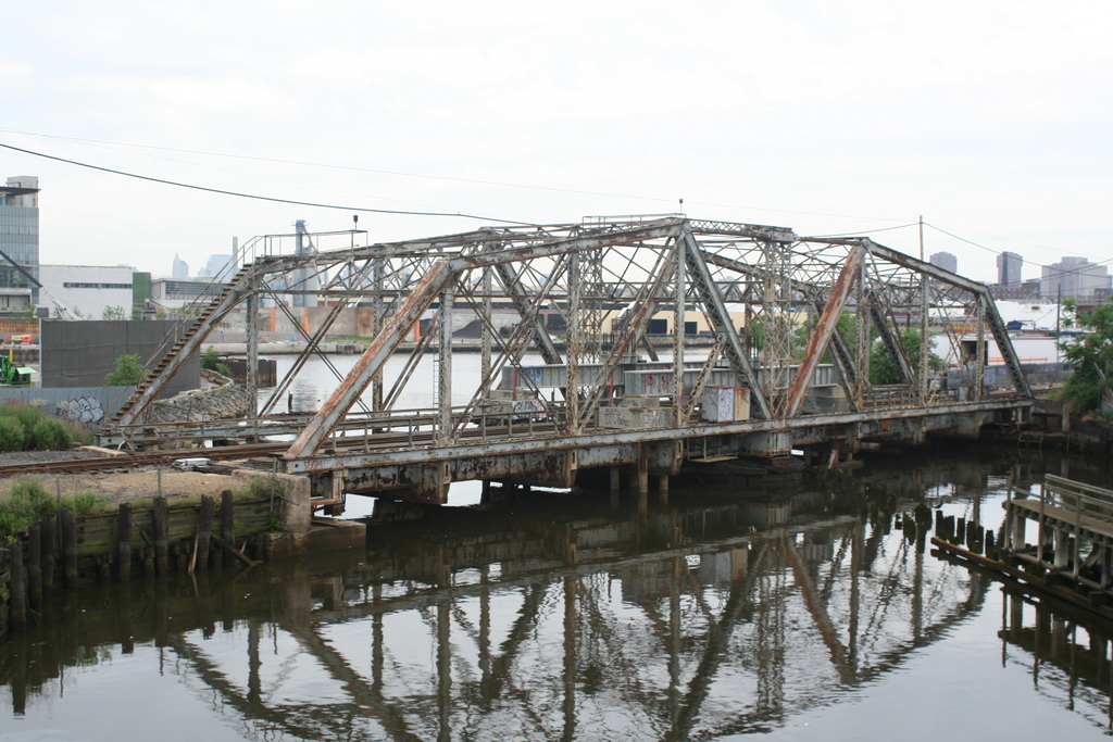
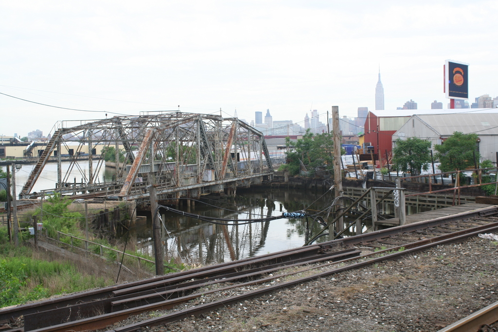
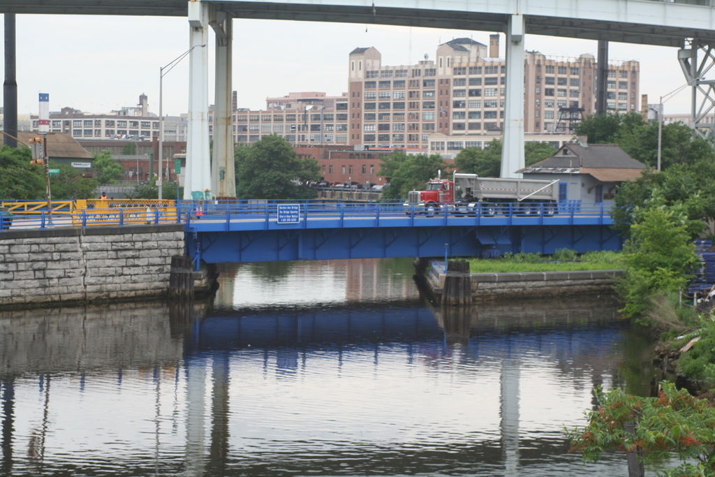
Dutch Kills view south. Both LIRR bridges in sight.
Foreground bridge: Montauk Cutoff to Sunnyside Yard
Background Bridge: Swing Bridge at DB Tower
The Lift Bridge:
"The Bridge" is the Lift bridge on the Montauk Cutoff, it's
where M Cabin is perched on top of.
LIRR #612 crossing Dutch Kills
drawbridge (swing bridge) eastbound over Dutch Kills 06/1981 Photo: S. Goldstein
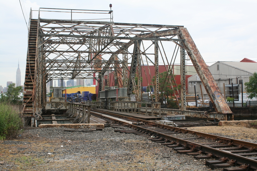
Montauk Cutoff - View E 6/14/1974 Photo/Archive: Richard Makse
Note: Above the bridge abutment, you can see the home signal for M Cabin, complete with smash board. The Montauk Cutoff was left-handed (English) running based on the design of Yard A. The westbound cutoff, closest to the camera, only had a low home (dwarf) signal protecting eastbound moves. Richard Makse
Note
2: The location above is Meurer's siding; named after the Meurer
Steel Barrel Company.
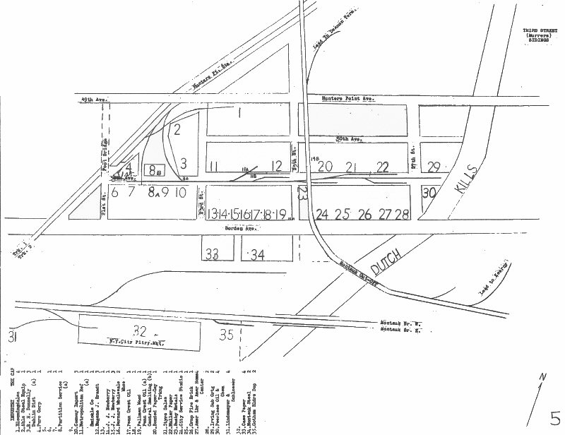
LIRR map - Meurer Sidings 1966 Page 5
:
All the shots of M Cabin (more like M-container!) are facing west, we
risked walking the draw bridge, but the lift is way to sketchy.
"M" cabin 12/70 Photo: Dave Keller
Dutch Kills Swing Bridge:
Dutch kills swing bridge taken from M cabin drawbridge,
February 2005 while working the rosustabout. Photo: Bob Anderson
Dutch kills swing bridge
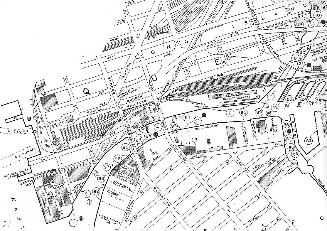
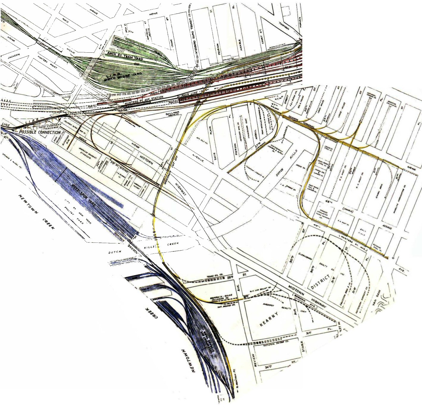
LI City detail of Hunter's Point and Newton
Creek area. Circa 1947-1954 as the Pulaski Bridge is under construction on
this map. Archive: Steve Lynch
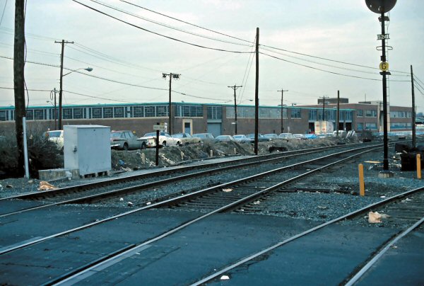
DB Cabin 05/16/1976
Archive: Henry Wagner
Wheelspur Yard:
The Wheelspur yard (on the right) is on the west end of the swing/draw
bridge, the switch lead for LI city is in the far background, as well as
the signal protecting the secondary. In its place is a
building, and a pile of junk. Hard to imagine there was a major yard
located here with the building there now!
Montauk cutoff drawbridge at “M”
cabin, looking west at
Wheelspur Yard
Photo: Art Huneke 1955
Back towards Bliss. The shot facing up towards the old signal bridge is also on the C-secondary.
Check out the switch leading to nowhere facing west, standing on the
C-secondary. The bridge is in the distance, in my infinite wisdom I didn't
get a detail shot of the switch!
Borden Ave
View north, LIE above
06/2007
Haberman Station - Montauk Branch 03/19/1976
Archive: Henry Wagner
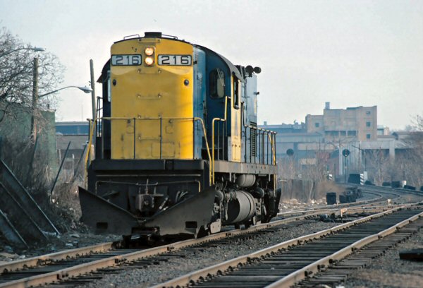
LIRR #216 east of Haberman 03/05/1976
Archive: Henry Wagner
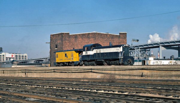
Blissville looking at the Montauk Cutoff LIRR #1106, caboose #56 heading east Archive: Henry Wagner