| Hell
Gate Bridge Construction
|
|
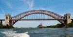
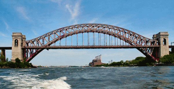
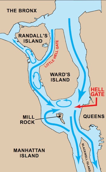 The bridge is known as the Hell Gate Bridge because it spans the section of the East River known as the Hell Gate. This particular section of river has no demonic connection, nor does it lead to any section of hell; it just separates
Randall-Ward Islands from Queens. The water was named in 1614 by Adriaen Block, captain of the Onrust sailing south from Albany;
Hellegat, in Old Dutch, translates apparently to 'beautiful strait'**. (Please remember that the Dutch named many of the peculiar features of this town: their word for "river" came into English as
"Kill". Thus: Bronx Kill, Arthur Kill (Staten Island, etc.) The bridge is known as the Hell Gate Bridge because it spans the section of the East River known as the Hell Gate. This particular section of river has no demonic connection, nor does it lead to any section of hell; it just separates
Randall-Ward Islands from Queens. The water was named in 1614 by Adriaen Block, captain of the Onrust sailing south from Albany;
Hellegat, in Old Dutch, translates apparently to 'beautiful strait'**. (Please remember that the Dutch named many of the peculiar features of this town: their word for "river" came into English as
"Kill". Thus: Bronx Kill, Arthur Kill (Staten Island, etc.)
Plans for a rail bridge connecting Long Island to the American mainland were long in coming. The previous methods of getting trains through the area either involved ferrying the trains down the Hudson from the Bronx to Jersey City, or a long and costly detour through Westchester into New Jersey. Oliver W. Barnes, an engineer and friend of Pennsylvania Railroad president Alexander J.
Cassatt, first drew up plans for the East River Arch Bridge in 1892. This bridge was to be part of a whole series of connections joining the
Pennsylvania Railroad New Jersey and Connecticut through New York City. Bridge designer Gustav Lindenthal saw in these plans the possible realization of his dream to build a huge suspension bridge over the Hudson River. The New York Connecting Railroad company was formed that year to bring these ideas to reality.
The Pennsylvania Railroad acquired the New York Connecting Railroad sometime around 1904, and that year appointed Lindenthal as consulting engineer for the entire project.
He had made a name for himself in New York with his work (some still ongoing) on three other East River bridges; this new project would ask him to join the tracks of three separate rail companies on three separate land masses. Unfortunately for
Lindenthal, the plans favored rail tunnels under the Hudson rather than the bridge he dearly wanted; he was, however, given a bridge to design over the Hell Gate.
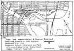
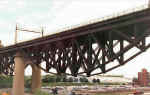
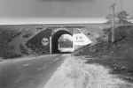
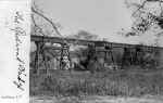
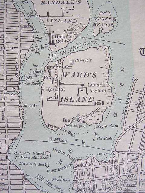
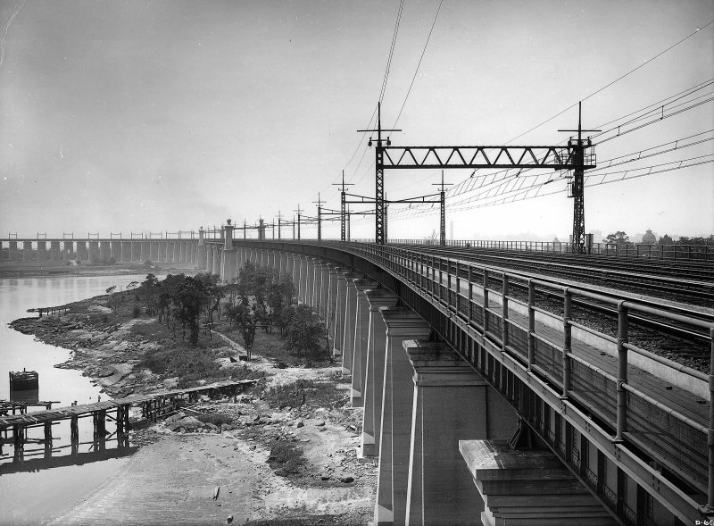
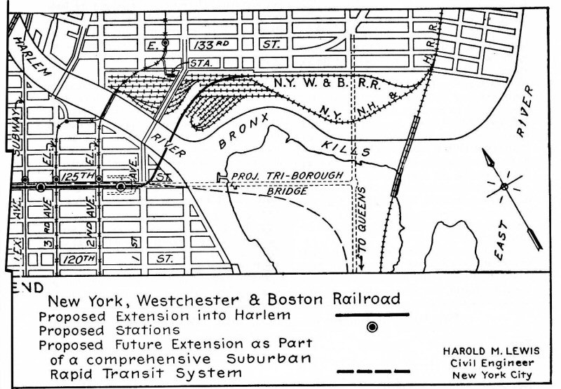
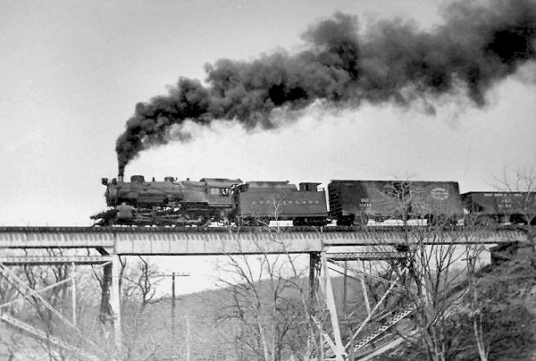
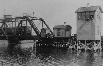
The bridge project would actually be constructed of three smaller bridges joining north Queens to the south Bronx. The first, crossing the Bronx
Kills 1, was originally planned as a bascule bridge in case the Kills ever became navigable, ended up as a 350' long truss bridge. The second, crossing the now-filled Little Hell Gate
2
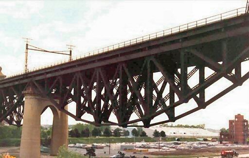
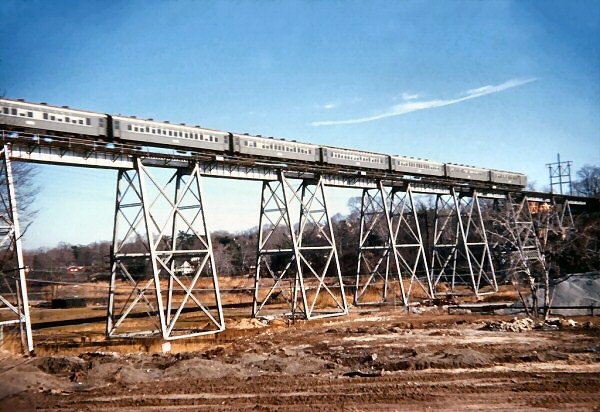
between Randall's and Ward's Islands, would be four reverse-arch bridges of 300'. And finally, there would be the main span, crossing the Hell Gate itself to land in Queens. All of these bridges would be connected by several thousand feet of viaducts; the full project would be more than three miles long. The bridge would also carry an unprecedented four lines of rail traffic.
Designing the bridge was difficult. The final steel-arch design was chosen because of the limiting factors inherent in the project's design. It would have to be strong enough to bear the weight of several locomotives crossing at once, with the ability to bear the locomotives of the future; it would have to rise high enough over the East River to allow ships to pass underneath; and its approach would have to handle the sharp curve required to avoid the mental hospitals on Ward's Island. And, of course, it would have to be cheap.
Lindenthal hired 95 engineers to work on the technical details of the bridge's construction, freeing himself to work on the aesthetics. Not only, he reasoned, should the bridge look impressive in order to accentuate the importance of this rail link, but it would be seen by all the passengers on these trains and also visible from all over the city. Otharr
Ammann, his assistant chief engineer, felt that
[a] great bridge in a great city, although primarily utilitarian in its purpose, should nevertheless be a work of art to which science lends its aid. An elaborate stress sheet, worked out on a purely economic and scientific basis, does not make a great bridge. It is only with a broad sense for beauty and harmony, coupled with wide experience in the scientific and technical field, that a monumental bridge can be
created.
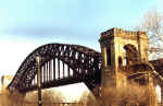
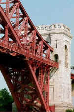
Two designs for the arch were brought forward in 1905. The first design, inspired by a bridge built by Gustave Eiffel in France, was rejected due to its
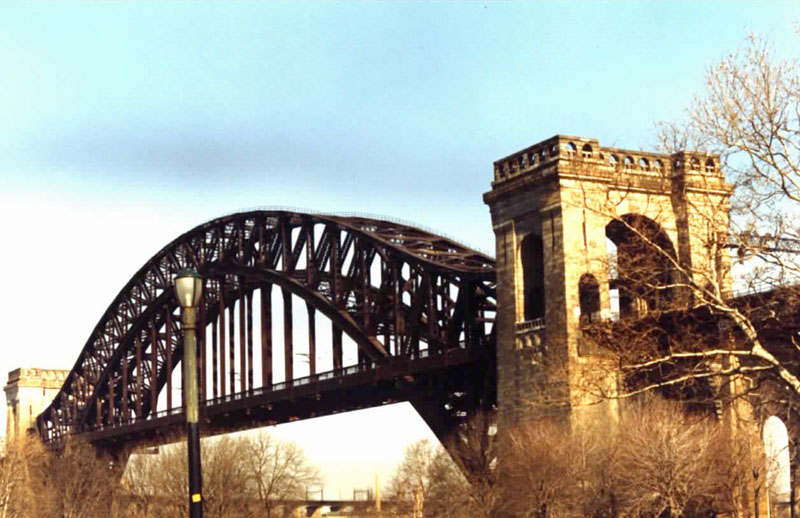
apparent weakness. The second, approved, design, was similar to that of bridges that spanned the Rhine in Germany, and appeared more sturdy than the former. The bridge was to consist of a great steel arch, flanked on either side by two tremendous stone towers.
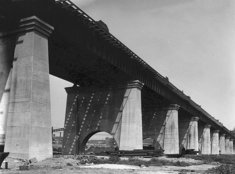
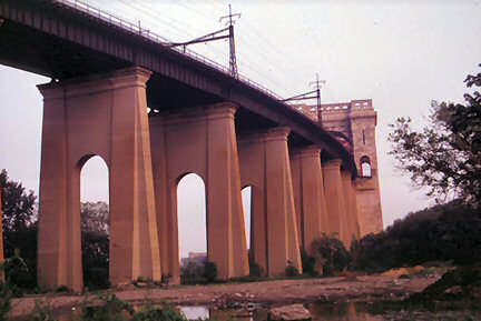
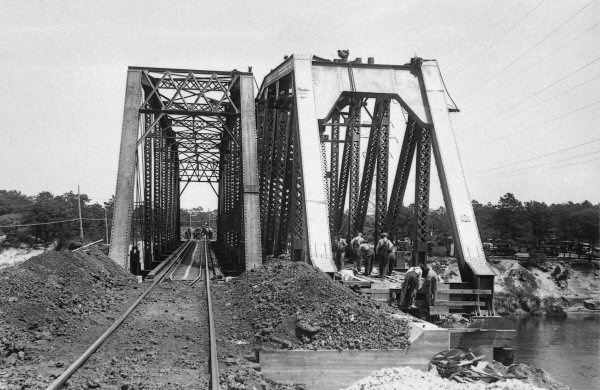
Construction was started on the project in 1912. Lindenthal was forced to changed some plans in 1914. The original design called for the viaduct to be supported by steel piers and girders, but the local government felt that the inmates of the island's mental hospitals could climb the steel girders and escape. This, along with the knowledge it would quiet the sounds of the rails, changed the makeup of the piers from steel to concrete.
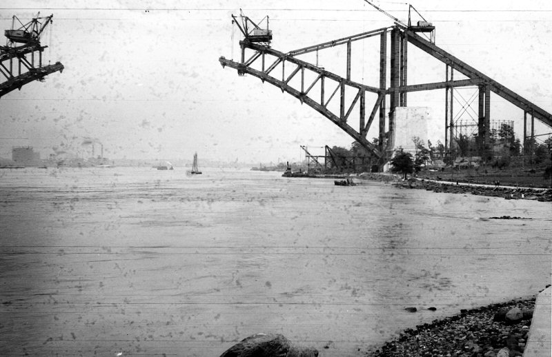
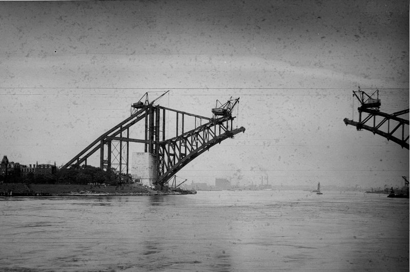
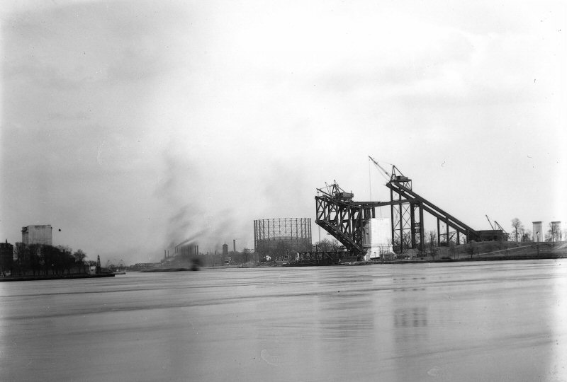
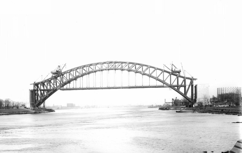
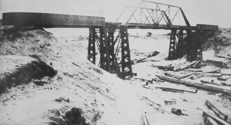
The arch had to be constructed simultaneously from both sides with no falsework in between. The Hell Gate itself was still being used for shipping, and its waters were far too treacherous to build any support in the middle. The arches would be supported from behind, anchored in boxes filled with 850 tons of pig iron, until the two halves were joined; this happened in 1915, making it the longest steel arch bridge in the world.
The bridge project was completed in 1916, and supposedly opened to rail traffic on September 30th of that year. Most other sources point to the Opening Day ceremonies being held on April 1, 1917, with the first train (part of the Federal Express service, running from Boston to Washington) crossing the bridge two days later, and completing the link started in 1904 with the building of the Pennsylvania tunnels under the Hudson River and furthered with the 1910 opening of the East River rail tunnels.
The bridge underwent very few changes in the rest of its history. Lindenthal suggested that a second deck be added to carry cars and pedestrians and join the bridge to Manhattan, but this was overruled in favor of the Triborough Bridge. The bridge went unmaintained for most of its life, unpainted (except for graffiti) and raining rust and the occasional bolt down onto Astoria. Amtrak president W. Graham
Claytor, Jr. felt that since the bridge was still structurally sound, they didn't feel the need to spend money to make it look better. A campaign, started in the late 1980s by Astoria native and state Senator Daniel Patrick
Moynihan, got $55 million from Congress to refurbish the bridge. The project was finished in 1996 and the bridge was repainted the unique color "Hell Gate Red".
BRIDGE FACTS
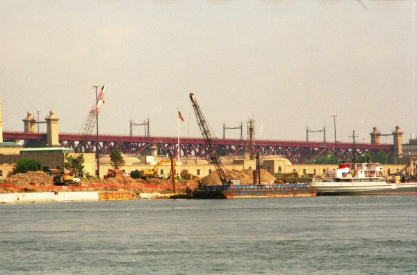
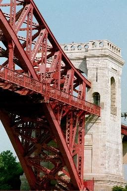
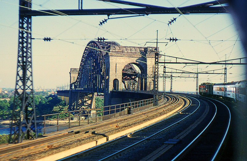
The entire bridgeway is 16,900' long. The Hell Gate Bridge itself has a 977' span, 1,017' with the two Gothic towers on either side of the arch included. The bridge was the longest of its kind in the world until the Sydney Harbor bridge opened in 1931 (itself quickly beaten out by the Bayonne Bridge that same year), and remains the 17th longest in the world as of at least 1997. The bridge was also the heaviest in the world when constructed, containing 20,000 tons of steel; this is more steel than used in the Manhattan and Queensboro bridges combined, and four times as much as used in building the Woolworth Building. The roadway clears the East River by 135 feet. The four towers rise 250' above the two islands, and the arch itself reaches a peak of 305' above mean high water.
The girders that connect the top of the arch to the towers were installed purely as a cosmetic decision, changed from the plans of architect Henry Hornbostel by
Lindenthal. Lindenthal feared that the original design, with the arch terminating before it reached the towers, would cause the public to feel that the towers were the sole support of the bridge and modified the design to allay those fears.
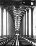
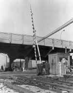
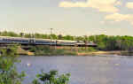
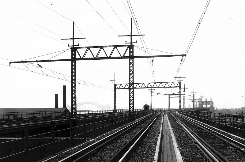
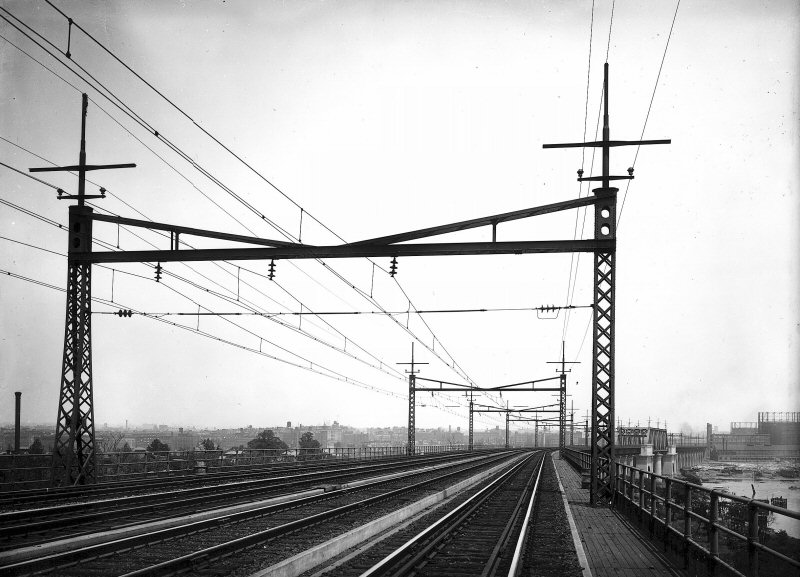
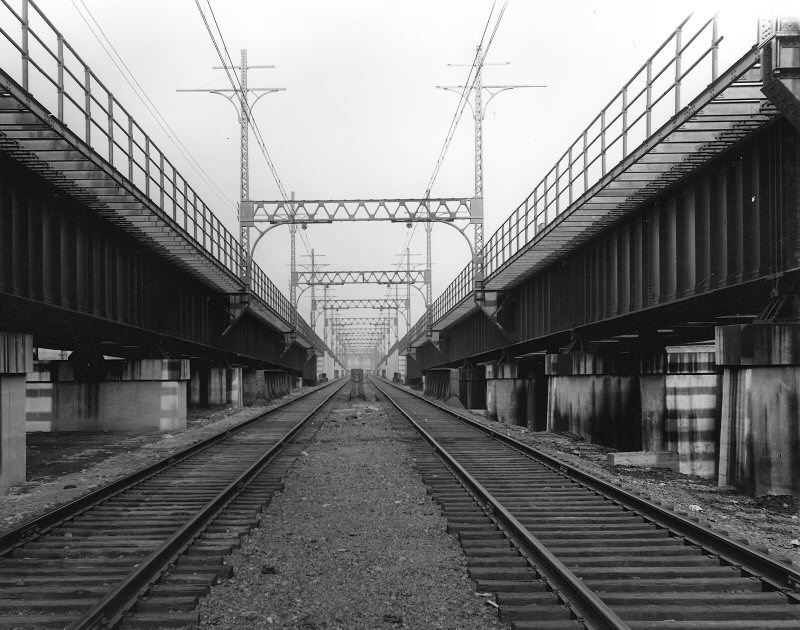
The bridge is still in use today. The two south tracks are electrified (using overhead
catenary) and run Amtrak's Northeast Corridor lines up into Boston. The more southerly of the northern tracks carries freight trains. The final track is used solely for maintenance vehicles; sources differ as to whether the tracks have been removed entirely or are used by service cars and road
railers.
The bridge was the first four-track railroad bridge ever, and as of this writing, remains so. The bridge was designed to hold up to 90 locomotives (at their weight in 1917) at once, making it still adequate for the electric and diesel trains of today.
The plaque on the bridge still gives its name as the East River Arch Bridge. Some sources claim the official name of the bridge is the New York Connecting (Railroad) Bridge; none specify when the "real" name of the bridge became generally
accepted. Compiled Research with
Steve Anderson contributor
|
|
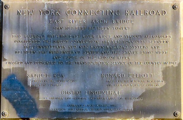
Dedication Plaque South
Tower
|
NEW YORK
CONNECTING RAILROAD
EAST RIVER ARCH BRIDGE
SPAN 1017 FEET BETWEEN TOWERS
THIS RAILROAD WITH ITS EAST RIVER BRIDGE AND VIADUCT APPROACHES
COMPLETED THE DIRECT CONNECTION, VIA THE NEW YORK CITY, BETWEEN
THE PENNSYLVANIA AND NEW HAVEN RAILROAD SYSTEMS AND
BETWEEN THE NEW ENGLAND STATES AND THE STATES LYING WEST
AND SOUTH OF THE HUDSON RIVER
FINISHED AND DEDICATED TO THE TRANSPORTATION SERVICE OF THE COUNTRY IN 1917
SAMUEL REA
HOWARD ELLIOTT
PRESIDENT THE
PENNSYLVANIA
PRESIDENT THE NEW YORK NEW HAVEN
RAILROAD COMPANY
AND HARTFORD RAILROAD COMPANY
GUSTAV LINDENTHAL
BUILDER AND DESIGNER EAST RIVER BRIDGE AND APPROACHES
AMERICAN BRIDGE COMPANY INC
FABRICATOR AND ERECTOR OF EAST RIVER ARCH BRIDGE
|
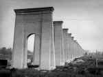
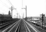
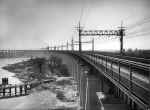
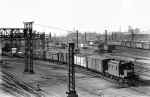
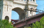
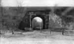
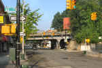
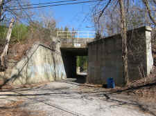
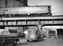
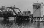
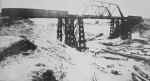
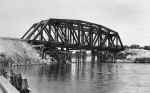
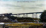
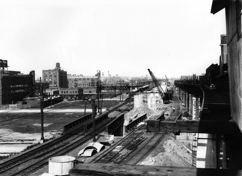
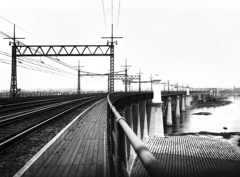
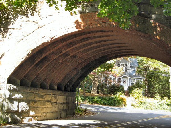
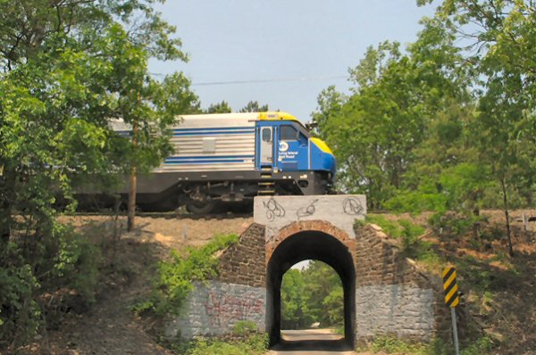
Construction of viaduct towers
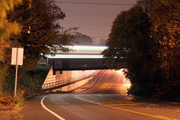
approach to bridge view SE Astoria, Queens, NY
|


All views NE Randalls-Wards Island to the left, Astoria Park, Queens to the
right
The arch had to be constructed simultaneously from both sides with no falsework in between. The Hell Gate itself was still being used for shipping, and its waters were far too treacherous to build any support in the middle. The arches would be supported from behind, anchored in boxes filled with 850 tons of pig iron, until the two halves were joined; this happened in 1915, making it the longest steel arch bridge in the world.
|

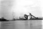
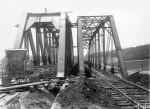
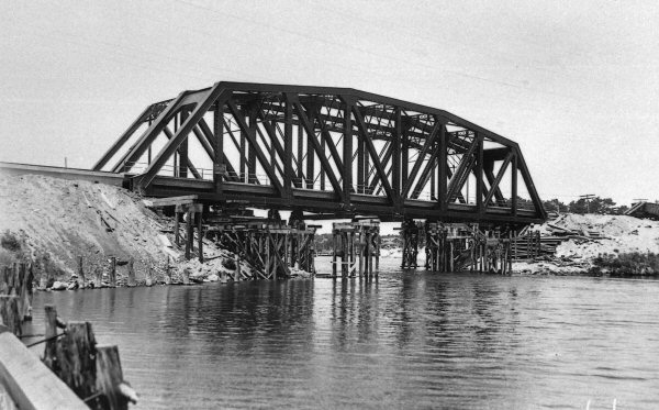
Nearing arch completion
|

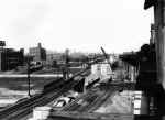
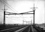
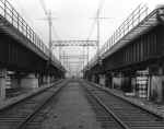
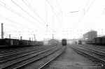
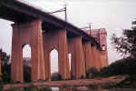
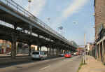
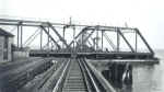
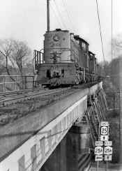
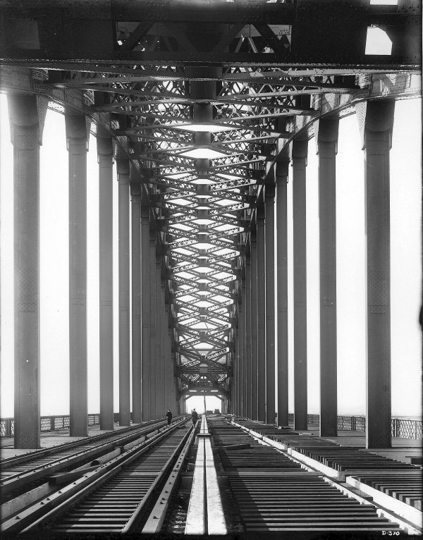
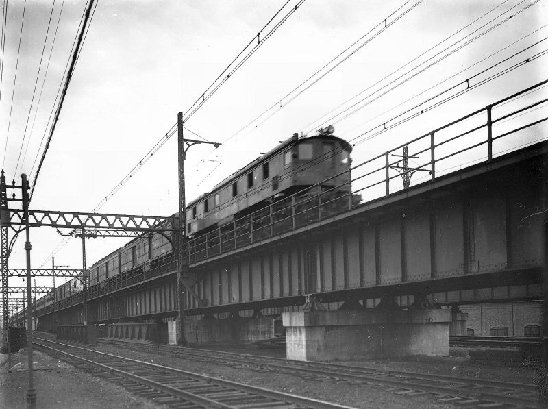
Viaduct towers with 4 track approach to bridge view NW
|
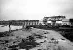
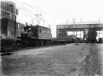
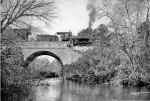
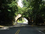
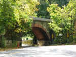
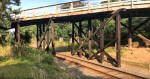
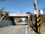
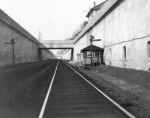
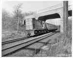
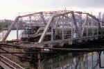
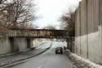
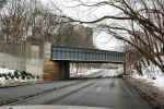
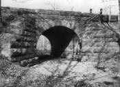
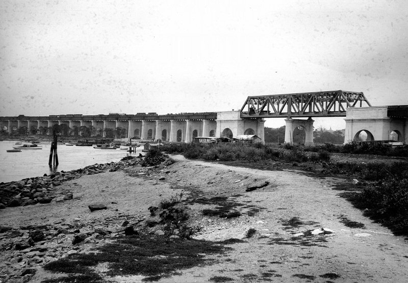
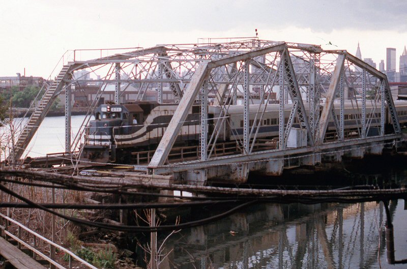
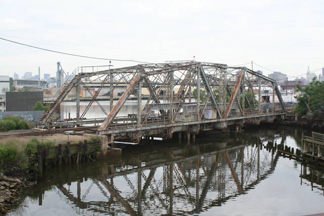
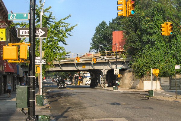
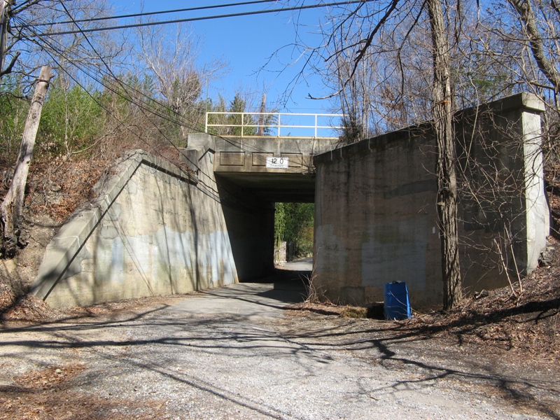
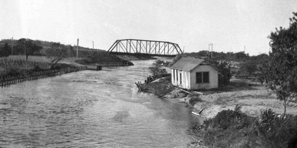
350' long truss bridge crossing the Bronx Kills1
(see map above), was originally planned as a bascule bridge in case the Kills ever became
navigable
|
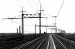
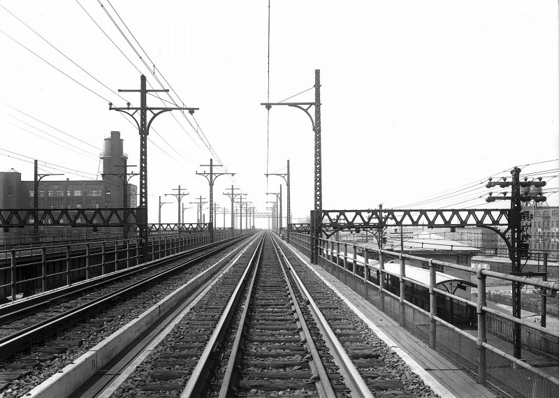
Construction of the overhead catenary NYCRR 4
track ROW
|
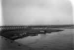
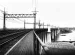
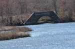
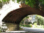
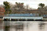
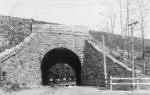
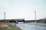
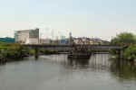
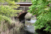
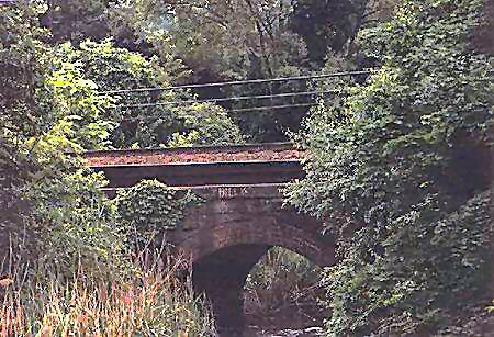
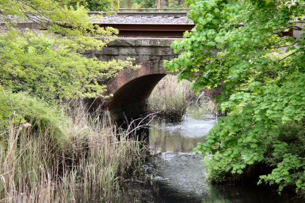
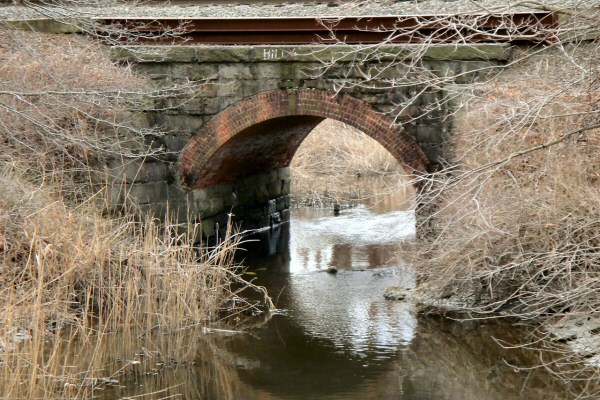
Four reverse-arch bridges of 300' crossing the now-filled Little Hell Gate between Randall's and Ward's
Islands
|
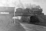
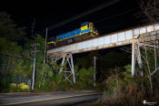
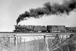
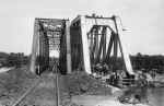
Hell gate 4 train main under construction
|
The approach to the Bronx River bridge just
north of 132nd Street view SW
|
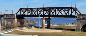
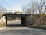
Port Morris, Bronx view SW approaching the Bronx Kills bridge.
Hell Gate bridge left background
|
Ward's Island approach to Bronx River View
NE
|
Randall Island view NE to Little Hell Gate -
Bronx Kills bridge in background
|
Ward Island view SW approach to Little
Hell Gate Randall Island
|
Beginning approach to Bronx River bridge and
on to Hell Gate view NE
|
Beginning approach to Bronx River bridge and onto Hell Gate view SE |
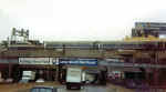
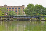
Harlem River Terminal
Archive: Dave Keller
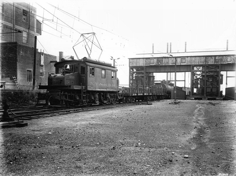
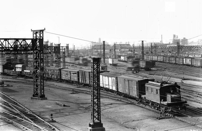
NYNH&H yard
|
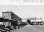
Harlem River Terminal view W
The building at the far
right shared NYW&B and NH office building (the NH was the parent company
of the NYW&B)
The tracks are the storage tracks of the Harlem River terminal and the NYW&B,
until Jan 1. 1938, had its Harlem River station covered platforms on the far
side of this building with stairs to the street below.
The building stood as late as 2004 with NYW&B RR Co lettering still
visible on the structure on the far side (street side) according to Robert
A. Bang's / Otto Vondrak's 2004 hard cover book on the NYW&B.
Research: Dave Keller
|
NYW&B General Offices East 133rd Street Station Harlem River Terminal
1937 view W Archive: Dave Keller
NYNH&H yard View NW
|
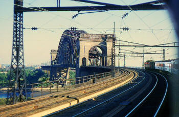
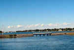
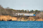
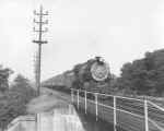
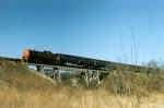
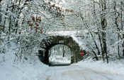
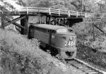
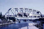
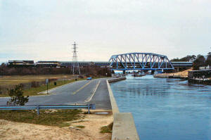
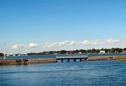
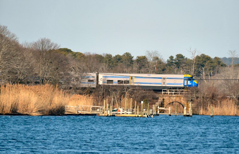
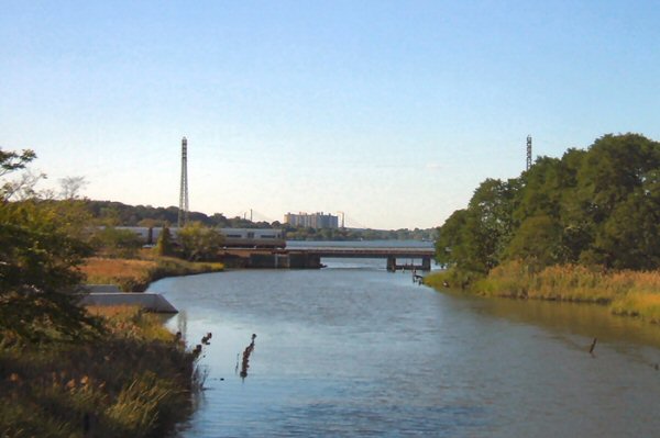
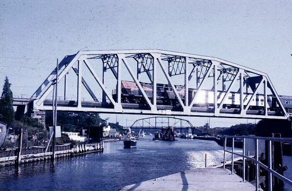
Hell Gate view NE Photo: Wayne Koch 5/25/09
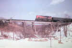
Hell Gate in winter view NE from Astoria
Park
|

Reverse-arch bridges
2
(see map above)
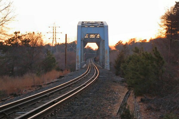
Little Hell Gate view NW Photo: Steve Lynch
6/17/2000
Reverse-arch bridge over Little Hell Gate
2
view W
|
Base north tower Photo: Steve Lynch 6/17/2000
|
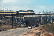
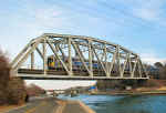
South tower view N Note: southbound freight on 2 track main
with PRR position light signals. Photo:
Steve Lynch 6/17/2000
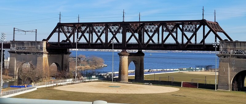
Concrete viaduct towers
approach from Randall's Island view SE
|
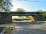
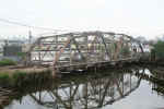
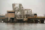
Bronx Kills Warren Truss bridge
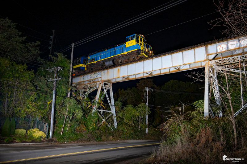
2024 Photo/Archive: Kevin Katta |
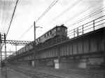
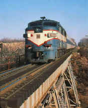
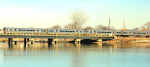
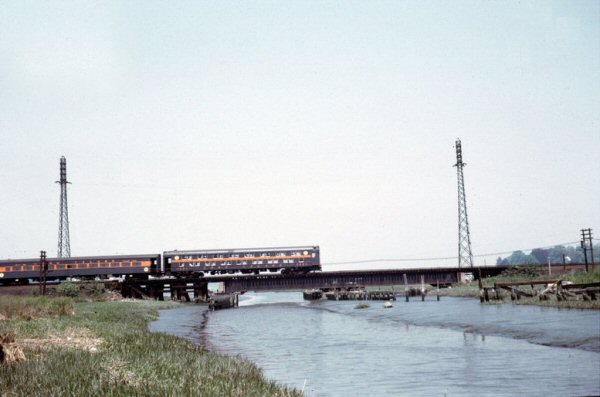
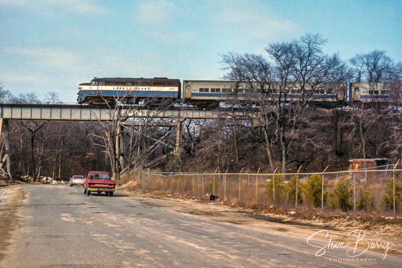
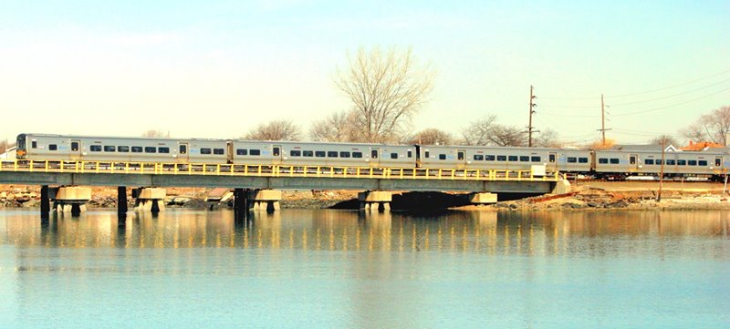
Hell Gate Bridge view S - NYNH&H electric passenger train inbound to PENN
Station, NY - c.1965
Silverman Slide Collection, Railroad Museum of Pennsylvania, PHMC |
|
| LIRR
BRIDGES AND TRESTLES
|
 |
|
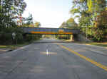
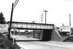
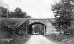
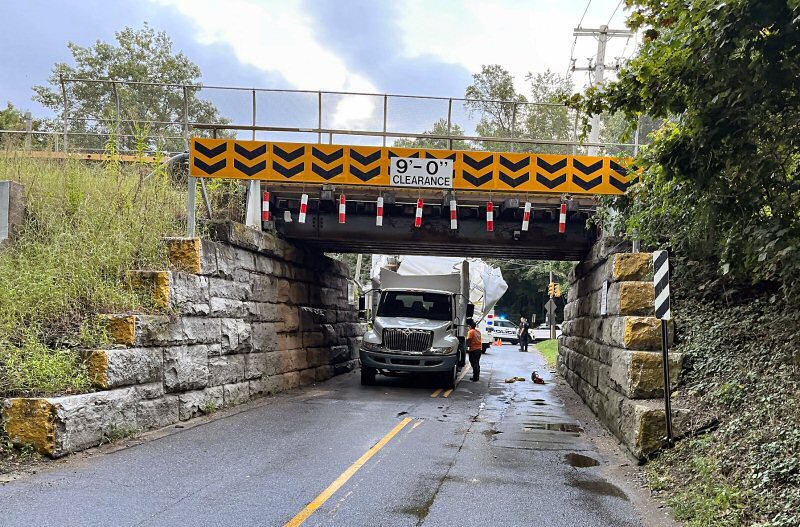
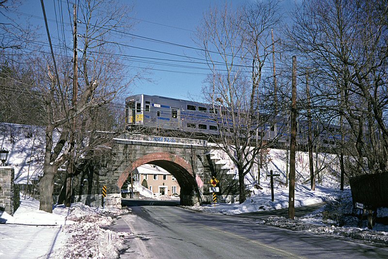
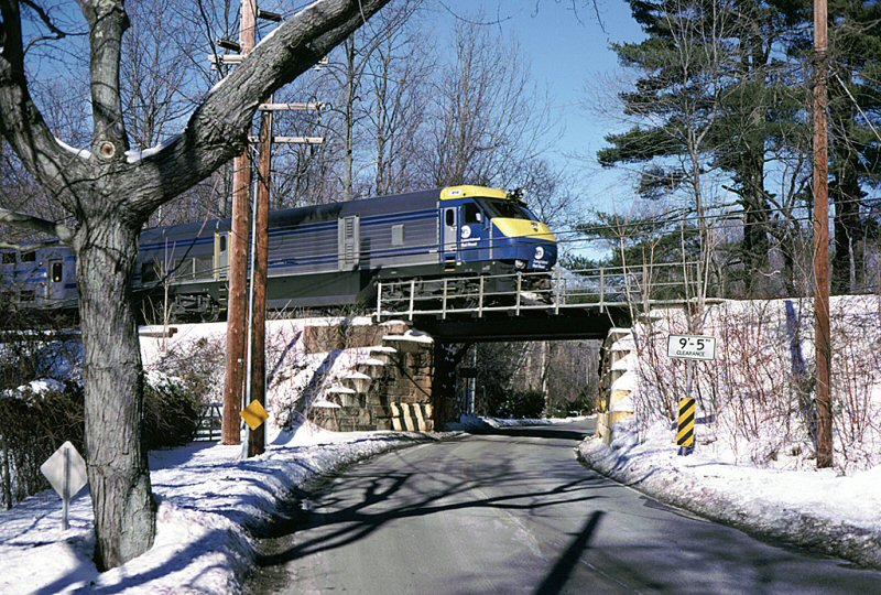
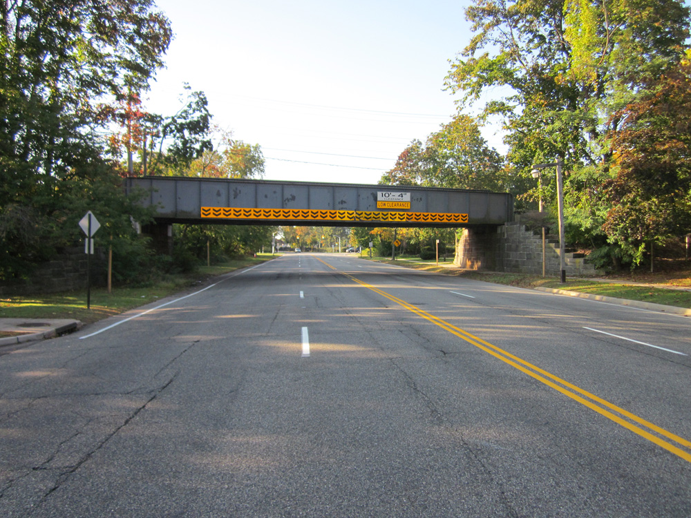
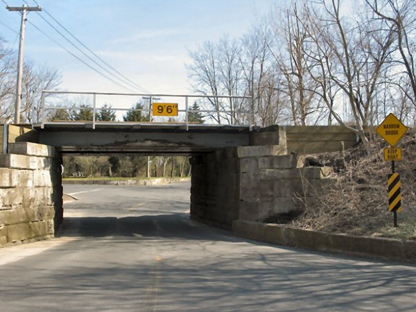
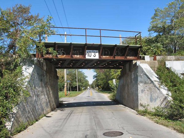
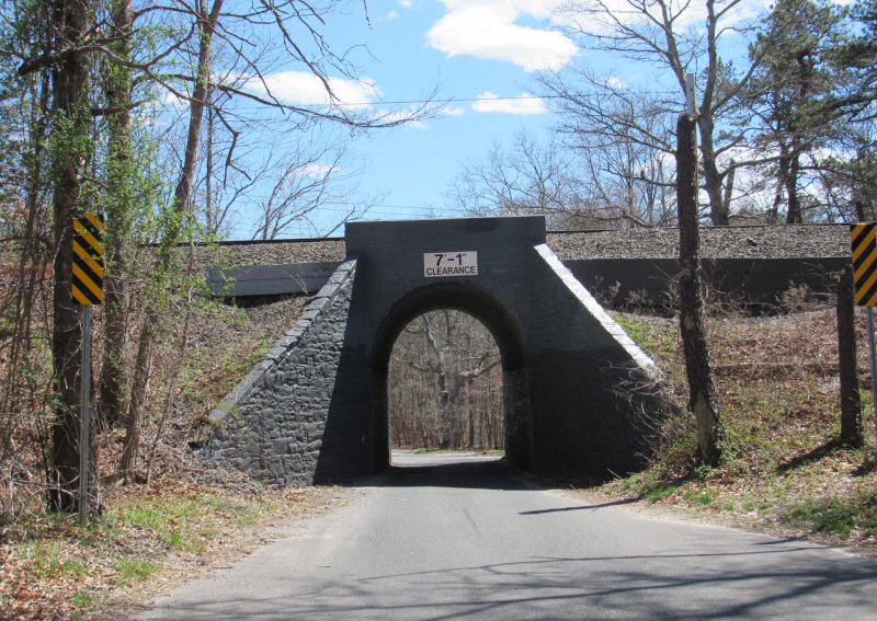
Low Clearance LIRR Bridges
Cherry Valley (Garden City) (10' 4")
Chestnut St (West of CLP) (6� 11�)
Montauk Highway (Center Moriches) (11� 6�)
Stephen Hands Path (Wainscott) (10� 0�)
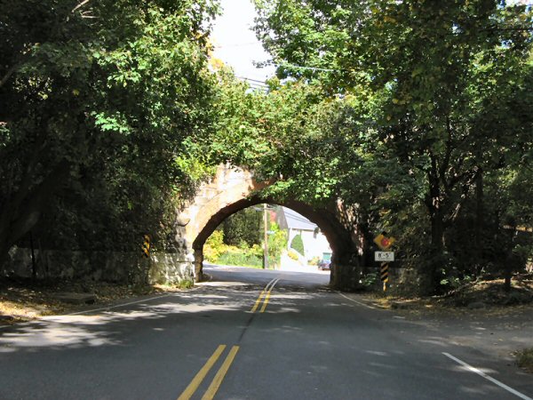
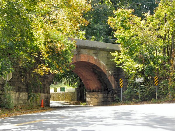
Cove Hollow Road (East Hampton) (8� 5�)
Stonytown Road (Plandome) (9� 0�)
Continental Ave (Forest Hills) (10� 5�)
Town Line Road (East of Bridgehampton) (8� 0�)
Info: Jeff Erlitz 3/2023
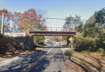
Stonytown Rd., Plandome View E 9/11 2023 Photo/Archive: Vincent Lee |
Jamaica Turnpike bridge - View E
Creedmoor Branch, Floral Park
Photo/Archive: LI Press c.1980
Carmans River, Brookhaven 5/18/2006
Montauk Branch
Photo: Nick Kudreyko
|
Carmans River - East of Yaphank
1898 Main Line
Photo: Harold Fullerton
Carman's River, Yaphank - View S 4/11/2020
Archive: Mark Kwiatkoski
|
Stony Brook Road, Port Jefferson
Photo: McEnery
College Point Blvd, Flushing -
View N 1939
|
Town Cocks Lane looking north
through the bridge towards Buckram Rd. single track east of Locust Tower
10/17/2008 Photo: Al Castelli
Town Cocks Lane View N 10/17/2008
Bridge underside detail Photo: Al Castelli |

C3 train at Town Cocks Lane, Locust Valley - View N 1/28/2000 Photo/Archive:
Bill Mangahas

Frost Mill Rd., Mill Neck View N
2/2000 Photo/Archive: Bill Mangahas |

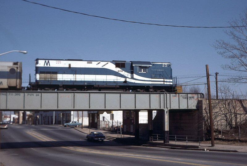
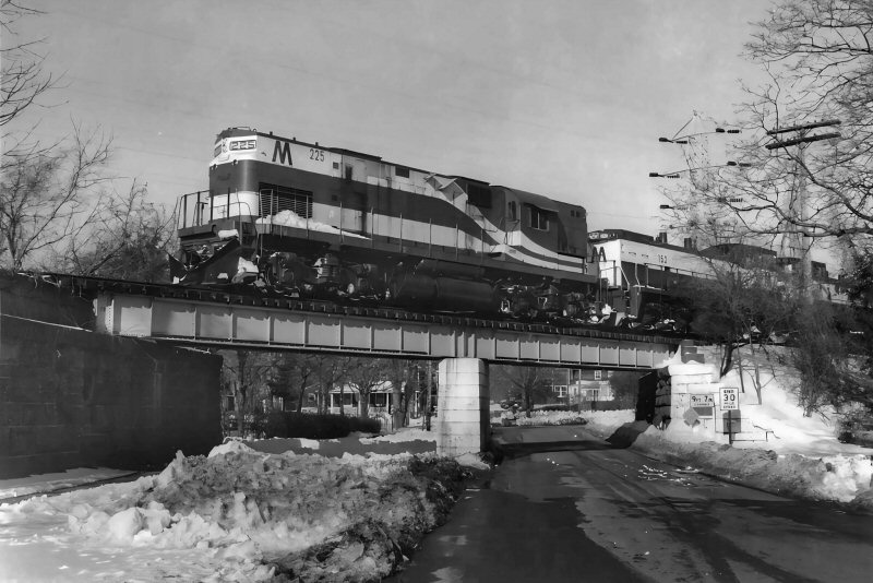
C420 #225 freshly painted crossing Jericho Turnpike, Mineola, view W, on the
Oyster Bay Branch.
3/22/1978 - Photo/Archive: Paul DeLuca |
Buckram Road looking
southwesterly from the other side
of the bridge,
east of Locust Tower
10/17/2008
Photo: Al Castelli
Forge River Mastic 5/07/2006
Photo: Nick Kudreyko
|
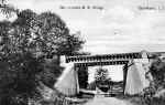
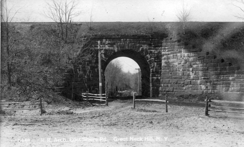
East Shore Rd., Great Neck bridge postcard 1912 Archive: Dave Morrison

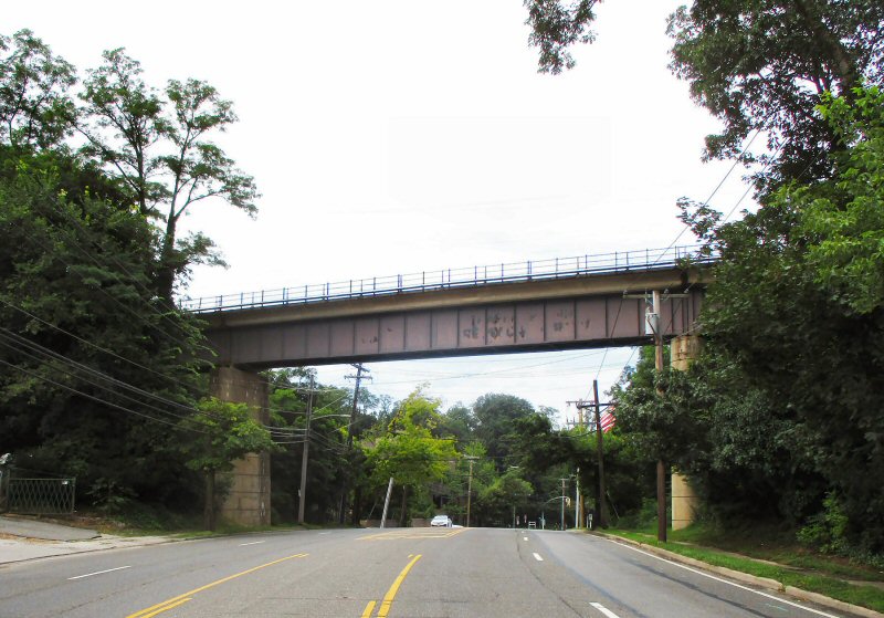
East Shore Rd., Great Neck 8/09/2021 Photo/Archive: Dave Morrison |
Tanners Pond Rd., Stewart
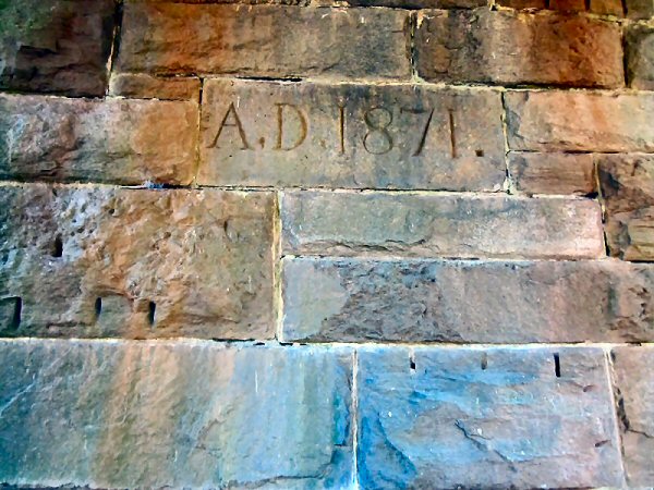
Manor 1871
cornerstone 2016 Photo: Dave Morrison
Tanners Pond Rd., Stewart Manor
view S 2016 Photo: Dave Morrison |
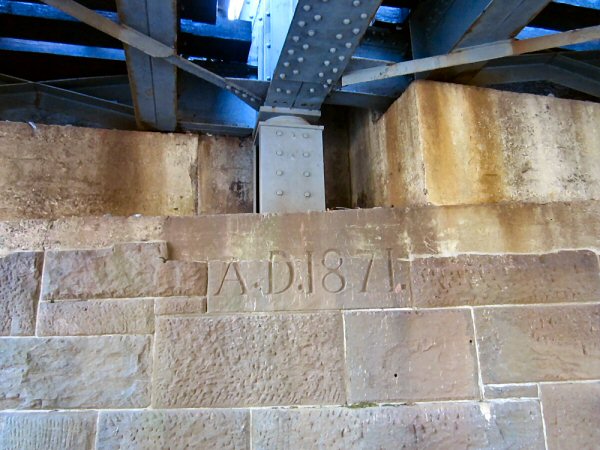
Cherry Valley Ave., Garden
City view N
Photo: Dave Morrison

Cherry Valley Ave., Garden City 1871
cornerstone 2016 Photo: Dave Morrison
|

Cranberry Hole Road - Amagansett - 8/22/2013
(Kyril Bromley-The East Hampton Press)
Cranberry Hole Road - Amagansett
View SE 6/2019 |
|
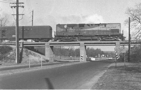
Tunnel Rd Holtsville 1940
Collection: Dave Keller
Same Location

Holtsville C420 #206 train #204 east N. Ocean Ave 1969
Photo: Dave Keller
|
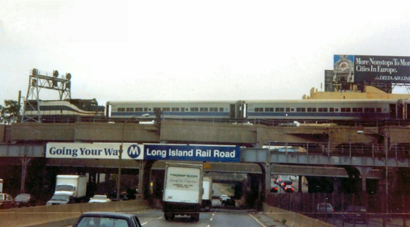
"Going Your Way"
Van Wyck Exp. c.1990
Jamaica view S Montauk
Division and Mainline 2012 |
Newton Rd Hampton Bays 2/20/2007
Photo: Nick Kudreyko
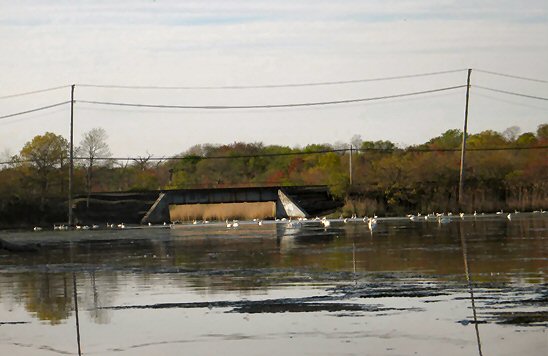
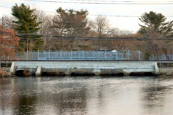
Connetquot River, Oakdale view S of
Sunrise Hwy Route 27
|
Mill Creek, south end of Hashamomuck Pond,
Southold 2006 Photo: Nick Kudreyko
Butter Lane, Bridgehampton 4/22/2007
Photo: Nick
Kudreyko |
Route 112 Medford 1969
Photo: Dave Keller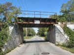
South Jamesport Ave., Jamesport
10/14/2006 -
Photo:
Nick Kudreyko
|
Yaphank River Road, Yaphank 06-01-06
Photo: Nick Kudreyko
Yaphank River Rd., Yaphank - View S 4/11/2020 Archive: Mark Kwiatkoski |
Seatuck Creek, East Moriches
- View N
1/31/2016 Photo: Edward Hand
Whitney Lane, Woodbury 1878
Photo: George Brainerd Archive: Queens Public Library |
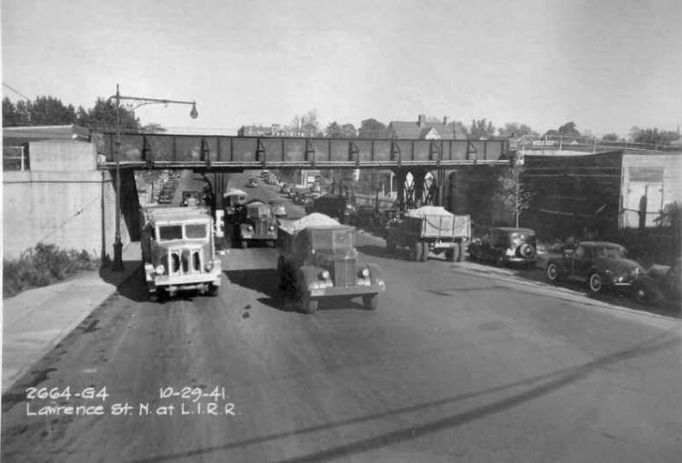
Lawrence St., Flushing - View N
10/29/41
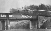
Nicoll Road, Stony Brook - LIONEL vandalism
Summer-1964 "Steel Rails to the Sunrise" Ron Ziel |
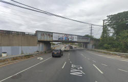
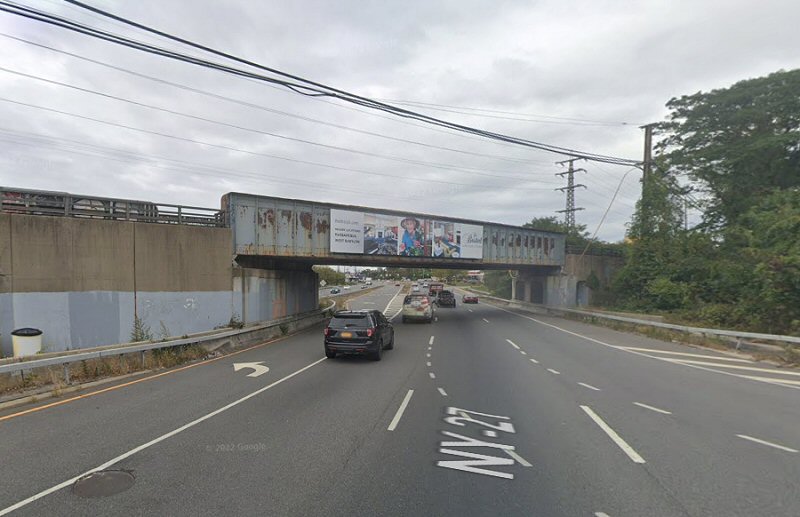
Sunrise Hwy NY-27, Massapequa view NE Google maps 2024 |
South Country Rd, view
north c. 1900
Post-Morrow Foundation Historical
Collection
South Country Rd., Brookhaven view N 2019 |

St. Albans Coal Trestle
c. 2007
|

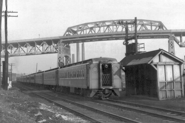
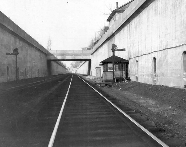
Station Penny Bridge 1954 Archive: Dave Keller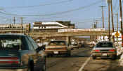
Deer Park Ave. (Rte. 231),
Deer Park View S
1/11/1988 Photo: Edward Hand
|
|
Merillon Ave 7/13/1947
Photo: George E. Votava Archive: Dave Keller
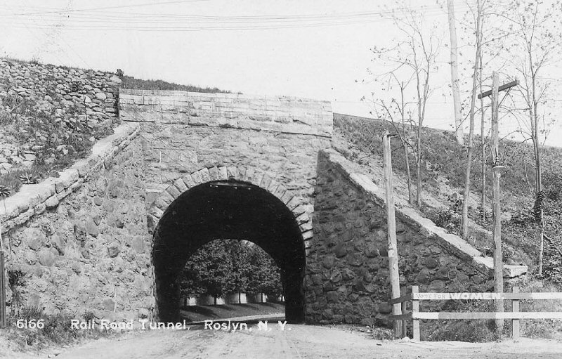
Roslyn - c. 1905
Archive: Robert Hoffmann
|
Greenpoint Ave Blissville 12-70
Photo: Dave Keller
|
Pitkin Ave, East New York 1925
Photo: James V. Osborne
Archive: Dave Keller
|
Murray Hill 1925
Photo: James V. Osborne
Archive: Dave Keller
English Kills Bobtail Swing
Bridge view S
Photo: Mitch Waxman
|
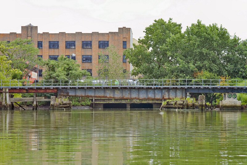
Hunter's Point - Borden Ave at Newtown Creek |
Denton Ave 1/2007
Photo: Robert Andersen |
Montauk Hwy, Sayville
Photo: Fred Miller 2007
|
LIRR 22 westbound 1969
Photo by Jules P. Krzenski, Archive: Dave Keller |
Douglaston Drawbridge 1965
Douglaston Drawbridge 09/29/2007
|

Shinnecock Canal Bridge guard rails
approach
12/31/07 view west
Photo: Mike McDermet
|
Dutch Kills Swingbridge 7/26/97 Photo: Edward Hand
Dutch Kills Swingbridge
06/21/07 Photo: Joe Gregory
|
Dutch Kills Lift Bridge "M"
Cabin
View South 07/19/2008 Photo: Mike Kubiak
|
Carlton Ave ex-Rte 111 view N
10-12-01
Photo: Steve Lynch
|
Myrtle Ave. 07/19/08
Photo: Mike Kubiak
|
Nostrand Ave. 07/19/08
Photo: Mike Kubiak
|
Metropolitan Ave.
07/19/08
Photo: Mike Kubiak
|

MP54s Manhasset Viaduct c.1950's
Archive: Art Huneke
|
Rockaway Beach Branch over Union Turnpike
Forest Hills 12/25/09 Photo: Mike Kubiak
|
Lower
Montauk Branch over Union Turnpike Forest Hills 12/25/09 Mike Kubiak
|
Woodbury Whitney Lane View N 4/03/12 Photo: Al Castelli
|
Bread and Cheese Hollow Road, Kings Park 11/03/2021 Photo/Archive: Gregory
Grice |
Bread and Cheese Hollow Rd., Kings Park 3/05/1983 Photo/Archive: Steve
Berry
 |
Kings Park, Town Line Rd 3/1960
Archive: R. McEnery
Note: Town Line Road, west of Kings Park
Station, becomes Bread and Cheese Road when it crosses Pulaski Rd north of
the LIRR. LIRR crews refer to it as Bread and Cheese Hollow Road.
|
Kings Park, Town Line Rd LIRR C420 #214 1966
Photo: J. Guthure
Kings Park, Town Line Rd LIRR 2-8-0 Class H10s #113
1955
Photo: Norman E. Kohl
|
Mill Race Oyster Bay
Photo: Steven Lynch c. 2000 |
Mill Creek Bridge - west of town view SE
5/05/2012 - Photo/Archive: Andy Ciavarella |

Mill Race view S 3/02/2013
Photo: Andrew
Ciavarella
|

East Hampton, North Main St. - C420 #225 MP15AC #152
View N 2/10/1978 - (Ziel-Queens Public Library) |
Beach Channel Draw Bridge Rockaway
line
view N 1939 -
Photo: Harold Fagerberg
Archive: Art Huneke |
Malverne, Mill River east of Ocean Ave - 12ft. stone arch - 6/1978
Archive: Dave Morrison |
Dark Hollow Road, Port Jefferson View N
1/04/1988 Photo: Edward Hand
|
LIRR MP-54 #4924 eastbound crossing Liberty Ave. bridge, Jamaica
View NE 11/1958 - Archive: James Harris |
Bread and Cheese Hollow Rd, King Park Trestle
LIRR FA2 #615 eastbound 11/1980 View E
Note: Marker lights on
|
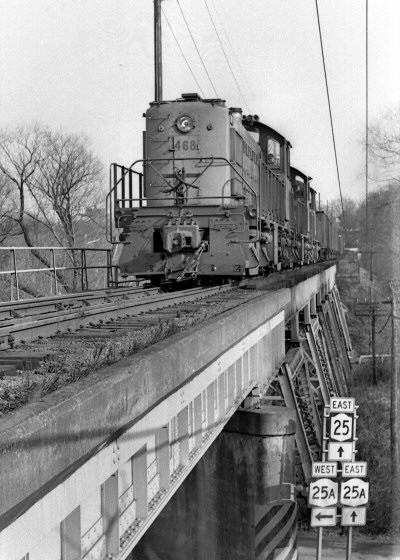
LIRR #468
Smithtown Trestle view SE c.1970 Photo: R. Glueck
|

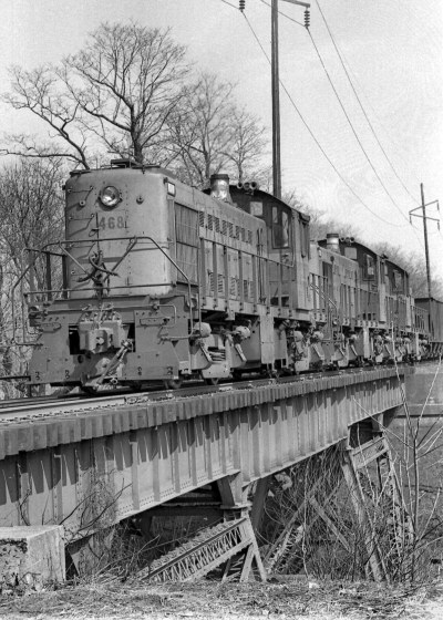
LIRR #468
Smithtown Trestle c.1970 Photo: R. Glueck
|

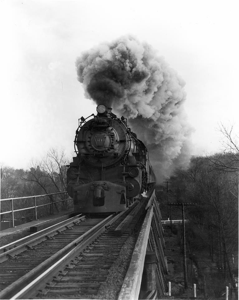
Nissequogue River Trestle - Rte.
25, Smithtown View E c.1950 k
(Kings Park Heritage Museum - David Flynn)
|
Reynold's Channel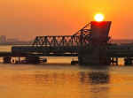
|
A lead is an old nautical
expression for a navigable channel or passage that also found its way into
railroading. That portion of Reynold's channel where the bridge is was more
complex prior to the dredging operation, with several sand bars and islands
in the midst of the channel and the shore of Barnum Island (southern portion
of Island Park) farther north than it is today. The wider passage hugged the
shore of Barnum Island and that was the original Wreck Lead. Whatever event
(shipwreck of some sort) that gave it it's name occurred before then.
Approx. where the bridge cabins are now was several smaller bars, the
biggest was called Inner Island and the smaller channel was called Inner
Lead. Around the turn of the century, they dredged Reynold's Channel to what
you see now and just retained the name Wreck Lead for that portion.
Wreck Lead Bridge 9/05/2014
Photo: Jordan Torregrosa
 Wreck Lead Bridge northern end - view
W - Train heading eastbound (south) to Long Beach
Wreck Lead Bridge northern end - view
W - Train heading eastbound (south) to Long Beach
|
Broad Channel 1917 Photo: William
J. Madden
|
Forge
River Mastic view E 05/1988
|

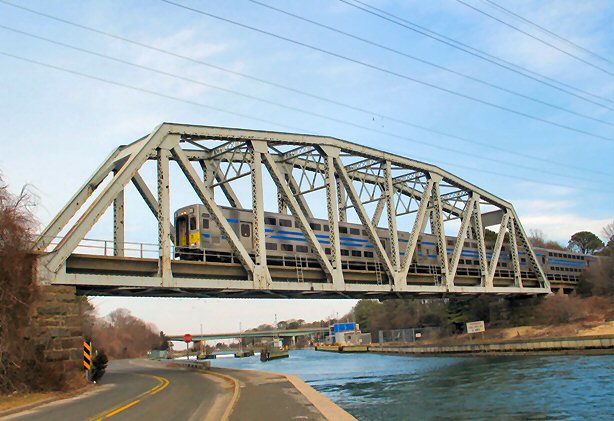
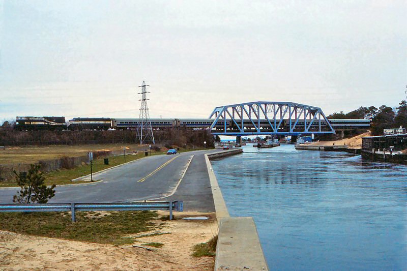
Shinnecock Canal c.1935 Archive: Rick Nydegger |
FM #2404 and train westbound under Sheep
Pasture Road overpass west of Port Jefferson 1957 (J. P. Krzenski photo,
Dave Keller archive) |
Shinnecock Canal Bridge 1887 LIRR Railroader magazine 1953 cover
Archive: Dave Morrison
|

Shinnecock Canal 1915
Thomas R. Bayles photo, Dave Keller archive
|
Shinnecock Canal bridges old and new-K4 5/26/1931 view W Archive:
Art Huneke
|
K4 Trestle replacing old trestle Shinnecock Canal 05/26/1931 View E -
LIRR valuation photos, Dave Keller archive
|
K4 Trestle replacing old trestle Shinnecock Canal 6/21/1931 LIRR
valuation photos, Dave Keller archive
|
K4s
locomotives were first used on the Montauk branch after
installation of the heavier bridge over the Shinnecock Canal.
June/1931 Prior to that, Montauk trains
of 12 or more cars were required to be double-headed by 2 - G5s locomotives.
Research: Dave Keller
|
Shinnecock Canal Steve Hoskins c. 1960s
|
Shinnecock Canal 2/20/2007 Photo: Nick Kudreyko
|
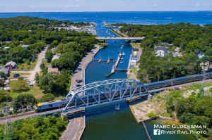
The water is the way! In this overhead side view of Shinnecock Canal with MTA LIRR train 8710 (DM30AC 505) on July 16, 2017, one can see across to the Great Peconic Bay. Since the canal opened to marine traffic in 1892, it has grown to facilitating the passage of 27,000 boats per year. Shinnecock Canal LIRR Trestle
- View N 1/31/2018 Photo/Archive/Info: Marc Gluckman
|
LIRR #227 and #620 cross the Shinnecock Canal in Hampton Bays on an
Electric Railroaders' Association (ERA) Special. 4/1984 Photo/Archive: Jay
Bendersky |
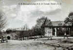
Post Cards of LIRR Bridges
Courtesy of Dave Morrison Collection
|

Flushing
|
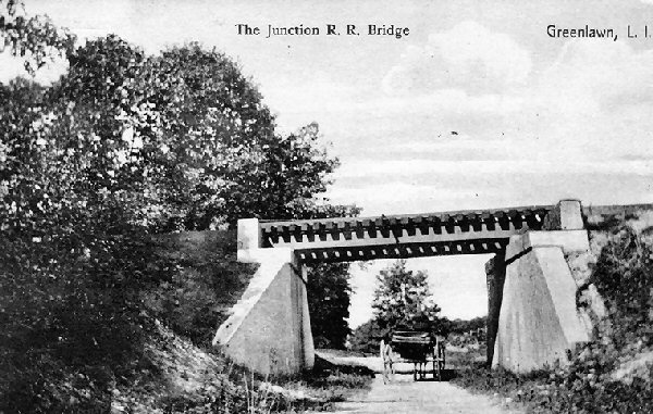
Greenlawn
|
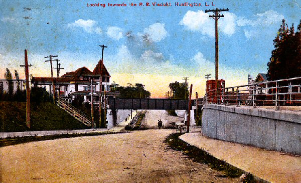
Huntington Route 110
|
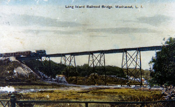
Manhasset
|
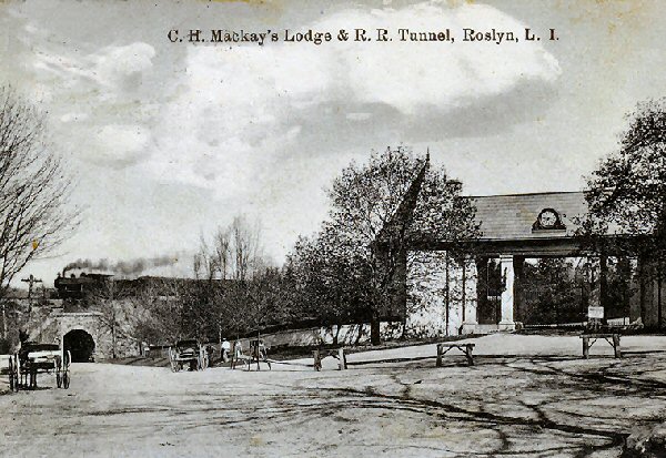
Roslyn with train
|

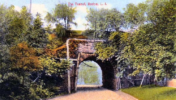
Roslyn
|
Woodville Rd., Shoreham c.1920 |
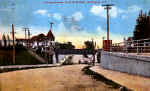
Smithtown - Postmark 1906
|
 LIRR
Trestles, Bridges, and Viaducts
LIRR
Trestles, Bridges, and Viaducts 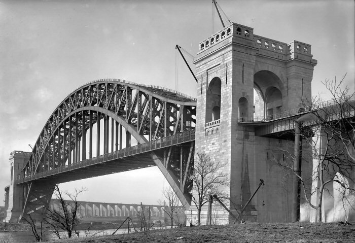
.jpg)
%20-%2003-23-33%20(Sperr-Keller).jpg)


.jpg)


.jpg)