|
Rocky
Point
|
|
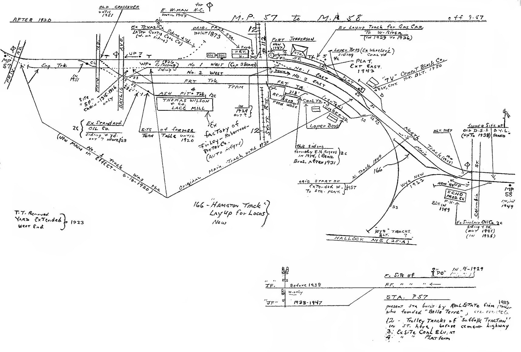
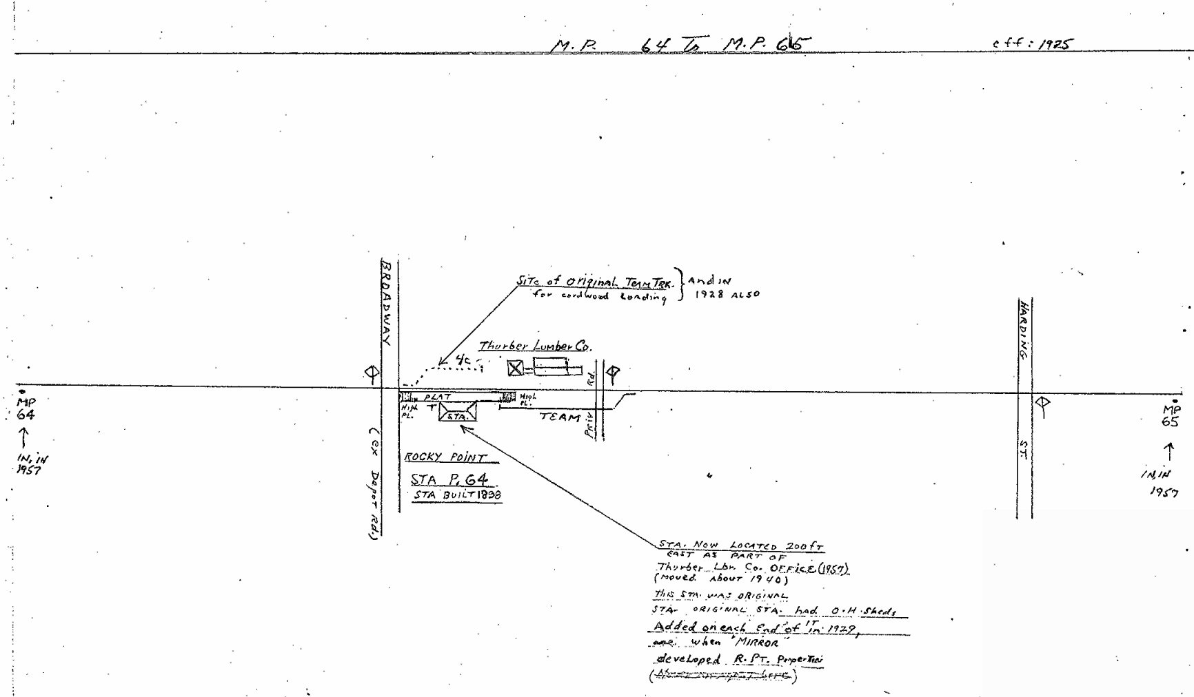
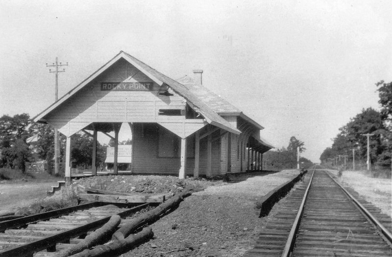
ROCKY POINT: STATION STOP WITH OPENING OF EXTENSION BRANCH:
06/27/1895. NO DEPOT.
DEPOT BUILT: 1898. LARGE, COVERED PLATFORM SHEDS ADDED: 1928 TO HANDLE
CROWDS THAT ARRIVED WHEN BUILDING LOTS
WERE BEING SOLD CHEAPLY BY THE “NEW YORK DAILY MIRROR” NEWSPAPER. AGENCY
CLOSED: 1929.
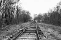
LAST REVENUE TRAIN: 10/9/38. OUT OF SVC. PER G.O. #1006C: 3/29/39 AND BRANCH
ABANDONED.
MOVED OFF R.O.W. A SHORT DISTANCE SOUTH OF TRACKS, AND 200' EAST OF ORIGINAL
LOCATION c. 1940 (Robert Emery data).
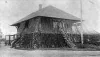
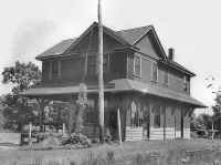
BECAME OFFICE FOR THURBER LUMBER CO: 19_?_. COVERED PLATFORMS ENCLOSED.
HEAVILY REMODELED (per 2013 Google
Maps Imagery). ONLY ROOF IS RECOGNIZABLE. STILL STANDING: 2019 (per
Google Maps imagery).
|

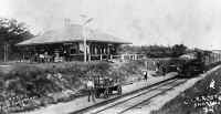
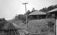
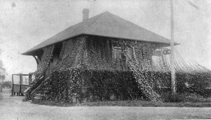
Rocky Point depot
1928 View NE. Archive: Dave Keller |

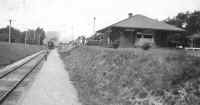
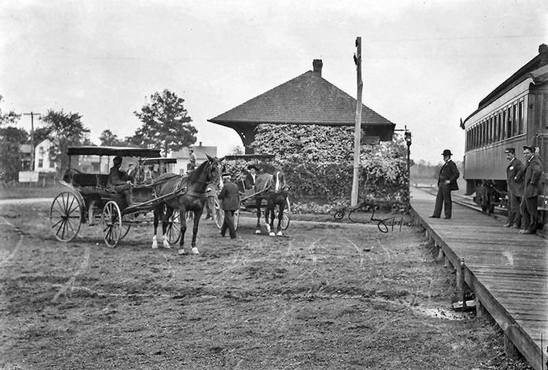
Rocky Point Station-View W
1930 -
(Osborne-Keller) |
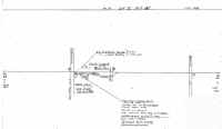
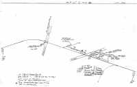
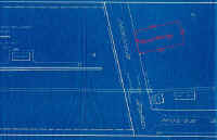
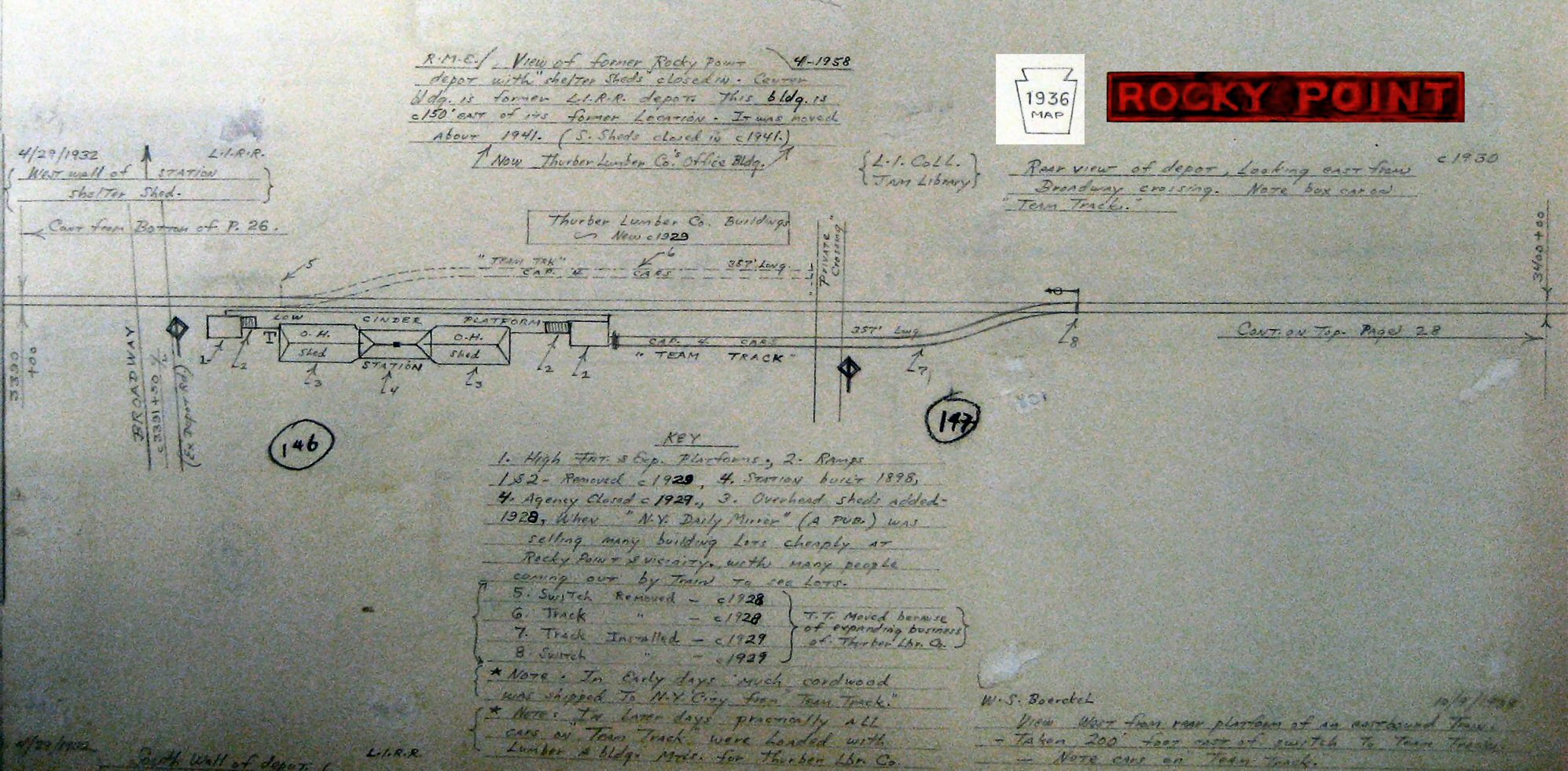
MP64-65 Emery Map 1925
Archive: Dave Keller |
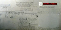
Emery Map Rocky Point 1936
Archive: SUNY-Stony Brook |
|
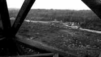
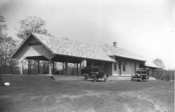
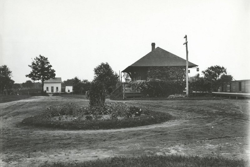
The large covered platforms were added
to the tiny depot in 1928 for projected land purchase crowds visiting the
area. Guess it wasn't too successful as the agency closed the
following year (1929), and the 19303 photo (above) shot the year after that.
Info: Dave Keller |
|
The depot was
moved a short distance south of the tracks and slightly east of the original
location c.1940 and used by Thurber Lumber Co. 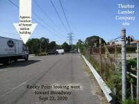
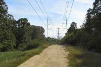
ex-Rocky Point Station site 9/22/2020 Photo/Archive: Dave Morrison
|
%20(Keller-Keller)_small.jpg)
View NE - September, 1976 (Dave Keller photo and
archive)
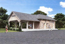
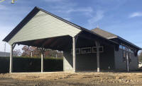
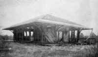
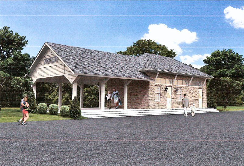
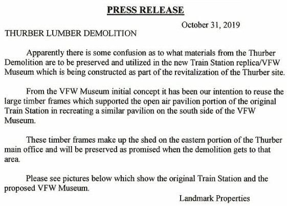
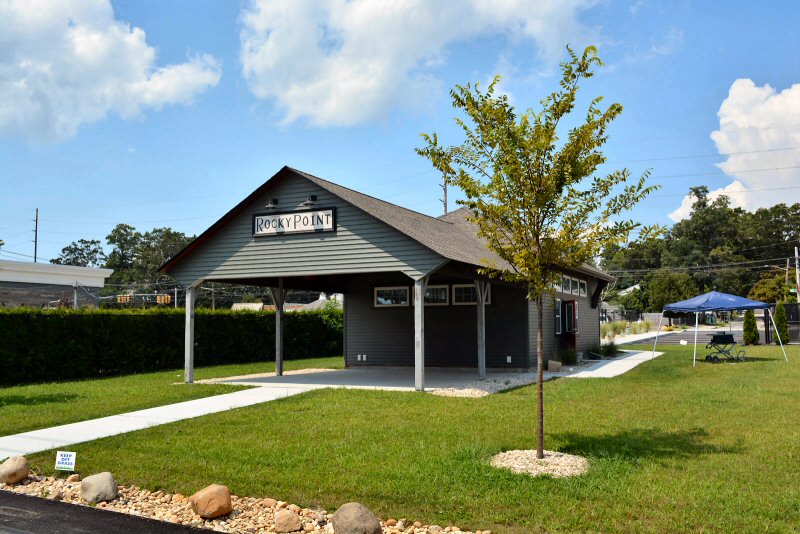
ex-Thurber Lumber proposed VFW Museum 10/31/2019 |
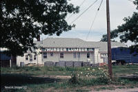
Thurber Lumber, Rocky Point 8/1982
Photo/Archive: Bill Mangahas
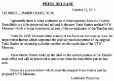
Proposed VFW Museum and Press Release 10/31/2019 |
Removing stone bridge at Hallock Lodge Rd.
- 1939 ( A. Bayles-Keller)
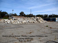
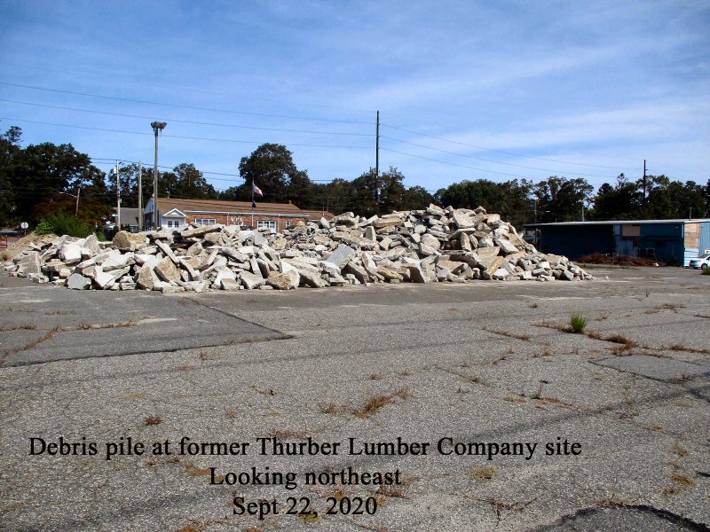
Rocky Point ex-Station-Thurber Lumber debris pile 9/22/2020 Photo/Archive:
Dave Morrison |
Rocky Point 12/15/2021 Photo/Archive: Antonio Morrow |
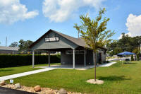
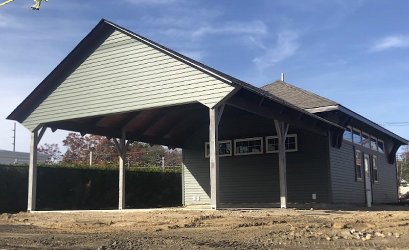
Rocky Point - VFW Museum 8/09/2022 Photo/Archive: Dave Morrison |
|
|
|
Shoreham
|
|
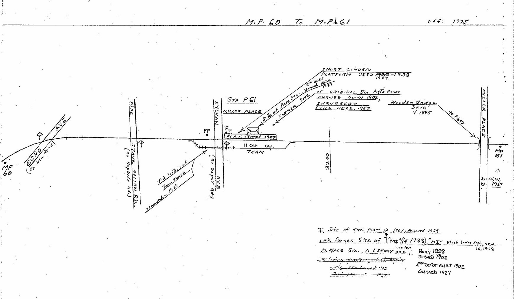
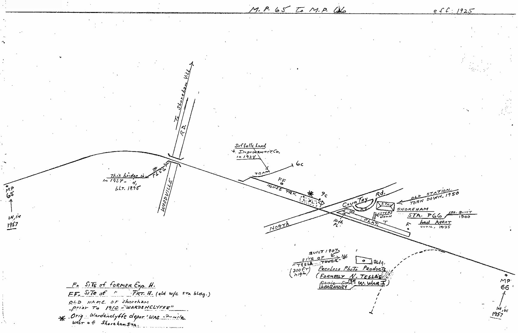
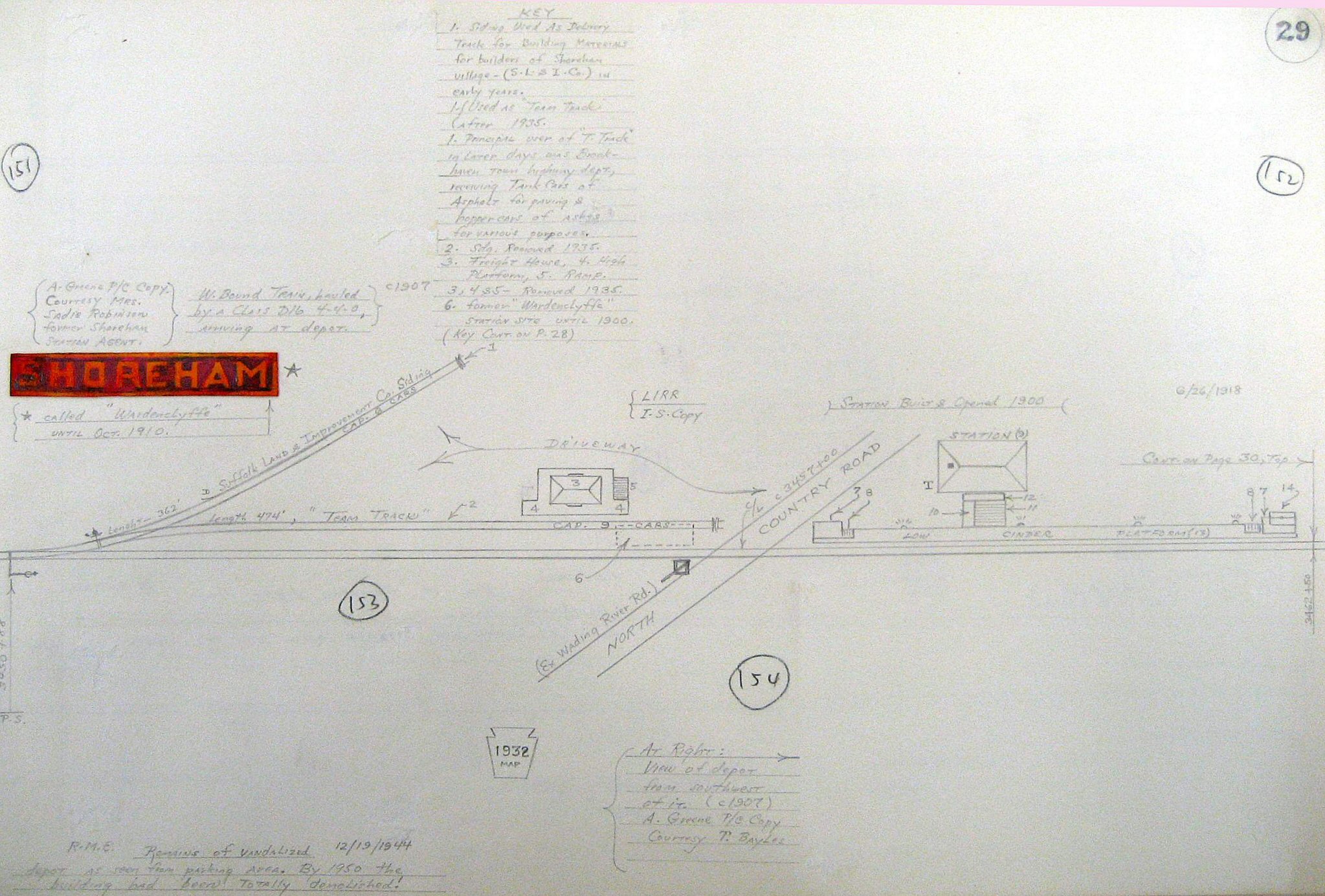
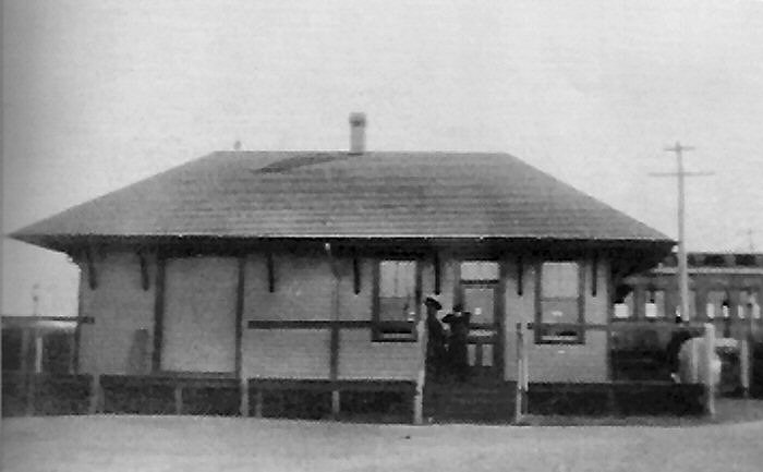
SHOREHAM: FIRST APPEARS IN TIMETABLE OF JUNE, 1900 AS “WARDENCLYFFE.” LOCATED ON WEST SIDE OF NORTH COUNTRY ROAD CROSSING.
2ND DEPOT BUILT: 1902, ON EAST SIDE OF NORTH COUNTRY ROAD CROSSING, .2 MILES EAST OF FORMER LOCATION. RENAMED “SHOREHAM”: 1906. AGENCY CLOSED: 1935. DEPOT CLOSED WITH LAST REVENUE TRAIN: 10/9/38. OUT OF SVC. PER G.O. #1006C: 3/29/39 AND BRANCH ABANDONED. (Per Vincent Seyfried: used as real estate office and 1950. Per Bob Emery, with photographic proof, building remained abandoned and was repeatedly vandalized for lumber as late as 12/1944. Demolished in 1950.)
Research: Dave Keller |
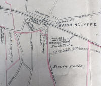
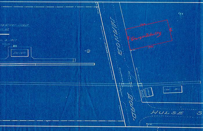
Nikola Tesla's Tower location map of Wardenclyffe
(now Shoreham) 1909
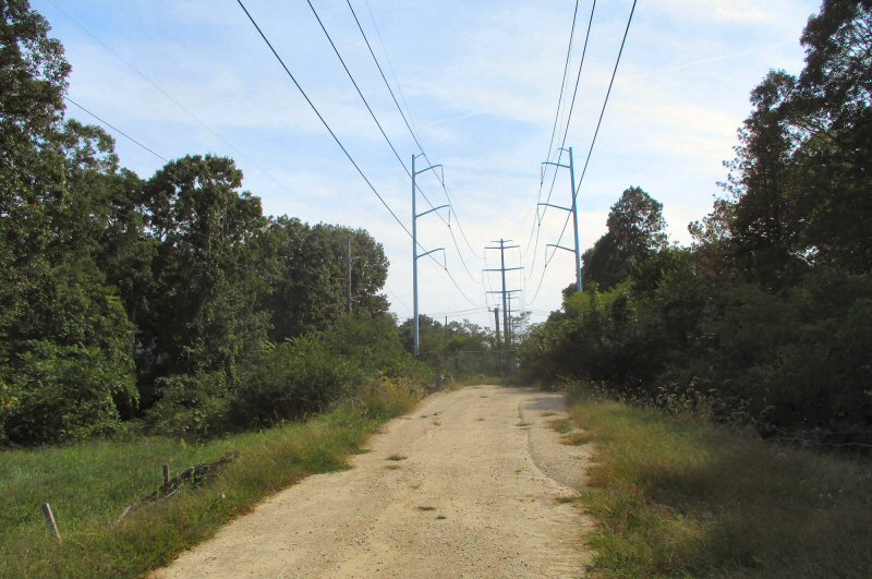
ROW view W toward Woodville Road bridge 9/22/2020 Photo/Archive: Dave
Morrison |
MP65-66 Emery Map 1925, Shoreham Station Archive: Dave Keller
ROW view E toward Woodville Road bridge 9/22/2020 Photo/Archive: Dave
Morrison |

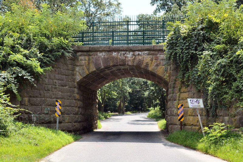
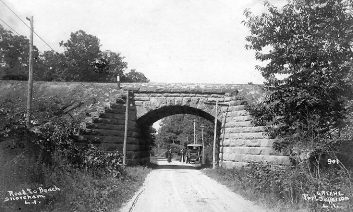
The old stone bridge over Woodville Road just west of the Shoreham
station looking north c. 1905. This
bridge remains in place currently and, along with the relocated Rocky Point
depot building, is one of the two remaining structures of any kind along the
former Port Jefferson-Wading River extension that was placed out of service on March
29, 1939. (Photo by A. Greene, Dave Morrison archive)
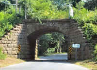
The old stone bridge over Woodville Road,
Shoreham View S
7/14/2018 Photo: Robert Kryger
|
Here's a rear view of Shoreham station c. 1905 looking SE from within the
rustic wooden entrance to the Shoreham Inn. Visible above the depot
roof is the upper portion of Nikola Tesla's Wardenclyffe tower.
Wardenclyffe was the original name of Shoreham. (Photo by Greene, Dave
Keller archive) 
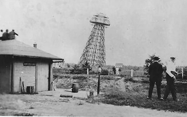
Nikola Tesla Tower (aka Wardenclyffe Tower) demolition
view SE at Shoreham Station 7/04/1917 |

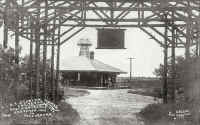
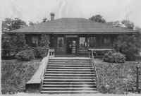
Shoreham station looking NE c. 1905. This was the
"sister" station to the depot building at Auburndale in
Queens
, minus the Porte cochere that the Auburndale structure had. According
to the late LIRR ticket agent Thomas R. Bayles, the Shoreham depot was
considered one of the fancier stations on the LIRR, with wicker furniture in
the waiting room and wooden shakes on the exterior walls. Teenage
telegraph messenger Bayles would ride his bicycle daily to the station
from his home on Rt. 25 in
Middle
Island
and then deliver telegrams via bicycle from the depot into Shoreham village
and return, then back home to
Middle
Island
at the end of a long day. Note the old hand-pulled Long Island Express
wagon loaded on the platform, awaiting train time. Also note the sole
Dietz kerosene platform lamp at the foot of the wooden access stairs.
There are three very old automobiles also awaiting train time and in the
background behind the station can be seen the rustic wooden entrance to the
Shoreham Inn. (Photo by A. Greene, Ken Brady archive)
|
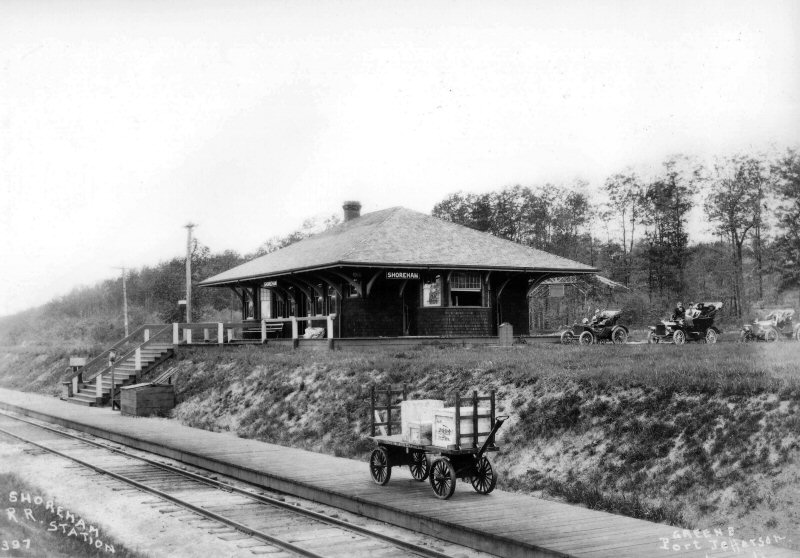
This is yet another terrific image of the Shoreham station as
photographed by A. Greene of Port Jefferson. This view is looking NE
c. 1907 and approaching the station is class D16b (4-4-0) #206 with
westbound train. Note the first two extremely old baggage cars.
The agent or his clerk is pulling the loaded Long Island Express wagon,
contents of which will be loaded into one of those two lead cars.
(Dave Keller archive)
|
This 1912 view of Shoreham station is looking NE and was photographed by
Albert Bayles, a LIRR carpenter and amateur photographer. He was the
brother of Thomas R. Bayles mentioned previously. (Dave Keller
archive)
|
Albert Bayles took his view the same day as the previous 1912 image.
The camera is looking west with an eastbound class D56 (4-4-0) locomotive
and train passing the freight house on the west side of North Country
Road and is in about the same location as the original Wardenclyffe station
that first appears on timetables of June, 1900. This 2nd depot was
built in 1902 and the name changed to Shoreham in 1906. In this summer image, we see a couple of girls in their white summer finery
heading for the stairs to meet the train. The rustic wooden entrance
to the Shoreham Inn can be seen in the right background, and note that in
both 1912 images, a low, white, fence border has been added around the
roadway. (Dave Keller archive)
|
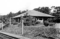
Thomas R. Bayles photographed this side view of the Shoreham depot with
his little Kodak Brownie box camera in 1914. We're looking east and
the roadway fence border is very visible. (Dave Keller archive)
|
After all that bicycle riding on a daily basis, Thomas Bayles must've had
some stamina as a teenager, because one day in 1914 he climbed the many
steps to the top of Nikola Tesla's abandoned Wardenclyffe tower and
photographed this birds-eye view of the Shoreham station area. Visible
at the right is the eastbound express house and at the left, the grade
crossing of
North Country Road
. At the far left, inside the "V" of the tower's wooden
timbers, the freight house / westbound express house is visible. This
view is looking northwest. The rustic wooden entrance to the Shoreham
in is in the background as is the little outhouse . . .the toilet facilities
for the station and the low, wooden fence border. Not visible in this image
are the remains of the curving siding that serviced Tesla's laboratory which
was at the foot of the tower and still stands today. The tower was
demolished in 1917. (Dave Keller archive)
|
This is an official
Long Island Rail Road
valuation image of Shoreham depot looking due north. What's
great about this photo is that it not only shows the non-ADA handicap access
to the tracks and/or depot (only wooden slat stairs!) but it also shows the
wooden slatted baggage "slide" down which baggage and express were
slid to be caught at the base and loaded onto the express/baggage wagon
which appears in earlier photos on this page. This view is dated as
June 26, 1918 and also shows another Dietz kerosene platform lamp at the
head of the stairs as well as at their foot. (LIRR - Dave Morrison archive)
|
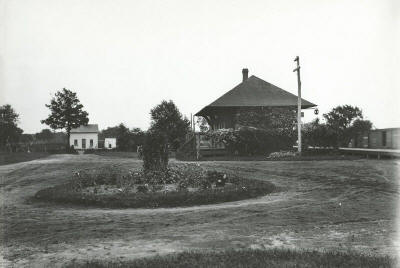
LIRR block operator James V. Osborne photographed the Shoreham station
c. 1925 in this view looking NW. You'll notice the bushes have grown
larger AND . . . the two Dietz kerosene platform lamps have been replace by
electric lights on platform poles. Also gone is the rustic wooden
entrance to the Shoreham Inn. (Dave Keller archive)
Emery map - Shoreham 1932 - Archive: SUNY Stony Brook |
Compare this sad image with the previous one as well as with the similar
angle view from 1912 with eastbound train. This is the end for the
once-fine Shoreham depot. This view, looking west, is not dated, but
as it appears to have been shot from the rear of an eastbound train, and
judging by the ramshackle condition of the structures and the overgrown
grounds, it must've been photographed close to the end of scheduled revenue
train service which occurred in October, 1938. The fact that the rails
are very shiny indicate that daily train service is still in force, although
minimal service at that. Note the distant freight house no longer
stands and the platform electric lights and poles have been removed.
The extension between Port Jefferson and
Wading
River
, along which Shoreham was a station stop, was officially abandoned by
general order effective March 29, 1939 and the tracks were torn up shortly
thereafter. (Robert Emery collection: SUNY at Stony Brook)
|
Even sadder than the previous image is this view looking SE on December
19, 1944. While the Shoreham station was taken out of service and the
branch abandoned in March, 1939, it appears the old depot building stood for
a number of years afterward. Vincent Seyfried in his LIRR history
states the building was used by a realty company, but that was probably only
for a few years after the 1939 abandonment, because one can clearly see that
the structure had been heavily vandalized as a second-hand lumber source for
quite some time for it to be in this poor a condition by the end of 1944,
only 5 ½ years later. What's even more amazing, is that it
wasn't completely demolished until 1950 . . . another 5 years later!
(Robert Emery collection: SUNY at Stony Brook)
|
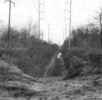
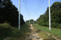
Fast-forward to the winter of 1969 and this image was photographed
looking east along the LIRR's former right-of-way towards the former
location of the Shoreham depot, which was approximately between the two
power poles at the left. The original cut below grade is still evident
at the time of this photo. (Dave Keller photo and archive)
|
|
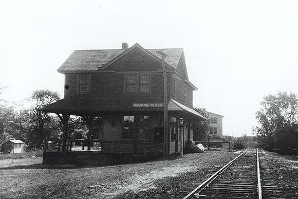
Wading
River
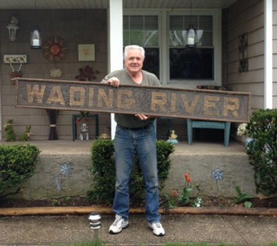
Dave Morrison holding the Wading River Station to be restored by Carl Dimino and returned to the Wading River Historical Society.
Photo: Dave Morrison 5/09/2014
|
|
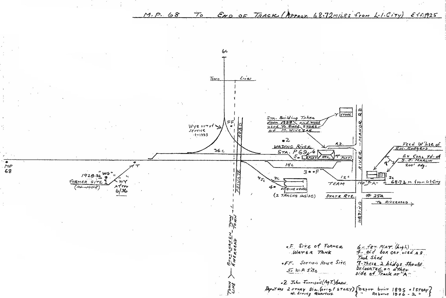
WADING RIVER: BUILT: 1895,
REMODELED TO TWO STOREY: 1906. AGENT AND FAMILY LIVED UPSTAIRS. AGENCY
CLOSED: c. 1933. TRACKS CUT BACK AND STATION FACILITIES RELOCATED 1 MILE
WEST OF FORMER LOCATION TO RANDALL ROAD: 1/18/38 (MILLER FAMILY RECLAIMED
THEIR PROPERTY FROM RIVERHEAD TOWN LINE EAST TO ORIGINAL END OF TRACK).
WOODEN DEPOT RAZED SOMETIME AFTER AND LUMBER USED TO BUILD STORE NORTH OF
STATION SITE. LAST REVENUE TRAIN: 10/9/38. RELOCATED STATION OUT OF SVC. PER
G.O. #1006C: 3/29/39 AND BRANCH ABANDONED.
|

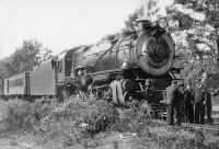
Wading River Station - View S 1895
Archive: Wading River Historical Society
Wading River winter 1912
A rare image this is. The upstairs has recently been added so the agent and his family could live on site.
There are his two kids in the foreground: the boy in the sleigh wearing no hat and freezing his ears off and
the little girl, well-bundled up and walking along the freshly-shoveled wooden
platform.
In the background it appears that the agent is sweeping off the remainder of the platform and some LIRR men are clearing snow from around the switch which allowed the engine to be cut off and run around the train at end-of-track. You can see the switch target to the right of the single guy at the right . . . it towers over him as does the lone, Dietz kerosene platform lamp towering over the sweeping
agent.
Collection: Dave Keller
|
Wading River 1907, In
red it says "George Schultz" and dimensions
are 50' x 100' Collection: Art Huneke
Wading River Station - Experimental
Greenery c.1898
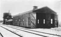
Engine house, coaling bunker and water tank at Wading
River
terminal June, 1918. View looking southeast.
Archive: Dave Keller
|
Wading River Station 1905 Photo: Harold B. Fullerton
Collection: Queens
Library |

Wading River Station 8/1905 - Surrey's 19th & early 20th century carriages
wait to take passengers to their destinations.
Photo: Harold B. Fullerton Collection: Queens
Library |
Wading River - MOW boxcar to be used as housing 1905
Photo: Hal Fullerton Archive: Queens Public Library |
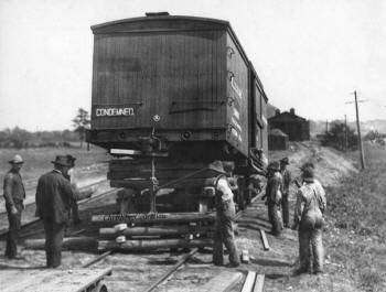
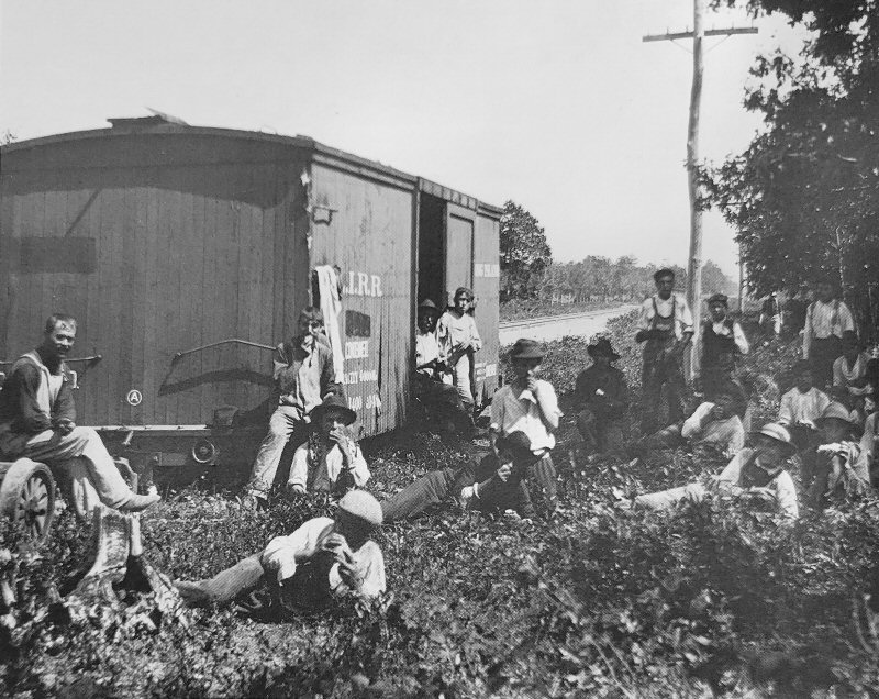
Men hauling a LIRR condemned boxcar
that served as living quarters for laborers who were clearing land for
Experimental Station No. 1 near the old Wading River railroad station in
Wading River, 1905.
The Experimental Station was an
80-acre agricultural project that was set up to show how crops can be raised
in the soil of Wading River and the Central Pine Barrens region around the
area of Long Island Avenue in Medford. The project was started by Hal and
Edith Fullerton to show how crops would grow in what seemed to be infertile,
sandy soil of Long Island. The first of these experimental stations was
located in Wading River and yielded such great results that a second site
was chosen in Medford. Hal and Edith lived in Huntington and routinely made
trips out to each of the stations. Hal was a well-known, accomplished
photographer who documented the success of these farms through the lens of
his camera showing the potential that Long Island soil brought to produce
farming.
|
|

Wading River - MOW boxcar housing 1905
Photo: Hal Fullerton Archive: Suffolk County Historical Society |
Hal B. Fullerton photo (left) 1905 from Ron Ziel's
The Long Island Rail Road in Early Photographs. This temporary MOW
(maintenance of way) housing for the Italian "Gandy Dancers" (track workers)
was typical, rugged, with no frills. The man, newly arrived immigrants in
many cases, were typically Brooklyn residents transported back for the
weekends to join family. |
|
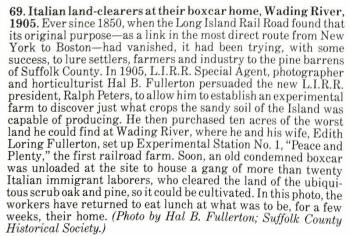
G5s #29 Last revenue train on Wading River Extension preparing to leave
the relocated Wading River station at Randall Road - 10/09/1938 |
Wading River 1918 View E.
|
Depot building looking northeast 9/06/1937
(Votava- Keller)
|
End of track of Wading River extension as cut back to 1,550' east of the
east leg of the wye at Port Jefferson with line abandonment effective March
29, 1939. (see General Order below) View is looking due east in 1968. (Dave
Keller photo and archive) |

MP68 Emery Map 1925 Collection: Dave Keller |
%20-%2008-2012%20(Google%20Maps)_small.jpg)
Former Site Wading River Station after Cut-Back to Randall Rd on 1/18/1938 -
Wading River, NY (View SW) - 08-2012 (Google Maps)
|
|
The Wading River terminal had a wye, located north of the tracks to turn engines around. It also had a wooden, two-stall engine house south of the tracks along with coaling and watering facilities.
The LIRR’s main track ended on the west side of Wading River-Manor Road, with the depot building on the north side of the tracks. However, a siding used to service a coal supplier branched south off the main and extended further east across Wading River-Manor Road a distance. So . . . . while the LIRR’s end-of-track was technically on the west side of Wading River-Manor Road, it really extended further, via the siding.
As business got really slow, the railroad stopped running actual trains out to Wading River, but ran a shuttle service between Port Jefferson and Wading River utilizing a self-propelled gas car, nicknamed a “doodlebug.” This car ran on gasoline and carried passengers as well as baggage and could operate with only a motorman and a conductor. Quite a bit of savings from a steam locomotive and tender using lots of coal and water had having a full crew of engineer, fireman, conductor, trainman and brakeman.
An interesting point to note is that in January, 1938, the end-of-track was cut back one mile west with a low-level platform constructed for use as the new station as the description above for Wading River station mentions.
Per official LIRR General Orders, the following information may be of interest to you as it spells out the final days of service:
GENERAL ORDER #811C, EFFECTIVE 1/18/38:
WADING RIVER STATION AND STATION FACILITIES RELOCATED 1 MILE
WEST OF FORMER LOCATION.
GENERAL ORDER #1006C, EFFECTIVE 3/29/39:
SINGLE TRACK FROM A POINT 1,550’ EAST OF EAST LEG OF WYE, PORT
JEFFERSON STATION TO WADING RIVER STATION OUT OF SERVICE.
(Last revenue train was on 10/9/38. DK)
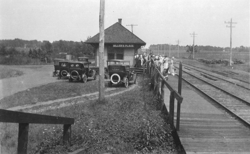
MILLER PLACE STATION AND STATION FACILITIES OUT OF SERVICE
ROCKY POINT STATION AND STATION FACILITIES OUT OF SERVICE
SHOREHAM STATION AND STATION FACILITIES OUT OF SERVICE
WADING RIVER STATION AND STATION FACILITIES OUT OF SERVICE
PO (Port Jefferson) UNATTENDED BLOCK STATION OUT OF SERVICE
MI (Miller Place) UNATTENDED BLOCK STATION OUT OF SERVICE
WY (Wading River) UNATTENDED BLOCK STATION OUT OF SERVICE
JF (Port Jefferson) EASTWARD BLOCK SIGNAL OUT OF SERVICE
WESTWARD LOWER QUADRANT SEMAPHORE DISTANT SIGNAL LOCATED
EAST OF PORT JEFFERSON STATION OUT OF SERVICE
The right-of-way was acquired by Long Island Lighting Company (LILCO) to run their power lines. The
right-of-way is now used by LIPA, the successor to LILCO.
The late Robert Emery, railfan and LIRR Conductor walked the remains of the right-of-way in October of 1957 and provided the following data regarding mileposts:
Location of mileposts in relation to Route 25A, all located on north side, as of
10/1957:
MP 58 300’ east of Columbia Street - Port Jefferson
MP 59 On embankment 400’ west of Gulf gas station - Mt. Sinai (still in)
MP 60 Back of Miller Machine Tool factory – Miller Place
MP 61 100’ east of Miller Place Road – Miller Place (still in)
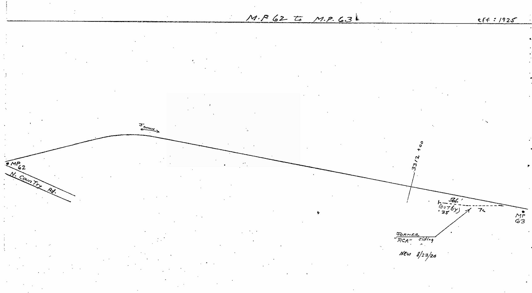
MP 62 North on Harrison Ave. where it crossed the LIRR tracks – Sound
Beach
MP 63 About 400’ north of the point where LILCO high tension feeder line to RCA crosses Route 25A – Rocky Point
MP 64 500’ north of Rocky Point School – Rocky Point (still in)
MP 65 300’ east of Harding Street – Rocky Point (still in)
MP 66 Approx. ___’ north of Miller Ave. on ROW – Shoreham (still in)
MP 67 400’ west of “Nike” Air Base Road – Wading River (still in)
MP 68 Approx. 300’ north of hollow on Route 25A which is 1,000’ west of Riverhead Town Line – Wading River
The stone overpass at Woodville Road in Shoreham is the last of the right-of-way structures that is still intact. The wooden trestle over the tracks at Miller’s Place was dismantled in 1939. The stone overpass at Rocky Point was demolished around the same time and the reddish-brown stones were shipped up the road and used as a retaining wall at Cedar Beach.
The depot building at Rocky Point is still standing, having been moved slightly south of the original right-of-way and onto private property and has been incorporated into the structures on their grounds. As far as I know it is still standing.
Dave Keller 11/2006 (updated:
02/25/17) |


%20(A.%20Bayles-Keller).jpg)
%20(A.%20Bayles-Keller).jpg)
%20(A.%20Bayles-Keller).jpg)

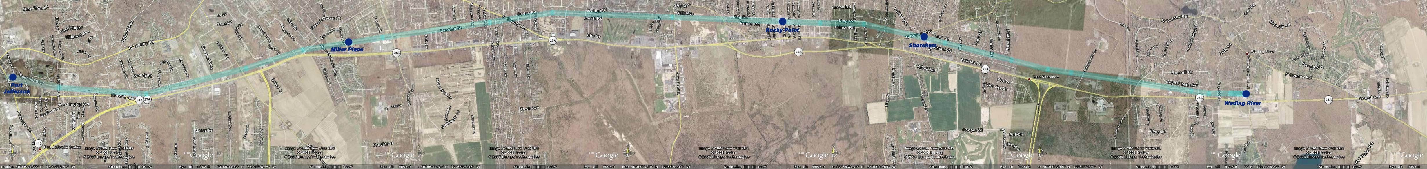
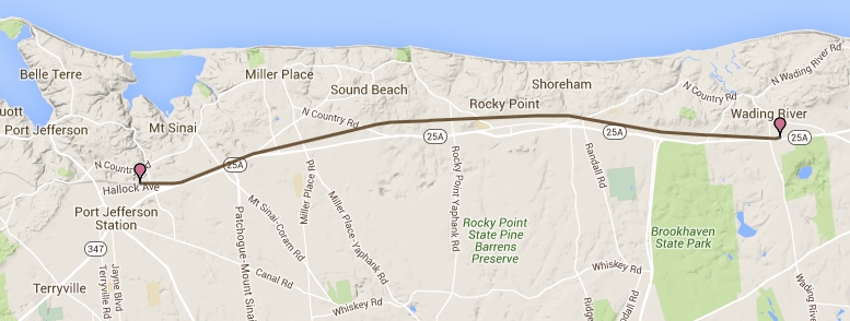
 The Wading River Extension headed east from Port Jefferson in 1895, built by the “LIRR
Co. North Shore Branch,” a subsidiary of the LIRR. The
stations were as follows, after leaving Port Jefferson:
The Wading River Extension headed east from Port Jefferson in 1895, built by the “LIRR
Co. North Shore Branch,” a subsidiary of the LIRR. The
stations were as follows, after leaving Port Jefferson: 
-c.1914%20(Keller).jpg)

%20(Keller-Keller).jpg)

.jpg)


%20(Greyscale).jpg)
.jpg)
.jpg)
.jpg)
.jpg)
%20-%201914%20(T.%20Bayles-Keller).jpg)
.jpg)
.jpg)
.jpg)
.jpg)
.jpg)


.jpg)
%20-%2008-2012%20(Google%20Maps).jpg)